
Aughleam
The name comes from a horse. Eachléim - the Irish form of Aughleam - means 'horse's leap,' and local folklore holds that a horse once jumped from the eastern edge of the townland to the west, marking out the village's borders in a single bound. Whether the horse was real or a way of explaining ancient boundaries no one can now remember, the name has stuck for centuries. Aughleam sits on the Mullet Peninsula in Erris, North Mayo, a thin sliver of Gaeltacht country reaching out into the Atlantic. It is small, exposed, and Irish-speaking; the wind moves through the village constantly; and at its centre stands a heritage centre dedicated to a woman who lived here in the sixth century.
Ionad Deirbhile
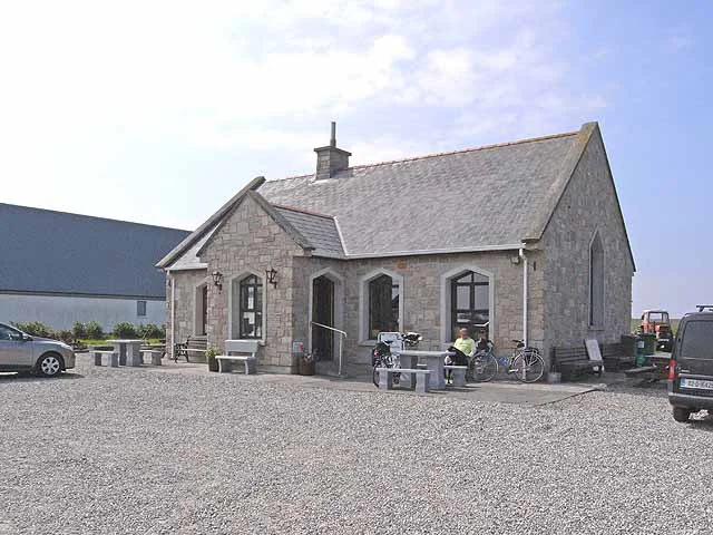
The heritage centre - Ionad Deirbhile - was built to look like a traditional thatched cottage, low-roofed and white-walled, so that it would not jar against the older buildings around it. Inside, the centrepiece is a 10-foot stained glass window depicting Saint Deirbhile, a replica of a much older window in the pre-Norman church at Fallmore a short walk away. The centre's collection includes locally gathered research on Mullet Peninsula life: the disappearing language of the inshore fishermen, photographs of curragh-makers from the early twentieth century, family histories, and a careful retelling of one of the oldest stories in Ireland - the Legend of the Children of Lir, the four siblings turned into swans by a jealous stepmother and condemned to wander Irish waters for 900 years, finally finding burial on nearby Inishglora.
Saint Deirbhile, Sixth Century
Deirbhile - or Dairbhile - is one of the obscurer of Ireland's early Christian saints, but her presence on the Mullet is everywhere. The sixth-century church that bears her name stands a short distance from Aughleam at Fallmore, on a knoll above the sea. Her holy well is nearby. Tradition holds that Deirbhile lived as an anchoress here in the years around 575-600 AD, in a landscape that would have been as remote then as it sometimes feels now. The window in the heritage centre tells her story in glass: a young woman in monastic robes, sea behind her, the wind in her veil. Local pilgrims still visit the well, where the water is reputed to cure eye ailments. Whether you believe in the cure or not, the practice of walking the path Deirbhile walked is itself a kind of prayer.
Gaeltacht on the Edge
Aughleam is part of the Mayo Gaeltacht - the small constellation of communities along this coast where Irish is still spoken as a daily language, not just learned in schools. Population pressure, emigration, and the slow gravitational pull of English have shrunk these communities over the twentieth century. But Aughleam holds on. Children attending the local school speak Irish in the playground; older neighbours still chat in the shop in the language of their grandparents. The Gaeltacht designation brings some state support, but mostly it brings a quiet stubbornness - a refusal to let go of a way of speaking, and therefore of being, that has been spoken here since long before Deirbhile arrived.
Along the R313
The R313 regional road runs the length of the Mullet Peninsula, and the road through Aughleam is part of the Wild Atlantic Way - Ireland's marked coastal driving route stretching from Donegal to Cork. Stop at the heritage centre. Walk to Saint Deirbhile's Church and well. Look west across the dunes toward the offshore islands - the Inishkeas, Inishglora, the Duvillauns - dark shapes on the horizon where monks and fishermen and lighthouse keepers have made small lives across centuries. The horse that leapt the village has the right idea: this is a place to move through with care, but also to land in.
From the Air
54.12N, 10.10W. Aughleam lies on the western side of the southern Mullet Peninsula, recognizable from the air as a small cluster of buildings along the R313 with the Atlantic visible to the west and Blacksod Bay's protected waters to the east. The Inishkea Islands lie 5 km offshore to the west-southwest. Best viewed at 2,000-3,500 ft. Ireland West Airport Knock (EIKN) is approximately 90 km east-southeast; Sligo Airport (EISG) about 100 km northeast. Atlantic winds on the Mullet are nearly constant; expect strong southwesterlies and rapid weather changes.
Nearby Stories
- Aughagower 3.4 km away
- Caher Island 8 km away
- Enaghbeg 10 km away
- Action of 7 May 1794 21 km away
- Lissadell House 59 km away
- RMS Carinthia (1925) 64 km away
- Glencolmcille 95 km away
- Inishtooskert 214 km away