
Babcock State Park
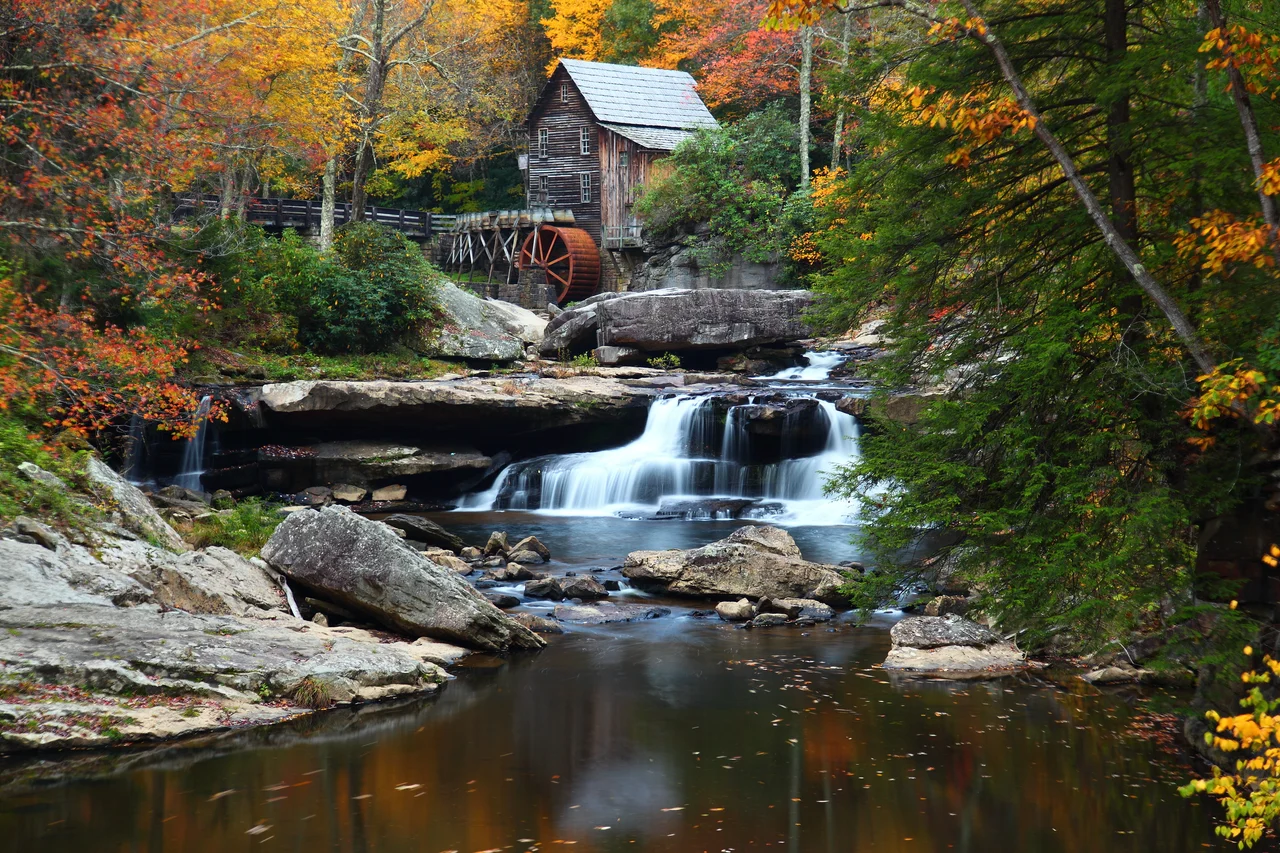
The mill is built of weathered chestnut and oak, its waterwheel turning steadily beside Glade Creek. Photographers know it. Painters know it. Calendars and postcards and the back of the West Virginia tourism budget all know it. The Glade Creek Grist Mill at Babcock State Park is, by some accounts, the most photographed building in West Virginia. What most visitors do not realize is that the mill is younger than they are: completed in 1976, it was stitched together from parts of three other West Virginia mills to replace the original Cooper's Mill, long demolished. The replica works. Corn meal and buckwheat flour milled here are still sold at the park. The whole park, in fact, is a careful piece of staging - a 1934 New Deal creation that turns Appalachian water and stone into something visitors keep returning to.
A New Deal Park
Babcock State Park opened on July 1, 1937, built during the Great Depression as a project of the Civilian Conservation Corps. The land was deeded to the state in 1934. CCC crews built the original trails, shelters, and stone-and-timber structures that still anchor the park - work so durable that the New Deal-era resources were nominated as a historic district decades later. The park sits on 4,127 acres of forested ridge and stream valley in southern Fayette County, about 20 miles from the more famous New River Gorge Bridge. It was named for Edward V. Babcock, a Pittsburgh lumberman, former mayor of Pittsburgh, and conservationist who donated the original tract of land to the state. His ridge of pine and hardwood became, in CCC hands, one of West Virginia's most enduring public spaces.
Glade Creek Grist Mill
The original Cooper's Mill, which ground grain for valley farms in the 1800s, was long gone by the time Babcock opened. The park rebuilt it - sort of - in 1976. The replacement is a composite. The basic structure came from Stoney Creek Grist Mill in Pocahontas County. Other parts came from Spring Run Grist Mill near Petersburg and Onego Grist Mill in Onego. The result is a working mill that the park describes as a living monument to the more than 500 grist mills that once dotted West Virginia. Visitors can watch the wheel turn, take photographs by the dozen, and buy bags of the corn meal and buckwheat flour that come out of the millstones.
What There Is to Do
Beyond the mill, Babcock runs as a full-service West Virginia state park: 28 rental cabins, 52 campsites, a swimming pool, a gift shop, picnic shelters, and more than 20 miles of hiking trails through hardwood forest. Boley Lake covers 19 acres - small enough to feel intimate, large enough to support paddleboats, rowboats, and canoes for rent. There is fishing in the lake and in Glade Creek itself. There are basketball, tennis, and volleyball courts, a horseshoe pit, and overlooks that, on a clear day, let you see south toward the gorge. The horseback-riding stable that long defined summers here has closed. Naturalist-led hikes still run regularly through the season.
An Accessible Park
Babcock was assessed for accessibility by West Virginia University in 2005, with the campground, picnic shelters, restrooms, and doorways of public buildings all found to be accessible. The park has accessible fishing access and two accessible cabins. Some concerns were noted at the time about parking lot signage and slippery stairways. The push to make the park usable by everyone reflects a broader commitment by the West Virginia park system: visitors with mobility limitations can roll down ramps to the lake, fish from accessible piers, and stay in cabins built to current standards. Babcock is not pristine wilderness. It is a designed landscape, intended from the start to be entered, photographed, and shared. The deliberate gentleness of it is part of what keeps people coming back.
From the Air
Babcock State Park sits at 37.99 N, 80.97 W, on the plateau south of the New River Gorge in Fayette County, about 20 miles south-southwest of the New River Gorge Bridge. Recommended viewing altitude is 3,000 to 5,000 feet AGL. The mill complex, Boley Lake, and the open meadows at park headquarters are easy to identify against the surrounding forest. Nearest airports are Raleigh County Memorial (KBKW) about 18 miles southwest and Greenbrier Valley (KLWB) in Lewisburg about 35 miles east. Best months for aerial photography are October and late April.
Nearby Stories
- West Virginia State Capitol 4.7 km away
- Greenbrier County, West Virginia 13 km away
- Beckley, West Virginia 13 km away
- Clay, West Virginia 16 km away
- The Greenbrier 18 km away
- Webster Sycamore 26 km away
- Kanawha State Forest 26 km away
- Welch, West Virginia 40 km away