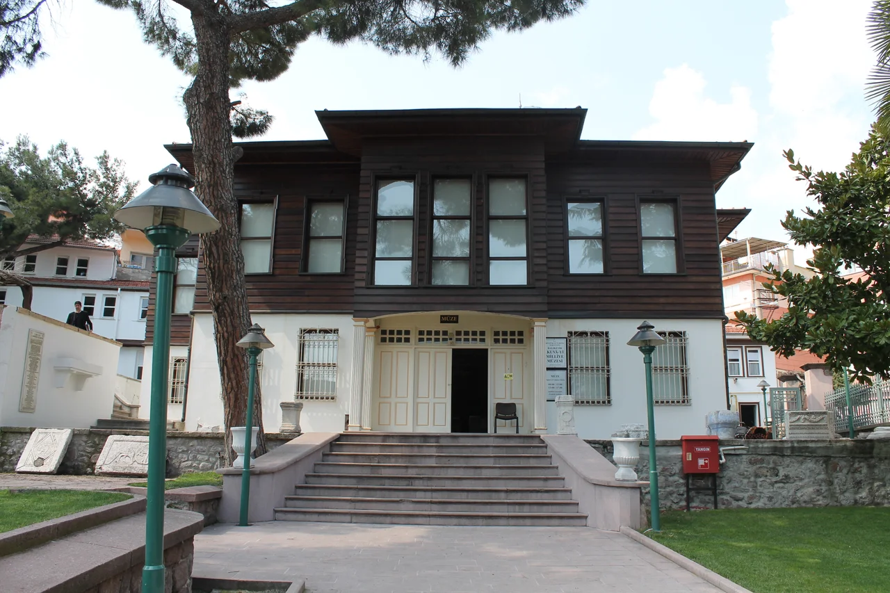

Balıkesir
The name Balıkesir carries its own history encoded inside it — the Turkish form of the Greek Palaeokastron, meaning 'Old Castle,' which itself replaced a Roman settlement that grew up around what the sources describe as a hunting lodge. That lodge dates to around 124 AD, built during the reign of an emperor who was famously fond of hunting. By the time a 1898 earthquake leveled most of what had accumulated over the centuries, Balıkesir had already been provincial capital, Ottoman administrative center, and hub of the main overland route between Istanbul and Izmir. What the earthquake left, the 20th century rebuilt — which is why the city you see today is largely modern, punctuated by a handful of structures that survived or were reconstructed.
Old Castle, New City
Almost nothing above ground in central Balıkesir predates the late Ottoman period. The 1898 earthquake was genuinely devastating, collapsing buildings accumulated over two millennia of continuous settlement. The Clock Tower (Saat Kulesi) on Anafartalar Caddesi stands as one of the city's focal landmarks — an Italianate structure that its Wikivoyage description dryly notes looks nothing like the Istanbul Galata Tower it is supposedly copied from, and would suit a railway terminus better. The original version was built in 1827; the current tower is a reconstruction in the same design, raised after the earthquake. Nearby, the Ömer Ali Bey manuscript library holds early Ottoman books and texts. The Umurbey Mosque, dating from 1413 with repairs in 1635 and 1925, is among the few structures with genuine age. In the Aygoren and Karaoglan neighborhoods east of Atatürk Park, some traditional Ottoman-era houses survive on winding streets that break the modern grid.
The Bones of Industry
The hilly terrain around Balıkesir is fertile — olives, wheat, dairy, sunflowers — and the city has built industries on that agricultural base. But 50 km northwest, along the scenic mountain road toward Çanakkale, lies the town of Balya, which tells a different story. In its peak years Balya had a population of 20,000 to 30,000 people, sustained entirely by lead and zinc mines worked under a French company concession obtained in the 19th century. The ore ran low by the 1930s and the French left, taking with them an economy the town has never recovered. What they also left behind was a legacy of cyanide processing — the earliest recorded use of that technique anywhere in the world, according to the Wikivoyage source — whose effects persist in patches of ground where grass barely grows and streams that still run acidic. The atmospheric ruins of processing buildings, French administrative villas, and ore-handling infrastructure remain, partly engulfed by pine forest, partly being reopened for new mining as of 2023.
At the Junction
Balıkesir's position on the Istanbul–Izmir corridor is not incidental — it has defined the city since the Romans built on that same route. Buses run every 30 minutes to Istanbul and Izmir, covering the respective distances in six hours and nine hours. The railways are slower and require patience: the İzmir Mavi Treni departs nightly from Ankara, taking nine hours to reach Balıkesir via Eskişehir and Kütahya. Balıkesir Koca Seyit Airport — renamed from Edremit Airport and technically 100 km west of the city — offers daily flights from Istanbul. The airport's distance from the city it supposedly serves is a running joke in local travel writing, its Wikivoyage description noting the name 'Koca Seyit' honors a Gallipoli artillery hero, not geographic convenience.
What to Eat and Drink
The local food in Balıkesir reflects the city's agricultural hinterland. Keskek is a meat and barley stew — slow-cooked, deeply savory, the kind of dish that takes hours and rewards the wait. Tirit combines leftover bread with meat and offal in a way that is exactly as rustic as it sounds and often better than it reads. The dessert höşmerim is a cream cheese halva, served with ice cream, honey, or nuts depending on the season and the cook. Zerde, a saffron rice pudding made with water rather than milk, provides a golden, slightly floral counterpoint. To drink, locals have a specific tradition: suma, the first raw distillation of what becomes rakı, is drunk here before the spirit has been refined to its standard commercial strength. Visitors unused to Turkish spirits are warned accordingly.
A City That Keeps Developing
Balıkesir belongs to the category of Turkish cities described as 'Anatolian Tigers' — provincial centers that developed manufacturing and commercial bases through the 1990s and 2000s, driven partly by proximity to Istanbul's markets and partly by educated local populations with university ties. Balıkesir University anchors part of this identity. Thermal springs in the surrounding hills fuel a modest spa tourism sector. Balıkesirspor, the local football club, operates in TFF Second League — Turkey's third tier — playing at the 15,800-seat Atatürk Stadium. The city is not a major tourist destination, but for travelers on the Istanbul–Izmir corridor with a day to explore a working Anatolian city, it offers layers of history accumulated under a modern surface that doesn't bother to hide what it is.
From the Air
Balıkesir sits at 39.65°N, 27.88°E in the hilly terrain of the Southern Marmara region, approximately halfway between the Marmara coast to the north and the Gulf of Edremit (Aegean) to the south. The nearest commercial airport is LTFD (Balıkesir Koca Seyit Airport), 100 km west near Edremit, with daily Istanbul connections. LTBG (Bandırma Airport) lies approximately 80 km to the north and serves as a regional alternative. Recommended viewing altitude is 4,000–6,000 m; the city's position in a valley between rolling agricultural hills is clearest from the south or west. The Kazdağı (Mount Ida) massif is visible to the southwest, and on clear days the Marmara Sea coastline is visible to the north.
Nearby Stories
- Battle of the Hellespont (321 BC) 12 km away
- Altıkulaç Sarcophagus 32 km away
- Lyrnessus 33 km away
- Akhisar Museum 52 km away
- Green Mosque of Bursa 60 km away
- Ayvalık 62 km away
- Bursa 80 km away
- Antalya Museum 337 km away