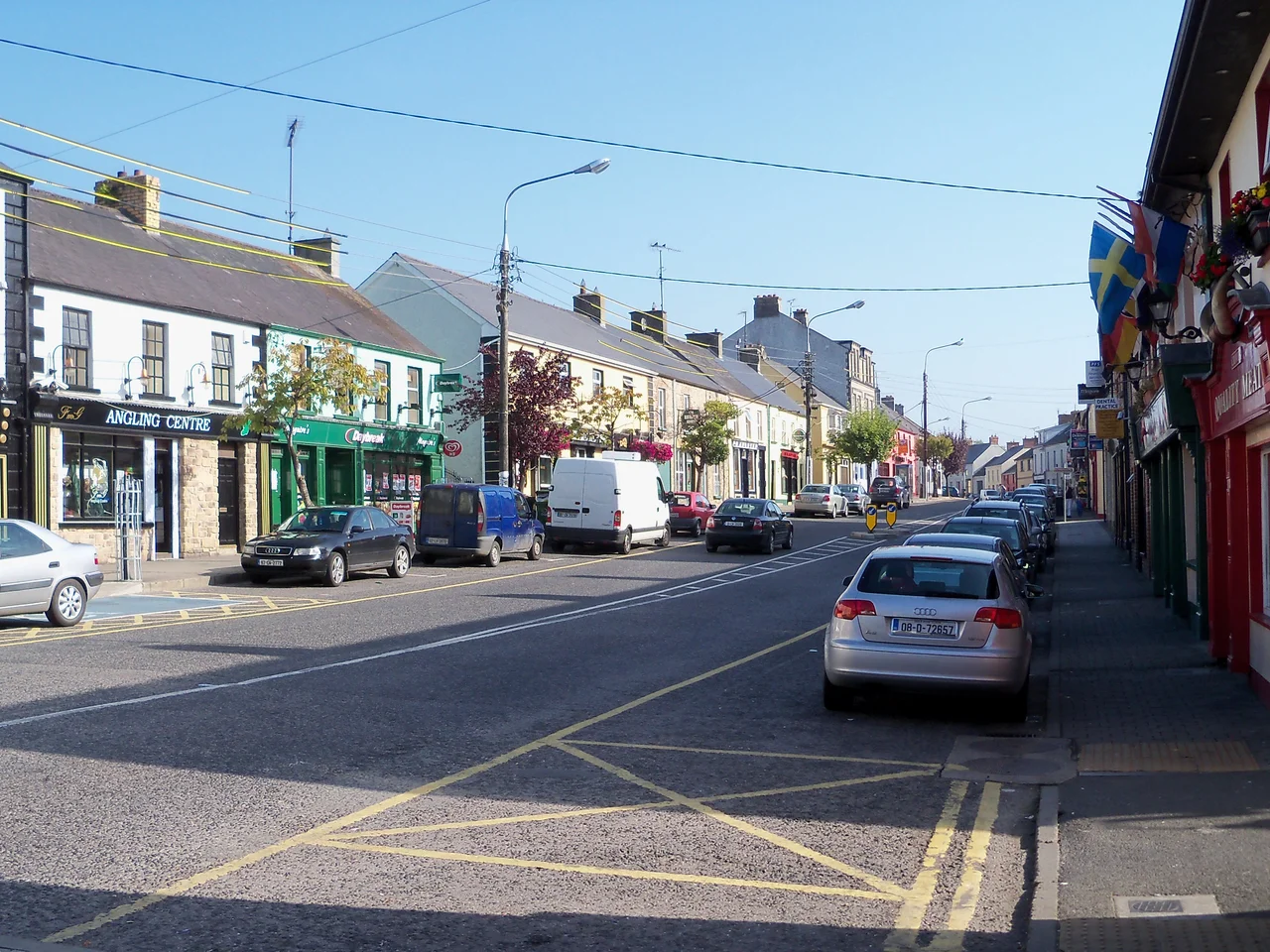

Ballyconnell
Colonel George Talbot was appointed Surveyor-General of Maryland in 1683. He owned an estate in Cecil County on the eastern shore of Chesapeake Bay, and he gave it a name that meant nothing to his American neighbours but everything to him. He called it Ballyconnell, after the small Cavan town where his grandparents had been the lords and his father had been born. The original Ballyconnell still sits today on the banks of the Woodford River, a fording point on the old border between the Gaelic kingdoms of Fermanagh and Breifne, won and lost a dozen times by the Maguires, the O'Rourkes, the O'Reillys and the McGoverns before any of the Talbots ever set foot in it.
The Ford in the Forest
Before there was a town there was a crossing. The Woodford River — *Sruth Gráinne* in Irish, the Gravelly Stream — ran through dense oak forest between Slieve Rushen and the higher land to the south, and a single shallow stretch let travellers across without boats. People had been living here a very long time when written history found them: a double-court tomb stands in the modern town centre and a wedge tomb dating to around 2000 BC sat on the side of Slieve Rushen until 1992, when it was excavated and moved to a hotel grounds to make way for sand mining. The area was on the eastern edge of Magh Slécht, the legendary "plain of slaughter," and the locality known as Maigin, "the little plain," was the birthplace of Saint Dallán Forgaill — the sixth-century poet to whom the original Old Irish words of the hymn "Be Thou My Vision" are sometimes attributed.
Walter Talbot's Bawn
In June 1610, King James VI and I granted the lands of Ballyconnell to Hugh Culme as part of the Ulster Plantation; Culme immediately transferred them to Walter Talbot, an Anglo-Irish Catholic with permission to keep his estate so long as he could prove he was bringing in settlers and building. He did. By 1613 a survey reported him erecting "a strong castle" by the ford; by 1619 he had built a bawn — a defensive square of stone wall a hundred feet on each side and twelve feet high, with two flanking towers and a three-storey castle inside it. The 1622 inventory of his arms reads like a small museum: eleven pikes, three calivers, five head-pieces, three targets, one halberd. Walter died in 1625 leaving his ten-year-old son James to inherit. James later married Helen Calvert, daughter of George Calvert, the 1st Baron Baltimore — the man who founded the Maryland colony — and from that marriage came the George Talbot who would carry the name Ballyconnell to America.
Lost and Won
The seventeenth century was hard on Catholic landlords in Ulster. The 1641 rebellion saw Talbot's estate confiscated; he was given lesser land in Roscommon. After the Cromwellian wars the estate passed to Captain Thomas Gwyllym, who renamed the town Gwyllymsbrook in his own honour — the name fortunately did not survive him. In 1688, with James II on the English throne, Catholic forces occupied the castle and burned it to the ground. The Gwyllym family fled. By 1724 the whole estate had been sold for £8,000 to Colonel Alexander Montgomery, and it passed through Montgomery hands for more than a century — including a melancholy episode in which one heir was placed under the Court of Chancery as a lunatic — before being broken up in 1856 with the opening of the Woodford Canal. The current bridge across the river was built in the 1830s. Pieces of Walter Talbot's bawn wall are still visible to those who know where to look.
The First GAA Club in Ulster
In 1885 Ballyconnell did something quietly historic: it founded the first Gaelic Athletic Association club in Ulster, only a few months after the GAA itself had been established. The club was called Ballyconnell Joe Biggars, in honour of Joseph Biggar, the West Cavan MP and pioneer of Irish parliamentary obstruction. It later renamed itself the more sober "Ballyconnell First Ulsters," and the original strip — horizontal stripes of black, red and yellow — became the founding colours of organised Gaelic sport in the province. Most of Ulster's GAA history runs from that 1885 moment in this Cavan border town. The Tidy Towns competition is the other thing Ballyconnell quietly excels at: national winners in 1971 and 1975, with many county titles besides.
Modern Ballyconnell
The town's population at the 2022 census was 1,422. Its largest single industry is the cement factory established by Sean Quinn, once Ireland's richest man, now a more complicated figure in the country's economic history. The Shannon–Erne Waterway, reopened in 1994, passes through Ballyconnell carrying cabin cruisers between Ireland's two great river systems; it is one of the longest navigable inland waterways in Europe, and the town has become a regular stopping point for crews working their way north or south. The local golfing twins Leona and Lisa Maguire grew up here — Leona is one of the most successful Irish women ever to play professional golf. A short walk from the centre of town stands the bridge where Walter Talbot built his castle four hundred years ago. The water still runs over the gravel ford. Most of the rest has had to be reinvented several times over.
From the Air
Ballyconnell sits at 54.12°N, 7.58°W in southwestern County Cavan, about a mile from the border with County Fermanagh in Northern Ireland. The town has an altitude of 55 metres above sea level, set at the foot of Slieve Rushen mountain. From cruise altitudes of 3,000–5,000 ft the layout is clear: the Woodford River cutting through the centre, the cement works on the outskirts, the Shannon–Erne Waterway threading away east and west. The nearest controlled airspace is Belfast (EGAA), about 110 km northeast; Dublin (EIDW) lies south. Knock (EIKN) and Ireland West Airport are to the west. Conditions tend toward low cloud and drizzle — mean annual rainfall is around 1,000 mm — so plan for marginal VFR. Clear days reveal the lake-and-drumlin landscape of the south Ulster border country.
Nearby Stories
- Clonfin Ambush 3.5 km away
- Lisgoole Abbey 4.7 km away
- Tulsk 11 km away
- Carrick-on-Shannon 12 km away
- Abbey of Kells 12 km away
- Bailieborough Castle 14 km away
- Belleek, County Fermanagh 18 km away
- City Status in Ireland 24 km away