Where the Streets Are Rivers
Before dawn, women in wide-brimmed hats paddle wooden jukung boats to the middle of the Martapura River. By the time the call to Fajr prayer has faded, they have arranged their wares -- jackfruit, river shrimp, sticky rice cakes wrapped in banana leaf -- and begun trading boat to boat, transactions conducted without ever touching dry land. This is the Lok Baintan floating market, and it has operated this way since the era of the Banjar Sultanate in the eighteenth century. In Banjarmasin, the river is not scenery. It is infrastructure.
A Sultanate Born at the Confluence
Banjarmasin was founded on 24 September 1526, at the junction where the Martapura River meets the Barito. The timing was deliberate: Surianshah, victorious after a long civil war, crowned himself the first Sultan of Banjar and established his capital at Kuin, on the riverbank. The sultanate rose quickly. By the early seventeenth century, it had become a major pepper producer and exporter, and soon virtually all of southwestern, southeastern, and eastern Kalimantan paid tribute to Banjar. The rivers were the sultanate's arteries, carrying pepper, diamonds from the mines near Martapura, and forest products downstream to trading ships. Arab, Indian, and Chinese merchants settled along the waterways, each community leaving its mark on the city's culture and cuisine. The sultanate endured until 1860, when the Dutch colonial government dissolved it following the Banjarmasin War of 1859 to 1863.
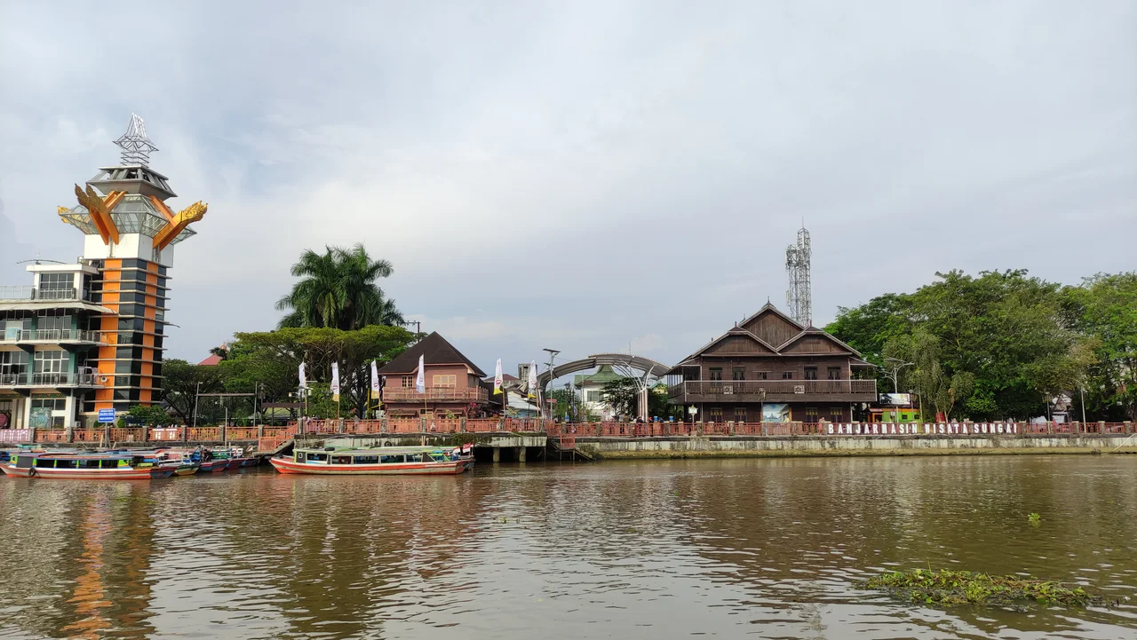
A Thousand Rivers, One City
The nickname is not poetic exaggeration. Banjarmasin sits on a low-lying delta island threaded with the Martapura, Sipandai, Sigaling, Keramat, Jagabaya, and Pangeran rivers, among dozens of others. For centuries, these waterways functioned as the city's road network. Houses were built on stilts over the water. Markets floated. Transport meant boats. Even today, speedboats remain an important form of transit, ferrying passengers across channels too wide for bridges. The shift from river culture to land culture -- as locals describe the transition to roads, cars, and fixed-foundation buildings -- has been gradual and incomplete. The floating market at Lok Baintan is shrinking, its merchants dwindling as land-based supermarkets compete for customers. But Siring Park, built along the Martapura's banks in the city center, tries to anchor the old identity. Locals call it '0 Kilometer Park' -- the point from which the city measures itself, and it faces the water.
The Bekantan and the Waterfront
At Siring Park, a statue of a bekantan -- the proboscis monkey -- watches over the Martapura River. It is a fitting mascot. Proboscis monkeys are endemic to Borneo, found nowhere else on earth, and they are creatures of the water's edge. Their oversized noses, pot bellies, and webbed feet make them strong swimmers, and they live in the mangrove and riverine forests that once surrounded Banjarmasin. The bekantan is locally nicknamed the 'Dutch ape,' a reference to the colonial administrators whose ruddy complexions and prominent noses apparently reminded Banjarese of the primates. The statue at Siring Park is one of the city's most photographed landmarks, standing beside gazebos, a watchtower, and a waterfront promenade where street food vendors gather at dusk. Across the river, the city's five districts sprawl outward, home to over 700,000 people, more than 3,000 industrial companies, and 60 traditional markets.
Between Tradition and Transition
Modern Banjarmasin is the economic and media hub of South Kalimantan. The Port of Trisakti, classified as a Class IA port, handles cargo and passenger ships connecting to Java and Sulawesi. The Trans-Kalimantan Highway links the city to Palangka Raya and Samarinda. Syamsudin Noor International Airport, about 25 kilometers southeast in neighboring Banjarbaru, serves as the region's air gateway. Yet the city's identity remains tethered to its rivers. Each year, the Haul Guru Sekumpul draws enormous crowds to commemorate the beloved ulema Zaini Abdul Ghani -- a celebration that fills the riverbanks as much as the streets. The cultural center in the city's park hosts performances of traditional Banjarese arts. And at Lok Baintan, the women still arrive before dawn, their boats loaded with produce, trading above water that has carried commerce here for five hundred years.
From the Air
Banjarmasin sits on a delta island at the confluence of the Barito and Martapura rivers in southeastern Borneo. Coordinates: 3.31S, 114.59E. From altitude, the city is identifiable by its dense urban footprint surrounded by winding river channels and wetlands. Nearest airport: Syamsudin Noor International Airport (ICAO: WAOO, IATA: BDJ), approximately 25 km to the southeast in Banjarbaru. Best viewed at 3,000-8,000 feet to see the river network threading through the city. The Port of Trisakti on the Barito River is visible as a major waterfront installation.
Nearby Stories
- The Million-Hectare Mistake 55 km away
- Sixty Seconds Over Banjarmasin 81 km away
- Borneo Orangutan Survival 98 km away
- The Night Kasongan Market Burned 160 km away
- The Monsun Boat That Almost Outlasted the War 186 km away
- Forty Hours in the Masalembo Sea 199 km away
- The Destroyer That Almost Changed History 233 km away
- The Ocean's Hidden River Between Two Worlds 235 km away