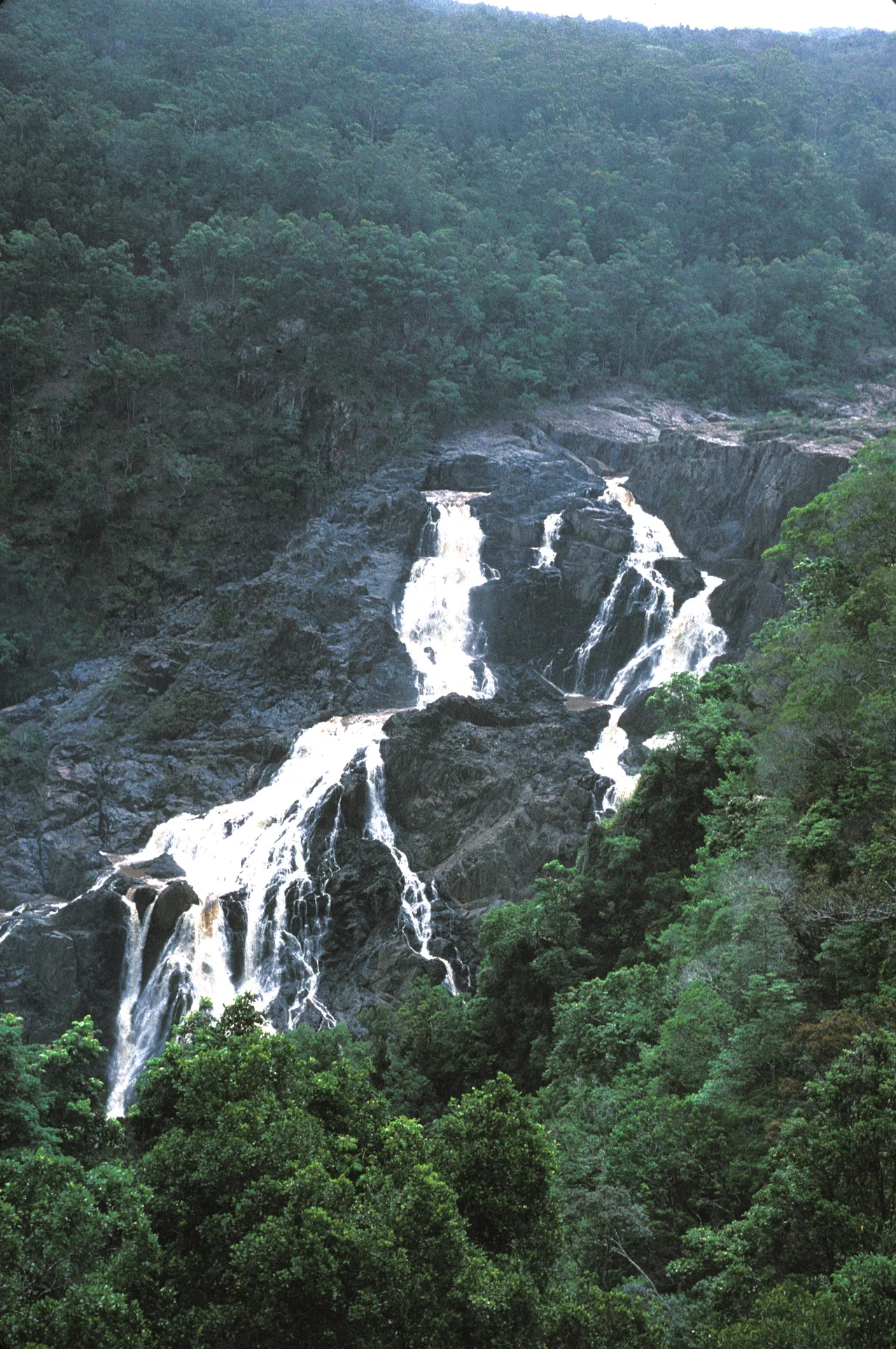

Barron Gorge National Park
The Djabugay call the falls Din Din, and they tell how the great carpet snake Budadji shaped this Country - gouging the rivers and creeks as it moved, before emu men killed it at the head of the gorge. Stand at the lookout when the wet season is in full flood and the story feels less like myth than report: the Barron River hurls itself off the eastern edge of the Atherton Tableland and drops 265 metres into the gorge, throwing spray high enough to soak you from across the chasm. In the dry months the same cliff can stand nearly bare, the water reduced to silver threads. Either way, you are looking at one of the most dramatic thresholds in Queensland, where tableland becomes coast in a single violent step.
The Edge of the Tableland
Barron Gorge exists because of a geological seam. The Atherton Tableland sits high and cool above the tropical coast, and along its eastern rim the land simply falls away in a steep escarpment. Where the Barron River reaches that edge, it becomes Barron Falls, plunging 265 metres to the floor below. The flow is wildly seasonal: during the summer monsoon the river can move enormous volumes of water in a single day, while in the dry it slows to a trickle. Two more waterfalls - Stoney Creek Falls and Surprise Creek Falls - tumble from tributaries within the park. The slopes are brutally steep, some pitched at 45 degrees, a fact that would later cost human lives.
Din Din and the Djabugay
This is Djabugay Country, and it carries Djabugay meaning. Din Din is not merely a scenic name borrowed for tourism; it sits inside a living web of Dreaming stories centred on Budadji, the carpet snake whose movements are written into the shape of the land itself. For the Djabugay people, the gorge is ancestral ground. In 2004, after a long road through the courts, Barron Gorge became the first national park in Queensland to be returned to its Traditional Owners under a native title determination, followed by an Indigenous Land Use Agreement registered in 2005. The handover changed little for visitors - the lookouts and trails remained open - but it restored something fundamental: the right of the Djabugay to once again hold traditional ceremonies on Country that had always been theirs.
Harnessing the Falls
The same drop that awes tourists drew engineers. A weir was built at the top of the falls in 1935, and it is still visible from the railway lookout and from Skyrail's Barron Falls station. Beneath the gorge, Australia built its first underground hydroelectric power station here in 1935, tapping the river's plunge for electricity. That early plant was replaced in 1963 by the larger Barron Gorge Hydroelectric Power Station, a run-of-river facility whose two turbines still generate power from the falling water. The arrangement is a peculiarly modern bargain: the falls run dramatically full in the wet season for the cameras, then a portion of the river is diverted through the turbines, so the spectacle and the power supply share the same water.
A Railway Built at a Price
Long before the cableway, there was the railway - and it was carved into these cliffs by hand. The Kuranda line threads through the gorge on a route so steep and unstable that construction in the 1880s and 1890s was genuinely deadly; the work claimed lives, and the surviving stonework still clings improbably to near-vertical rock. Today two tourist trains a day climb from Cairns through the gorge and back, passengers craning at waterfalls and tunnels that workers blasted and bridged through dense, snake-ridden rainforest. The engineering is rightly celebrated, but the gorge keeps the memory of what it took to lay a track across a wall of stone.
Life in the Wet Tropics
Barron Gorge is part of the Wet Tropics World Heritage Area, and its forest is dense with specialists. On the gorge floor, bird's-nest and elkhorn ferns nest in the branches of candlenut, corkwood, native olive and false red sandalwood trees. Noisy pittas flash their colours through the leaf litter; orange-footed scrubfowl rake at the forest floor; and the wary southern cassowary, that flightless living dinosaur, is occasionally glimpsed in the park's south. After dark the forest belongs to other residents - possums, flying foxes, the northern quoll, and Lumholtz's tree-kangaroo, an animal that defies expectation by climbing into the canopy on limbs built for the ground.
From the Air
Barron Gorge National Park centres on roughly 16.84°S, 145.65°E, just 2 km from Kuranda and immediately inland of Cairns. From the air the gorge reads as a sharp green cleft where the Atherton Tableland's eastern escarpment drops to the coastal plain, with Barron Falls a pale scar at its head (most visible in the December-April wet season). The Kuranda railway line and the Skyrail cableway both trace the terrain nearby. Cairns Airport (YBCS / CNS) lies about 15 km east-southeast; approach and departure traffic routinely passes within sight of the range. Mountain wave and rotor turbulence can develop over the escarpment in strong easterlies, and cloud frequently caps the tableland rim - plan viewing for clear mornings.
Nearby Stories
- HMS Mermaid (1817) 17 km away
- Rocky Creek World War Two Hospital Complex 32 km away
- Mount Mulligan Mine Disaster 36 km away
- Mbabaram language 38 km away
- Nuggety Gully Water Race and Chinese Camp 67 km away
- Cyclone Yasi 113 km away
- Kapa Kapa Trail 760 km away