Battle of Hurtgen Forest
A German lieutenant named Friedrich Lengfeld died on 12 November 1944, six weeks past his twenty-third birthday, of wounds taken while crossing a minefield called the Wild Sow to drag a wounded American soldier to safety. His memorial is a stone with a bronze plaque, placed at the Hurtgen Military Cemetery by veterans of the U.S. 4th Infantry Division. It is the only such monument anywhere in a German military cemetery dedicated by the men he had once been ordered to kill. That is the story most worth telling about the Hurtgen Forest. The rest of what happened here is a catalogue of mistakes paid in lives.
Why the Forest
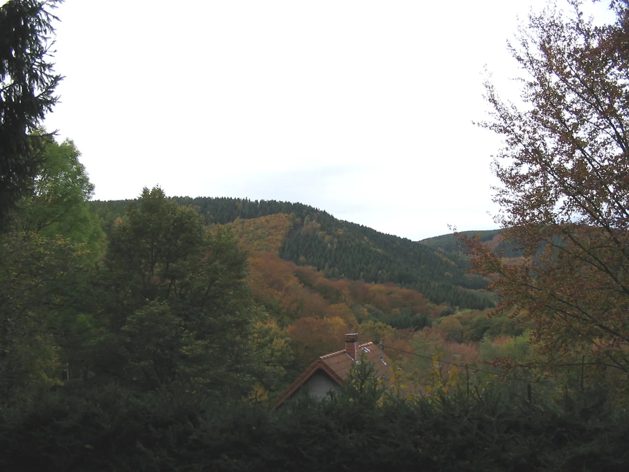
The Hurtgen Forest covers about a hundred and forty square kilometers of rugged terrain just east of the Belgian-German border, between the Rur River and the city of Aachen. By mid-September 1944 the Allied pursuit across France had bogged down on extended supply lines and stiffening resistance. The Americans needed to reach the Rhine. Courtney Hodges' First Army was pushing through the Aachen Gap and worried about Germans using the forest as a staging area. They also wanted the Rur Dam, because if the Germans opened it they could flood any Allied advance downstream. Omar Bradley, Hodges, and J. Lawton Collins decided the direct route to the dam was through the forest. Charles B. MacDonald, a U.S. Army historian who had commanded a company in the battle himself, later called it a misconceived and basically fruitless battle that should have been avoided.
Mud, Trees, and Pre-Ranged Guns
Everything about the forest favored the defenders. The dense conifers grounded Allied air superiority - pilots could not see targets and weather often kept them on the ground anyway. The few roads and firebreaks had been pre-ranged for machine guns, mortars, and artillery, so even small German units could deliver accurate fire on any predictable path. The mud became a morass that immobilized tanks. The American advantage in numbers, sometimes five to one, in armor, and in mobility shrank to almost nothing inside the trees. The German defenders were not in much better shape - many were teenagers and old men shoved into uniform after their regular divisions were chewed up in France - but their commanders had been fighting for years and knew how to fight in winter and in forests. The Americans were well-trained and inexperienced. As divisions took casualties, fresh replacements were fed directly into combat with no acclimation. Air bursts in the trees shredded men below; medics could not always reach the wounded; the dead were sometimes left where they fell because no one could get to them.
The Kall Trail
The 9th Infantry Division opened the attack on 19 September. By 16 October they had taken 4,500 casualties to gain about 3,000 yards. The 28th Infantry Division, a Pennsylvania National Guard unit, relieved them and inherited the worst piece of terrain: the Kall Trail, a narrow track running along a steep river ravine. Major General Norman Cota made three decisions that historians have spent decades dissecting. He did not order patrols into the woods to gather intelligence. He chose the Kall Trail as his main supply route without confirming on the ground that it could carry traffic. And he kept most of his tanks in the rear, believing the forest would not support armor, when the 9th Division had already shown that tanks could work in many areas if planned for. Men died for those decisions. The 28th Division was reduced to a shell. Tank routes had to be blasted through the woods by engineers. The 22nd Infantry Regiment failed to take a position called Raven's Hedge, beaten back by machine-gun fire along the fire-breaks. After three days the 22nd had three hundred casualties, including many officers and NCOs.
Hill 400 and the Rangers
On 14 November the 2nd Ranger Battalion arrived to relieve the battered 112th Infantry Regiment. On 7 December the Rangers seized the strategic position of Hill 400 from troops of the 980th Grenadier Regiment, 272nd Volksgrenadier Division. They held it for days under sustained counterattack. On 12 December the towns of Gey and Strass fell to American forces. Then, on 16 December - the very last day of the Hurtgen battle - the Germans retook Hill 400 from the 13th Regiment, which had replaced the Rangers, and the U.S. Army would not seize it again until February 1945. That same morning, the Germans launched the Ardennes offensive, what the Allies would call the Battle of the Bulge, which immediately overshadowed everything that had happened in the forest. The U.S. 2nd Battalion of the 309th Infantry was annihilated at Kesternich when the 272nd Volksgrenadiers counterattacked, the Germans understanding they had to deny that high ground to keep the buildup for the Ardennes hidden.
The Costs
The Battle of Hurtgen Forest lasted eighty-eight days. It was the longest battle on German soil during the Second World War. By U.S. estimates the First Army took at least 33,000 casualties, including 9,000 non-combat losses - pneumonia, trench foot, frostbite, the kind of injuries that come from living in a wet forest in winter - with upper estimates as high as 55,000. Roughly a quarter of every American unit fed into the forest came out a casualty. German losses were 28,000, including non-combatants and prisoners of war. Ernest Hemingway covered the battle for Collier's and wrote about it as a passion play for the infantry. Paul Fussell, who had been a lieutenant in the war and later became a historian, blamed the demoralization of untrained troops and the impracticality of Hodges' command. The battle has been described as an Allied defeat of the first magnitude. It is mostly remembered today because of what came after it, in the snow of the Ardennes. The soldiers who died here deserved to be remembered for their own sake.
A Memorial on the Kall Bridge
On 7 November 2004, the sixtieth anniversary of a brief ceasefire on the Kall Bridge to evacuate the wounded, a memorial sculpture was dedicated there. Michael Pohlmann designed the work; Tilman Schmitten of Eupen made the plaque; the Konejung Foundation paid for it. The memorial marks one of the moments when American and German soldiers stopped killing one another long enough to carry their casualties off the trail, and when Lieutenant Friedrich Lengfeld, in the same spirit, walked into the Wild Sow minefield to save a man whose uniform was not the same color as his own.
From the Air
The Hurtgen Forest is centered roughly at 50.71N, 6.36E, east of the Belgian-German border between Aachen and the Rur River. Recommended viewing altitude is 3,000-5,000 ft AGL to see the heavily wooded ridges, the Kall Valley, and the Rur Dam (Rurtalsperre) downstream. The Hurtgen Military Cemetery (Friedhof Hurtgen) and the village of Vossenack are useful waypoints. Nearest airports are Maastricht Aachen (EHBK) about 18 nm northwest, Liege (EBLG) about 25 nm west, and Cologne Bonn (EDDK) about 35 nm east. Weather in the Eifel uplands turns quickly; expect low ceilings and rain in autumn.
Nearby Stories
- Federal Ministry of Defence (Germany) 1.7 km away
- Hombourg, Belgium 4.1 km away
- Düren-Neuss railway 14 km away
- Maaseik 19 km away
- Unterburg trolleybus turntable 20 km away
- Marcinelle Mining Disaster 109 km away
- Basilica of Saint-Pierre-aux-Nonnains 150 km away
- Zwingenberg Castle 183 km away