Maaseik
There is a Gospel book in the sacristy of Saint Catherine's church in Maaseik that was almost certainly produced in the early eighth century, and may have been touched by the saints Herlindis and Relindis themselves. It is called the Codex Eyckensis. It is the oldest book in the Benelux. The town that holds it has 25,000 inhabitants, a market square shaded by lime trees, a statue of the Van Eyck brothers in the middle of it, the oldest functioning pharmacy in Belgium across the road, and a Roman road running through its history. None of that turns up in the average travel itinerary. Maaseik mostly keeps its treasures quiet.
Two Sisters, an Oak and a Border
The name 'Maaseik' means Meuse oak. The neighbouring hamlet of Aldeneik - older oak - is the elder sibling, founded by tradition around 700 AD when a Frankish lord named Adelard established a Benedictine nunnery there. His two daughters became its abbesses and eventually its saints: Herlindis, who died around 745, and Relindis, who died around 750. Their abbey became the centre of a small village. It was probably destroyed by Viking raiders in the ninth century. Around 950 the emperor Otto I gave the restored monastery to the bishop of Liege, who turned it into a religious chapter for male canons - perhaps because the area already had nunneries for noble women at Susteren, Thorn and Munsterbilzen. When the Eighty Years' War broke out in 1568 the canons abandoned Aldeneik and moved to Nieuw-Eycke - 'new oak' - which is the town of Maaseik. They took the church treasures with them. The Codex Eyckensis went with them. It has been here ever since.
City Walls and Burned Houses
The town was probably founded around the year 1000, perhaps by the same canons of nearby Aldeneik, on the old Roman road from Maastricht to Nijmegen. It received its city charter in 1244 from the County of Loon, and when Loon was absorbed into the Bishopric of Liege in the fourteenth century Maaseik became one of the twenty-three Bonnes Villes of Liege. The town was laid out on the planned medieval model: a rectangular wall, four streets radiating from a central marketplace to four city gates. The walls came down in 1467 when Charles the Bold of Burgundy attacked the Prince-Bishopric and destroyed many of the region's towns. Rebuilt in the sixteenth century, the fortifications were besieged again in 1672 by Louis XIV's armies and reinforced by Vauban himself. Then two fires - one in 1650, one in 1684 - did what no army managed. The 1684 fire destroyed a third of the town. After that the building of wooden houses was forbidden, which is why so many of the houses that line Markt and Bosstraat and Hepperstraat today are in the local Mosan Renaissance style, built of yellow Limburg chalk and harder blueish Namur limestone.
The Van Eyck Brothers
On the north side of the market square stands a nineteenth-century statue of two men who probably grew up here. Hubert van Eyck (around 1385/90-1426) and his younger brother Jan (around 1390-1441) are usually credited with inventing the technique that turned Northern Renaissance painting into what it became: layered oil glazes that gave skin a translucent depth no tempera could match. Jan painted the Arnolfini Portrait and signed the Ghent Altarpiece - the most stolen artwork in history - 'as I can.' Most of his working life he spent at the court of Philip the Good in Bruges. Maaseik's claim to him is the claim of a small town to a famous departed son, and the documents are sparse enough that scholars still argue. But the local tradition is firm, the statue has been here since the nineteenth century, and a permanent exhibition about the brothers is housed in the former Franciscan monastery a short walk away.
The Oldest Pharmacy in Belgium
Across from the market, in the Pharmacy Museum on the Markt, is the apotheek - the pharmacy museum - that has a reasonable claim to being the oldest pharmacy in the country. Its original Delftware pots and tin jars still line the shelves where they were arranged centuries ago. Behind the building is a small herbal garden, the kind apothecaries kept to grow their own materia medica when materia medica meant fennel and rue and feverfew. The Codex Eyckensis itself, those Anglo-Saxon embroidered textiles from the seventh and eighth centuries that may have been the working garments of Herlindis and Relindis, the ninth and tenth-century reliquaries - all of them are in the church treasury at Saint Catherine's. A small town can hold extraordinary things if it has eleven hundred years to gather them.
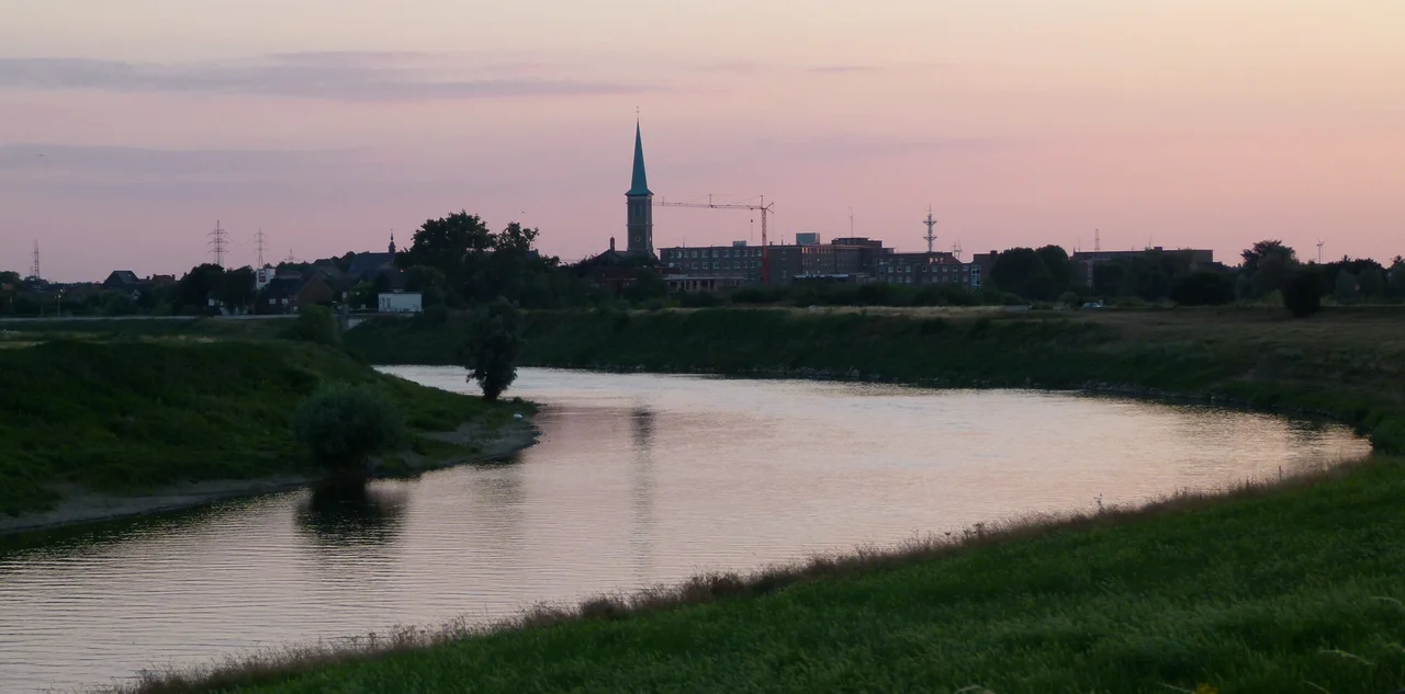
Across the Meuse
Maaseik sits on the left bank of the Meuse, on the Belgian side, but the river here is called the Grensmaas - 'border Meuse' - because the channel is the international boundary. On the far bank is the Netherlands. The bridge that connects Maaseik to its Dutch twin Echt-Susteren was destroyed several times during the two world wars; the current bridge dates from 1951 and replaced a temporary structure put up by American troops in 1944. Decades of gravel extraction have left a chain of disused pits along the valley that are now nature reserves and watersports lakes - the same kind of post-industrial recovery that built the Hoge Kempen National Park to the south. The Industrial Revolution mostly passed Maaseik by. That is why the seventeenth and eighteenth-century houses are still here. It is the strange Limburg pattern: what does not modernise, survives.
From the Air
Maaseik lies on the Meuse at 51.10 N, 5.79 E, right on the Belgian-Dutch border. The town centre sits a few hundred metres back from the river on a slightly elevated terrace that has historically protected it from floods. From altitude, look for the Meuse threading north-south with the chain of gravel-pit lakes alongside it, and the small grid of streets organised around the rectangular medieval town plan. Nearest airports: Maastricht-Aachen (EHBK) 30 km south-west, Liege (EBLG) 50 km south-west, Niederrhein/Weeze (EDLV) 40 km north in Germany.
Nearby Stories
- Schevenhutte Quarry 4.4 km away
- Ted Swales 5.3 km away
- Voeren 5.8 km away
- Rheindahlen 9.8 km away
- Kunstmuseen Krefeld 16 km away
- Battle of Neerwinden (1793) 16 km away
- Ysselsteyn German War Cemetery 17 km away
- Baarle-Hertog 27 km away