Baarle-Hertog
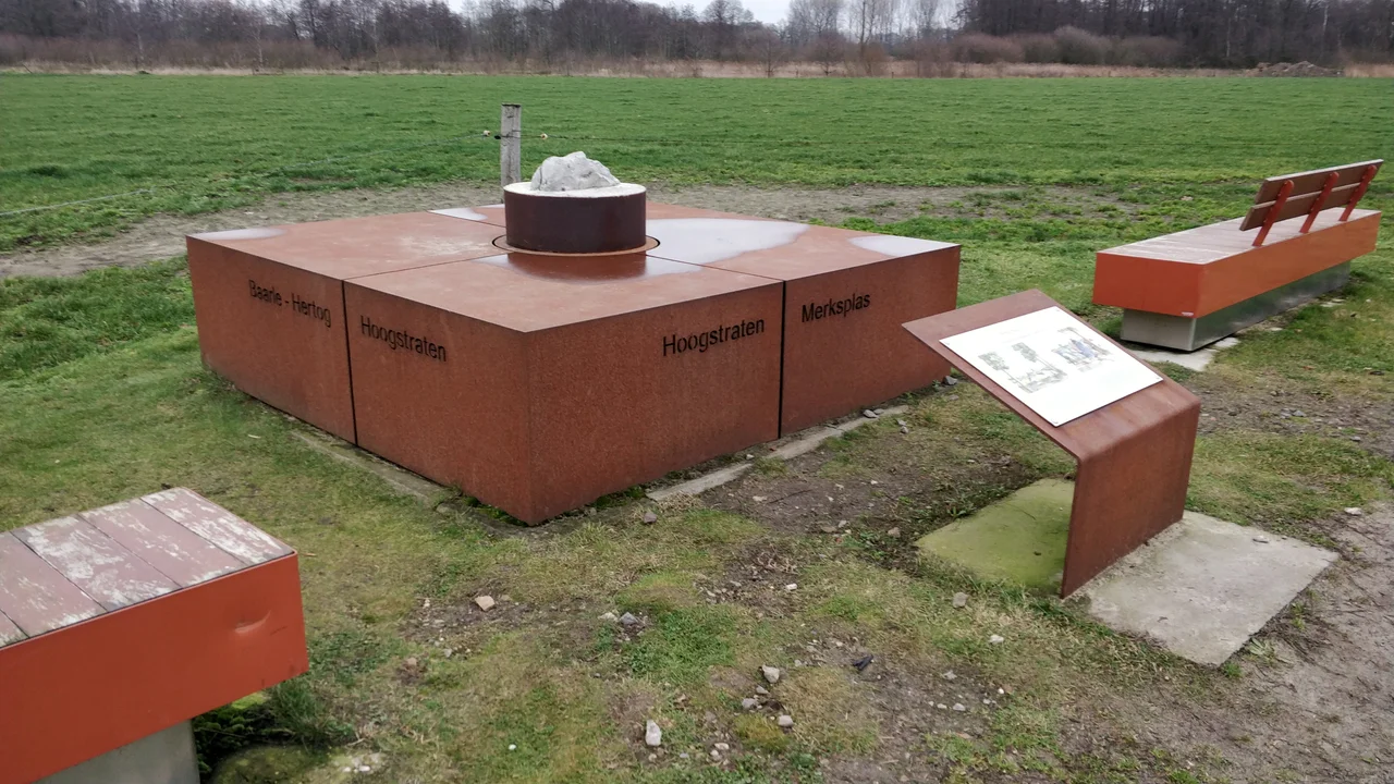
Look at a map of the Belgian-Dutch border and almost everywhere it is a tidy line. Then your eye reaches a spot about 50 kilometers south of Rotterdam, and the line dissolves into something that looks like spilled puzzle pieces. This is Baarle-Hertog, a Belgian municipality of 2,935 people whose 7.48 square kilometers are split into 26 separate parcels of land. Twenty-two of those parcels are Belgian exclaves entirely surrounded by the Netherlands. Two of those exclaves contain Dutch counter-enclaves: six Dutch parcels are tucked inside the largest Belgian exclave, and one more sits inside the second-largest. The smallest Belgian parcel is 2,469 square meters, roughly half the area of a football pitch. None of this is a mistake. All of it is a consequence of decisions made between 1198 and 1404 by people who could not have imagined that anyone would still be living with the results 800 years later.
The Land Deals That Made the Mess
The fragmentation began with a series of medieval treaties, swaps, and sales between the Lords of Breda and the Dukes of Brabant. Generally, the agreements followed a logic that made sense at the time: cultivated fields and buildings were assigned to the Dukes of Brabant, who eventually became Belgian; uncultivated heath and wetland went to the Lords of Breda, who eventually became Dutch. So whenever a Brabantian peasant cleared a new plot in the 1300s, that plot legally became Belgian, while the heath around it remained Dutch. Centuries of these micro-transactions, ratified one by one, produced the patchwork you see today. The Treaty of Maastricht in 1843 was supposed to clean things up. It did not. By then so many people had built houses, married across the imaginary lines, and inherited fractional plots that any tidy redrawing would have caused more disputes than it solved. The negotiators threw up their hands and ratified the chaos.
The Café That Closed in Two Languages
The strangest consequence is that the border runs through houses, gardens, and businesses. Where a national boundary crosses a building, a small cross is painted on the pavement outside, and the address depends on which side of that cross the front door opens. Some restaurants have tables in both countries, and for years this produced practical theater. When Dutch law required restaurants to close earlier than Belgian law, customers in border restaurants would simply move to a Belgian-side table when the Dutch hours ended. The dinner continued, in a different country, at the same address. In 2020, COVID-19 restrictions diverged sharply between the two countries. A Belgian resident living a few meters from an open Dutch bar might be barred from drinking there. Their neighbor across an invisible line might walk in freely. The town's residents have lived with this kind of thing for so long that it produces only mild eye-rolling.
The First World War Refuge
The strangest chapter came in 1914. When the Imperial German Army occupied Belgium, the Belgian exclaves inside the neutral Netherlands suddenly became unreachable. The Germans could not march into them without crossing Dutch soil, which the Dutch government refused to allow. So the Belgian enclaves of Baarle-Hertog became islands of unoccupied Belgium, surrounded by neutral territory, in a Europe at war. Belgian refugees crowded into them. A clandestine wireless transmitter was smuggled in and used to relay intelligence to the Belgian resistance fighters across the front line. The Dutch government fenced the enclaves off, controlling who entered and left, and built a church and a school for the Belgians stranded inside what amounted to wartime micro-states. In the Second World War the trick did not work: Germany occupied both countries this time. But for four years between 1914 and 1918, in the middle of a continental catastrophe, the bureaucratic absurdity of Baarle-Hertog saved lives.
Fireworks and Other Arbitrage
Today the border produces less drama and more commerce. Belgian laws on the sale of fireworks are much more relaxed than Dutch laws, so Baarle-Hertog has an outsized number of pyrotechnics shops catering to Dutch customers who drive south every December to stock up for New Year's Eve. The town has a single library with both Belgian and Dutch staff. Schools in the Belgian section, De Vlinder and De Horizon, follow Belgian curricula while their pupils may live three doors down in a Dutch jurisdiction. The Schengen Agreement and the European Union have stripped most of the bureaucratic friction out of the situation. Passports, customs, currency: all gone. What remains is a working civic life that quietly demonstrates what an open border actually looks like when you take the experiment to its logical extreme.
Petrus Christus, Born Somewhere Around Here
Sometime around 1410-1420, in or near Baarle, a child was born named Petrus Christus. He would grow up to become the most important painter in Bruges after the death of Jan van Eyck in 1441, the inheritor of the Early Netherlandish tradition that put oil paint on panel and changed the trajectory of European art. His birthplace is recorded only as 'Baarle,' which now leaves both Baarle-Hertog and Baarle-Nassau to claim him. Both do. It is fitting that a man whose national identity has been disputed for six centuries was born in the one place in Europe where national identity is itself a moving target. He left for Bruges to make his career. The little hyphenated town that gave him to the world simply got on with the business of existing, half here, half there, all at once.
From the Air
Coordinates 51.438°N, 4.932°E, approximately 50 km south of Rotterdam on the Belgian-Dutch border. From altitude, the town looks like an ordinary small Brabant settlement; the border patchwork is invisible from the air unless you know to look for the painted crosses, fences, and house-number plaques marking exclave boundaries on the streets below. Nearest airports: Antwerp International (EBAW) about 35 km southwest, Eindhoven (EHEH) about 40 km northeast, Breda International (EHSE) about 25 km northwest. The flat North Brabant landscape gives good visibility year-round, with the town surrounded by farmland and small wooded patches.
Nearby Stories
- Lier 2.4 km away
- Helmond 7.4 km away
- Essen, Belgium 9 km away
- Willemstad (Netherlands) 9.2 km away
- Dussen Castle 11 km away
- Aldendriel Castle 11 km away
- Maaseik 13 km away
- Ted Swales 13 km away