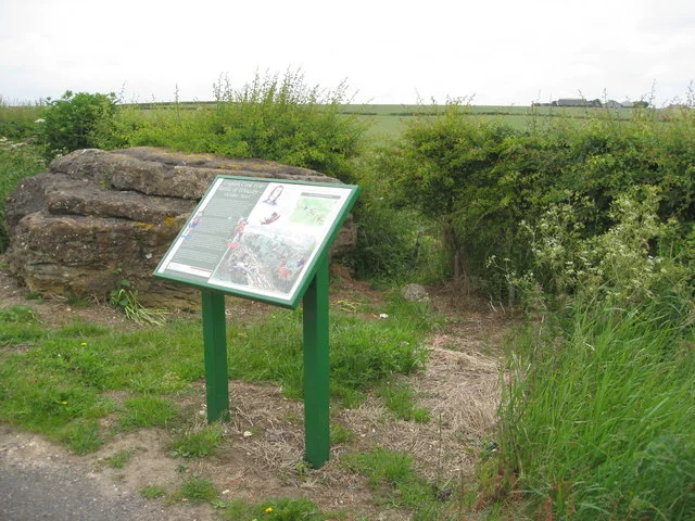

Battle of Winceby
It lasted about thirty minutes. The two cavalry forces met on a Lincolnshire field on 11 October 1643, in a place where the land falls away into sharp gullies on one side and rises away into open country on the other. Oliver Cromwell — not yet famous, not yet Lord Protector, still a colonel of horse in his second year of war — had his mount shot from under him and went down in the press. He climbed onto another horse and rode back into the fight. By dusk, three hundred Royalist soldiers were dead and the Parliamentary cavalry was hunting stragglers across the Wolds. In the village of Horncastle, at a place still called Slash Hollow, panicking Royalists jammed a parish boundary gate that only opened one way and could not get through it. The Battle of Winceby was one of the early proofs that the Earl of Manchester's new Eastern Association cavalry — Cromwell's Ironsides — could do something the king's horse no longer reliably could.
A war coming north
The summer of 1643 had gone badly for Parliament. The Royalists held most of the north and west of England. The Earl of Newcastle was besieging Hull from the north, and if Hull fell, the Royalist march on London became a real possibility. The Eastern Association — the Parliamentary military alliance of the eastern counties, commanded by the Earl of Manchester — moved to intervene. Manchester's infantry besieged the King's Lynn garrison, while his cavalry was loaded onto ships and ferried across the Humber to reinforce the Fairfaxes defending Hull. By mid-September the cavalry had crossed back south, joined Cromwell near Spilsby, and combined with Sir Thomas Fairfax's horse into a force strong enough to take the offensive. They moved against the Royalist garrison at Bolingbroke Castle, a few miles east of Horncastle. In response, Newcastle sent Sir William Widdrington with a relieving force of cavalry and dragoons from Lincoln.
The half-hour battle
The two forces met at Winceby, between Bolingbroke and Horncastle, on the morning of 11 October. Approximately equal in size and composition — all cavalry — they faced each other across the awkward, gullied ground. Cromwell, in tactical command of the Parliamentary horse, opened with a feigned retreat. A small advance party rode at the Royalists, who discharged their pistols at them. Cromwell then charged in force with his main body, hoping to close the distance before the Royalists could reload. The dismounted Royalist dragoons managed a second volley, hitting several of Cromwell's Ironsides. Cromwell's horse went down — apparently shot by Sir Ingram Hopton, who was himself killed shortly afterwards and is commemorated by a strange canvas inscription in St Mary's Church, Horncastle, that calls Cromwell the 'Arch Rebel' and records the wrong date for the battle. Cromwell got onto another horse and re-entered the fight. A flanking attack by Sir Thomas Fairfax broke a Royalist counter-charge under Sir William Savile, and when Savile's order to face about was misinterpreted as a retreat, his horse fled the field. The Royalist line collapsed.
Slash Hollow
What happened next gave the place its dark local name. The pursuing Parliamentary cavalry rode the broken Royalists back toward Horncastle. At a parish boundary gate — a one-way gate that opened against the fleeing direction — the press of men piled up against it and jammed it shut. Royalist troopers were killed or captured in the crush. The hollow where this happened was afterwards known as Slash Hollow, and the name has stuck for three and a half centuries. Manchester's troopers hunted stragglers across the countryside until the early-October dusk, when he recalled them. The Royalist dead came to about three hundred. The Parliamentarians lost about twenty, with sixty more wounded. On the same day, by chance, the garrison of Hull attacked Newcastle's besieging army with such force that the siege of Hull was abandoned the following morning. Two Royalist setbacks in a single afternoon.
Cromwell's reputation, Lincolnshire's recovery
Bolingbroke Castle's garrison surrendered on 14 November, with all hope of relief gone. Lincolnshire — which had been almost entirely in Royalist hands a month earlier — was now Parliamentary territory. The recovery set up the events of the following spring: Manchester would storm Lincoln itself in May 1644, then march north to join the army that won Marston Moor in July, the engagement that broke Royalist power in the north. Winceby itself was a half-hour scrap on a Lincolnshire field. It mattered because it was an early test of Cromwell's idea that disciplined, well-led cavalry could be the war-winning arm — an idea that would crystallise as the New Model Army two years later. The man whose horse was shot from under him at Winceby would, by 1653, be the head of state. The field is still farmed. The strange canvas in St Mary's, Horncastle — with its wrong date and its insult — is still there.
From the Air
The battlefield lies at approximately 53.20°N, 0.03°W, near the village of Winceby on the western edge of the Lincolnshire Wolds, about 18 miles east of Lincoln Cathedral. Horncastle (the town the Royalists retreated toward) is about 6 miles west; Bolingbroke Castle (the besieged garrison they were trying to relieve) is 4 miles east. The ground is gently rolling Wolds country — the gullies that complicated the cavalry action in 1643 still cut into the field edges. Nearest active airfield is RAF Coningsby (EGXC), 11 miles south, home of the Battle of Britain Memorial Flight. A registered historic battlefield.
Nearby Stories
- RAF Binbrook 2.4 km away
- Belvoir Castle 5.6 km away
- Newark Castle 13 km away
- Chain Bridge Forge, Spalding 14 km away
- Sandringham House 14 km away
- RAF Finningley 21 km away
- Hunstanton Lifeboat Station 26 km away
- Amethyst Gas Field 28 km away