Belait Swamp Forest
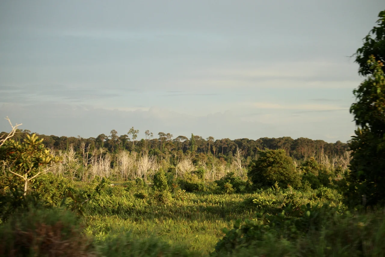
From altitude, the Belait Swamp Forest looks like any other stretch of Bornean jungle, an unbroken mat of green running from the coast toward the interior. Drop lower and the differences emerge. The canopy is shorter here, the trees thinner, their roots gripping not soil but peat, meters-deep accumulations of partially decayed organic matter so waterlogged and acidic that fallen wood decomposes at a fraction of the normal rate. This is Brunei's largest and most developed coastal peatland: 25,000 hectares of forested land in the Belait District of northwestern Borneo, where the ground is as much water as earth and the color of every stream runs to tea-dark black.
Built from the Dead
Peat swamp forests are landscapes constructed from their own decay. Over thousands of years, plant material falls into waterlogged, oxygen-poor conditions where bacteria cannot fully break it down. The result is peat, a spongy, acidic substrate that can accumulate to depths of several meters. In the Belait District, this process has built a seaward-expanding delta of organic soil along the coastline. The peat swamp forest covers some 90,884 hectares across Brunei, roughly 15.6 percent of the country's total land area, making it the second most widespread forest type in the nation. The largest unbroken extent runs through the Belait District and continues seamlessly across the border into Sarawak's Baram basin. This cross-border continuity matters. Peat ecosystems are hydrological units, and fragmenting them with roads or pipelines disrupts the water table that keeps the entire system from drying out and catching fire.
A Birdwatcher's Blackwater
BirdLife International designated the Belait Swamp Forest as an Important Bird Area for a reason that goes beyond species counts: the birds here are the kind that survive nowhere else. Storm's stork, one of the rarest storks on Earth, wades through the blackwater channels. Wallace's hawk-eagle, named for the naturalist who first described the biogeography of these islands, hunts from the canopy edge. The wrinkled hornbill's deep, resonant calls carry across the swamp at dawn. Bornean endemics anchor the list: the Bornean crestless fireback, a pheasant found only on this island, and the Bornean bristlehead, a strange, heavy-headed bird that taxonomists have struggled to classify for over a century. Blue-headed pittas flash color against the dark understory. The Malay blue-banded kingfisher perches motionless above the tea-colored streams, waiting. And the straw-headed bulbul, whose melodious song has made it a target for the cage-bird trade across Southeast Asia, still sings here.
Carbon Beneath the Canopy
Tropical peat swamp forests punch far above their weight in climate terms. Despite covering roughly three percent of the global land surface, peatlands store about one-third of all soil carbon on Earth. The Belait Swamp Forest is part of this planetary-scale carbon bank. As long as the peat remains waterlogged, the carbon stays locked in place, accumulated over millennia of slow, incomplete decomposition. But drain the water and everything changes. Exposed peat oxidizes rapidly, releasing centuries of stored carbon as carbon dioxide. Drained peat also becomes combustible. Peat fires burn underground, smoldering for months, producing the choking haze events that periodically blanket Southeast Asia. Brunei has so far avoided the catastrophic peat fires that have devastated Indonesia's Kalimantan, partly because so much of the Belait system remains intact, but pipeline construction and road-building have already fragmented portions of the lower Belait Valley.
Six Critical Sites
The Belait Swamp Forest is one of six sites Brunei has identified as critical for biodiversity protection. The country's protected area system already covers 41 percent of national land area, with plans to expand to 55 percent, a commitment tied to the Aichi Biodiversity Targets established under the Convention on Biological Diversity. The forest contains some gazetted reserves, but its protection is incomplete. Within the IBA boundaries, road construction and pipeline corridors for Brunei's oil and gas infrastructure have created linear clearings that fragment habitat and alter hydrology. Wildfire, both natural and human-caused, remains a persistent threat, particularly during El Nino drought years when the water table drops. The tension is specific to Brunei: the same oil wealth that gives this small sultanate the resources for conservation also demands the infrastructure that threatens the forest. Every pipeline corridor is a potential drainage channel, and every drainage channel is a fuse.
What Grows in Acid
The forest itself is a study in adaptation. Three distinct vegetation types intergrade across the peatland: peat swamp forest on the deepest, wettest soils; dipterocarp forest on slightly better-drained ground; and tropical heath forest, known locally as kerangas, on the nutrient-poorest substrates. Each supports its own community of specialists. The peat swamp trees grow slowly, their roots spreading wide rather than deep, buttressed against the unstable ground. Dipterocarps, the towering hardwoods that define lowland Borneo, reach smaller statures here than in the hill forests. The heath forest grows stunted and sparse, its plants adapted to soils so leached of nutrients that insectivorous pitcher plants supplement their diet by trapping insects. The upland peatlands on the Labi and Ladan Hills add another dimension: older, basin-type formations along the middle reaches of the Belait River that reflect different geological histories from the coastal swamp below.
From the Air
The Belait Swamp Forest is centered at approximately 4.40N, 114.42E in the Belait District of northwestern Brunei, on the island of Borneo. The forest stretches inland from the coast along the Belait River system. The nearest significant airport is Brunei International Airport (ICAO: WBSB) in Bandar Seri Begawan, approximately 100 km to the northeast. Miri Airport (ICAO: WBGR) in Sarawak, Malaysia is roughly 80 km to the southwest. From altitude, the peat swamp forest is distinguishable from surrounding lowland rainforest by its shorter, more uniform canopy. The Belait River and its tributaries are the primary landmarks for orientation. Oil and gas infrastructure, including pipeline corridors, may be visible as linear clearings. Expect hot, humid conditions year-round with frequent afternoon thunderstorms.
Nearby Stories
- The Town That Splits a Nation 5.3 km away
- The Fort That Ended the Feuds 13 km away
- Where the River Meets the Sea 19 km away
- Brunei's Green Jewel Across the Bay 25 km away
- Niah National Park 47 km away
- The Ants of Borneo 48 km away
- Similajau National Park 139 km away
- Luconia Shoals 198 km away