Where the River Meets the Sea
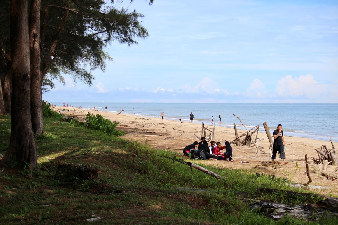
The name itself is a promise. Seri Kenangan translates roughly to "beautiful memories," and for more than half a century, this slender ribbon of sand between the Tutong River and the South China Sea has been delivering on it. Families spread mats under coconut palms, fishermen cast lines into the brown river current just meters from the surf, and the smell of satay drifts from stalls built in the shape of fish and mushrooms. It is not Brunei's most dramatic landscape. It is something arguably better: the place where an entire district learned to enjoy itself.
A District Officer's Gamble
In 1965, Pengiran Dato Paduka Othman bin Pengiran Anak Mohd. Salleh arrived in Tutong as district officer and saw potential where others saw scrub and driftwood. The narrow spit where the Tutong River curled toward the South China Sea was unused, overgrown, a place people passed through on their way to somewhere else. He proposed transforming it into a public picnic ground with an accompanying weekly market, or tamu, where villagers could sell produce and handicrafts. The idea was modest in scope but quietly radical in ambition: this would be a place built by the community, for the community, on almost no budget at all. The Tutong District Office, the Municipal Board, and the Health Office pooled their resources. The only dedicated funding was workers' wages.
Built by Hand, Opened by Curtain
On 1 October 1971, Tutong's residents turned out for a gotong-royong, the communal work tradition that runs deep in Malay culture. Government officers worked alongside youth groups, felling trees and hauling driftwood off the shore. Within months, the cleared beach began drawing visitors on its own. Craftsmen fashioned furniture from nibung palm, rattan, bamboo, and even discarded cable spools, building thirty table-and-bench sets, thatched pavilions for fruit vendors, and whimsical food stalls shaped like mushrooms and bird beaks. On 26 March 1972, the beach was officially inaugurated. The ceremony was simple: a curtain was drawn back from an entrance gate bearing the inscription "Selamat Datang ke Pantai Seri Kenangan Tutong" -- Welcome to Seri Kenangan Beach. What the community had built with rattan and willpower was now formally theirs.
A Sultan's Beach Palace
Long before the picnic tables arrived, this stretch of coast had already attracted royal attention. In the early 1950s, Sultan Omar Ali Saifuddien III built the Istana Pantai here, a modest beach palace constructed entirely of wood where he retreated for seaside picnics. The palace still stands, its timber frame weathered but preserved, a reminder that even a sultan understood the simple appeal of this particular meeting of river and ocean. The building's understated construction -- no marble, no gilt, just local hardwood -- suits the character of Seri Kenangan perfectly. This has always been a place that values the unpretentious pleasures: the sound of waves, the taste of grilled fish, the company of family on a warm afternoon.
Between Two Waters
Seri Kenangan's geography is its defining feature. The beach occupies a spit formed where the Tutong River meanders toward the sea, creating a narrow strip of land with salt water on one side and brackish river on the other. In the afternoons, visitors fish from the riverbank while their children play in the surf just a short walk away. The surrounding villages of Sengkarai, Penabai, and Kuala Tutong nestle among forests of coconut palms, and the road to the old ferry jetty at Kuala Sungai Tutong traces the route of a government ferry service that operated from 1930 until a bridge made it redundant in 1958. The clay soils of the area give the river its tawny color, and when the late sun catches the water, the whole spit glows amber.
Memories Still Forming
A memorial monument shaped like a gong and gendang gulingtangan -- the traditional drum ensemble of Brunei's Malay culture -- now marks the entrance to Seri Kenangan, surrounded by landscaped gardens. Chalets line the coast, their walls removed over the years to keep the views open and the breeze flowing. A children's playground draws families from across the district and beyond. When a research team from the Brunei History Centre visited in August 2002, they found the beach busy even on a regular weekday during school holidays, packed with families who had driven from other districts to picnic, fish, and watch the sun drop into the South China Sea. The beach that a district officer imagined from a stretch of driftwood and scrub had become exactly what its name promised: a place where beautiful memories are made.
From the Air
Located at 4.775N, 114.600E on the coast of Tutong District, Brunei. The spit is visible where the Tutong River meets the South China Sea, approximately 2 km west of Tutong town. Best viewed at low altitude (1,000-2,000 ft) where the river-sea junction and coconut palm forests are clearly visible. Nearest airport is Brunei International Airport (WBSB), approximately 50 km east. The coastline and river mouth make excellent visual navigation references.
Nearby Stories
- The Sultan's Island at the River's Mouth 4.4 km away
- The Dragon's Lake 7.7 km away
- USS Salute: The Minesweeper That Found the Last Mine 14 km away
- The Green Jewel You Can Only Reach by River 29 km away
- Kuraman Island: The Tiger's Lair of Borneo 79 km away
- Niah National Park 85 km away
- Similajau National Park 174 km away
- Luconia Shoals 175 km away