The Fortress That Buried Itself
The name gives it away. Benteng Pendem means "Buried Fort" in Indonesian, and for two decades that is exactly what it was: a pentagon-shaped Dutch colonial fortress on the southern coast of Java, slowly disappearing beneath sand, moisture, and neglect. When the Indonesian government excavated it in 1986, workers uncovered a 113-meter tunnel with four entrances, barracks with fourteen chambers, a two-story ammunition hold, and 330 meters of fortifications, all built of plaster-covered brick and buried under a meter or more of dirt. From a distance, the buildings had looked like nothing more than grassy mounds. Locals said the place was haunted. Television crews would later use it for on-camera tests of bravery, locking individuals alone in pitch-dark rooms for an hour. The ghosts, it turned out, were mostly history.
The Port Worth Defending
Cilacap mattered to the Dutch because of geography. Situated on Java's southern coast with a natural harbor sheltered by Nusa Kambangan Island, the port served as a critical link for shipping goods from the inland cities of Yogyakarta and Purworejo. When construction of the Kustbatterij op de Landtong te Tjilatjap began in 1861, the Dutch were building more than a battery. They were fortifying an economic artery. The pentagon-shaped complex eventually covered 10.5 hectares, ringed by a moat originally 10 meters deep and bristling with eleven cannon emplacements. The fortress began operations in 1879 and immediately took on a dual role: coastal defense and imprisonment. It held both civilian and military prisoners throughout the Dutch colonial period. According to the Babad Banyumas, a Javanese chronicle, the Sunan of Surakarta Pakubuwono IV had built a fortress in the Cilacap area in the early nineteenth century. Some historians believe the Dutch built directly over this older Javanese fortification.
Four Flags in Forty Years
The fortress changed hands with each political upheaval that swept through the archipelago. Japanese occupation forces seized it in 1942, and for three years the Imperial Japanese military controlled what the Dutch had built. When the occupation ended in 1945, the returning Dutch reasserted control, holding the fort until the Indonesian National Revolution concluded in 1949. The new Indonesian nation inherited the structure, and the Indonesian Army took possession in 1952. Between 1956 and 1962, the Resimen Para Komando Angkatan Darat, the elite unit now known as Kopassus, used Benteng Pendem for commando training. After 1965, the fortress was abandoned entirely. Pertamina, the state oil company, built storage facilities on four hectares of what had been fortress grounds. Sand crept over the walls. Vegetation reclaimed the cannon positions. The moat filled in. By the time anyone thought to look again, the Buried Fort had earned its name.
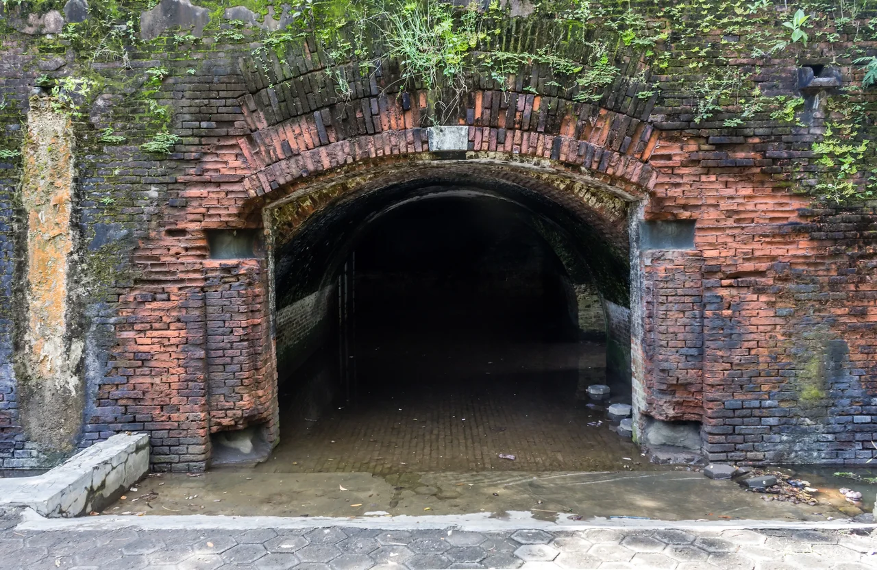
Digging Up the Past
The excavation of 1986 revealed a military complex that had been remarkably well preserved by its burial. The tunnel system, stretching 113 meters with four separate entrances, emerged intact. The barracks, the clinic, the ammunition stores, all built in a uniform architectural style, had survived beneath their protective layer of earth and sand. Not everything had made it through. Sea water and moisture had taken a toll on the plaster and brickwork, and by 2002 some sections were dangerously dilapidated enough to require fencing off. Persistent rumors hold that more structures remain unexcavated, including what locals describe as an undersea tunnel connecting the fortress to Nusa Kambangan Island across the bay. Whether such a tunnel exists remains unverified, but the idea captures the imagination of visitors who wander through the exposed corridors, aware that they may be walking above chambers that no one has entered in over a century.
Dinosaurs Among the Cannons
When the Cilacap regional government opened Benteng Pendem to tourists in 1987, the fortress entered a new and somewhat incongruous chapter. Swings and slides appeared alongside the cannon emplacements. Dinosaur statues were installed near the barracks. The tourist entrance was built on the eastern side, which had originally been the rear of the fortress, an irony that might have amused the Dutch military engineers who designed the complex to face the sea. By 2013, Benteng Pendem had become the region's premier tourist destination and was designated a Cultural Property of Indonesia. Guides lead visitors through the tunnels and fortifications, pointing out the ammunition holds and the prison cells. The moat, once 10 meters deep and designed to repel assault, now stretches 500 meters at a modest 5 meters wide and 2 meters deep. To the east lies Teluk Penyu Beach. Across the bay, Nusa Kambangan Island rises above the waterline, the same landmass the fortress was built to defend over 160 years ago.
From the Air
Located at 7.75S, 109.02E on the southern coast of Java, at the tip of the Cilacap peninsula. The pentagon-shaped fortress complex is visible from low altitude near the shore, adjacent to Pertamina oil storage tanks which serve as a visual reference. Nusa Kambangan Island lies directly across the bay to the south. Teluk Penyu Beach is immediately east. The nearest airport is Tunggul Wulung Airport (WIHL) at Cilacap, approximately 8 km to the northwest. Approach from the south over the bay for the best perspective of the fortress's relationship to the harbor it was built to protect.
Nearby Stories
- The Ring of Fire's Restless Spine 36 km away
- The Ghost Boat That Built an Empire 38 km away
- The Double Life of Cirahong Bridge 42 km away
- The Sultan Who Besieged the Future 51 km away
- A King's Canal, Carved in Stone 65 km away
- The Village at the Cliff's Edge 87 km away
- Shaken Foundations: The 2021 East Java Earthquake 316 km away
- SIEV X 351 km away