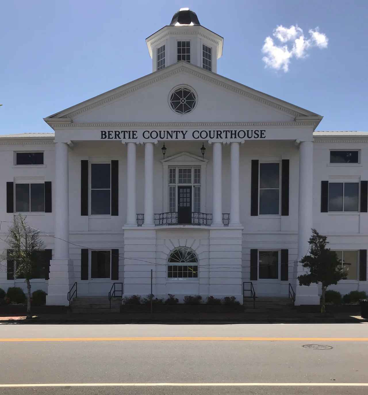

Bertie County, North Carolina
Bertie County (rhymes with 'thirty,' with the accent on the first syllable - a local pronunciation that defies the spelling) is one of the oldest counties in North Carolina and, by one peculiar statistic, the most rural in the state. According to the 2020 census, exactly zero percent of Bertie County residents live in what the Census Bureau classifies as an urban area. All 17,934 of them live in towns, hamlets, and crossroads small enough to count as countryside. Wedged between the lower Roanoke River to the south and the Chowan to the east, with cypress swamp and farmland in between, Bertie has been emptying out for decades. What remains is a quiet country that traces directly back to the colonial era.
A County of Sounds and Rivers
Bertie was formed in 1722, named for the Bertie family of English nobles, two of whom (James and Henry Bertie) were Lords Proprietor of Carolina. The original county was enormous; subsequent divisions carved out Northampton, Edgecombe, and parts of other counties from its territory, leaving the modern Bertie as a triangular wedge bounded by the Roanoke, the Chowan, and the Albemarle Sound. The county seat is Windsor, on the Cashie River - itself a quiet blackwater tributary of the Albemarle. The other towns are tiny: Askewville, Aulander, Colerain, Kelford, Lewiston Woodville, Powellsville, Roxobel. The land between them is mostly fields and pine plantations, with cypress swamp dominating the river bottomlands. Hope Plantation, just outside Windsor, preserves the home of David Stone, a U.S. senator and North Carolina governor from the early nineteenth century, and is open as a state historic site.
Indian Woods and the Tuscarora
One of the county townships is called Indian Woods, and the name preserves a difficult history. After the Tuscarora War of 1711-1715, the surviving Tuscarora in eastern North Carolina were confined to a reservation in what is now Bertie County. The reservation - a strip of land along the Roanoke River - was steadily reduced through the eighteenth century as colonial officials pressured the Tuscarora to lease or sell their lands. Most Tuscarora eventually moved north to join their Iroquoian relatives in New York and Canada. A small number remained in Bertie and the surrounding counties. The state-recognized Meherrin Indian Tribe, whose people are an Iroquoian group historically related to the Tuscarora, has members in Bertie and the neighboring counties today. The Indian Woods township carries the memory of a much older landscape.
Population in Decline
Bertie has been losing people for a long time. The 2024 estimate places the population at 16,939, down about 5.5 percent from 2020. Look further back and the trend is steeper - the county had 21,282 people in 2010 and over 19,000 in 2000. The reasons are familiar across the rural American South: young people leave for jobs in larger cities, the agricultural economy demands fewer workers, the local industrial base has thinned. Median household income across 2019-2023 was $45,931, well below the North Carolina median. About a fifth of residents live below the federal poverty line. The North Carolina Department of Public Instruction rated the Bertie County school system 'low-performing' for the 2021-2022 academic year, a label that reflects the gap between rural and metropolitan school funding as much as any other single factor.
A Quiet Country
What Bertie has, in compensation, is space. Open land, big skies, cypress-lined rivers running mostly empty. The county is the kind of place where photographers go for the unspoiled river views and where birders go for the migratory waterfowl that use the Roanoke and Cashie bottomlands. The historic crossroads of Merry Hill, on a peninsula reaching into the Albemarle Sound, offers some of the most expansive water views in northeastern North Carolina. The fishing in the Chowan and Roanoke is excellent. The roads stay quiet. The 2024 presidential election marked the strongest Republican performance in Bertie County since 1984, with Donald Trump winning nearly 42 percent of the vote - a political shift mirroring the broader rural realignment of the eastern Carolinas. The county still has a majority-Black population, sixty-two percent in 2010 figures, and remains part of the Black Belt's deep historical and political geography.
From the Air
Bertie County sits at 36.06 degrees North, 76.96 degrees West, in northeastern North Carolina between the Roanoke and Chowan rivers. From altitude the two rivers frame the county clearly: the broad blackwater Roanoke on the south, the equally dark Chowan on the east, both widening as they approach the Albemarle Sound. Windsor sits roughly central on the Cashie River. There are no large airports in the county itself; Edenton-Northeastern Regional (KEDE) lies just east across the Chowan, Plymouth Municipal (W41) lies south across the Roanoke, and Pitt-Greenville (KPGV) is about 40 miles southwest. Recommended viewing altitude is 4,500 to 6,500 feet AGL for the best perspective on the cypress-fringed rivers and the patchwork of farmland between them.
Nearby Stories
- Coast Guard Base Elizabeth City 18 km away
- Blackwater River (Virginia) 20 km away
- East Carolina University 28 km away
- Pocosin Lakes National Wildlife Refuge 30 km away
- Tarboro, North Carolina 31 km away
- Battle of Great Bridge 38 km away
- Lake Mattamuskeet 41 km away
- Lake Gaston 50 km away