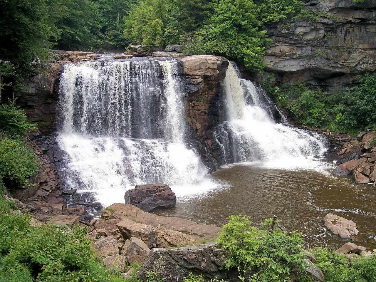

Blackwater Canyon
In 1914, the Blackwater Canyon burned for six straight months. The Allegheny gorge in eastern West Virginia had been clear-cut over the previous decades by the timber empires of Senator Henry Gassaway Davis and his successors. The slashings left behind - branches, sawdust, stumps - turned the canyon into a tinderbox. By 1910, fires were sweeping the wasteland annually, often burning continuously from spring until the first snows. The 1914 burn was the worst. When the smoke finally lifted, what remained was thin mineral soil and bare rock. Soil erosion and flooding followed. The river ran black with sediment. A century later, the canyon has substantially regrown - a thousand feet deep, eight miles long, walled by second-growth spruce and hemlock - but the fight over its future is not finished.
How the River Made the Cut
Blackwater Canyon runs eight miles, from the foot of Blackwater Falls near Davis to the confluence with Dry Fork near Hendricks. The river drops 1,250 feet along that stretch - from about 3,000 feet of elevation to 1,750 feet - producing some of the most concentrated whitewater in the eastern United States. The upper Blackwater carries Class IV-V+ rapids; the lower Blackwater settles to Class III-IV. The gorge separates Backbone Mountain to the northwest from Canaan Mountain to the southeast. Tributary streams like Pendleton Creek and Shay's Run have carved hanging valleys high above the canyon floor, leaving cascades to drop hundreds of feet into the main gorge. The geology is durable Appalachian sandstone, slow to weather and hard to climb.
The Senator's Railroad
In 1881, coal and timber magnate Henry Gassaway Davis - former US Senator from West Virginia - and his West Virginia Central and Pittsburgh Railway laid first tracks in eastern West Virginia. By 1884 the line reached Thomas. In 1888, Davis decided to extend it through Blackwater Canyon to Hendricks, an engineering feat that took a year. Workers excavated road cuts hundreds of feet high into Backbone Mountain. Where the route had to cross deep ravines and rushing tributaries, builders constructed massive stone archways and culverts - the Big Run culvert, 60 feet long, 25 feet wide, and 30 feet high, is the most impressive surviving example. Several wrecks and derailments occurred at Big Run because of the sharpness of the curve trains had to negotiate. The railroad opened the canyon to coal mines, coke ovens, and timber - and to the towns of Douglas, Limerock, and Coketon that grew along its line.
Clear-Cut, Burned, and Restored
By 1914, the canyon was virtually denuded. The clear-cuts of the 1890s and 1900s had left almost no standing timber. The fires that followed completed the destruction. Large-scale clear-cut timbering in the canyon has not occurred again since. The Monongahela National Forest was established in 1920, and its anti-erosion and forest restoration projects gave the surrounding country a slow chance to heal. The south side of the canyon, owned by West Virginia Power and Transmission Company (later Allegheny Power) and slated for an unbuilt hydroelectric project, was excluded from the federal protection but recovered anyway, sheltered by the adjacent public lands. In 1937, Blackwater Falls State Park was established at the head of the canyon, including the renowned 62-foot falls. The 1943-44 Army climbing school taught soldiers to climb cliffs here as they had at Seneca Rocks.
The Long Negotiation
In 1970, the National Park Service recommended the canyon for National Natural Landmark status. The railroad fell out of service in 1983; six years later, the grade became the Blackwater Canyon Railroad Grade Trail, twelve miles long and passing the great Big Run culvert and tributary cascades. In 1995, the U.S. Forest Service recommended the river for Wild and Scenic status. The Conservation Fund negotiated with Allegheny Power for public ownership. In 1997, the power company rejected the Fund's $3.5 million offer and sold its 2,750-acre tract to a private developer for $5 million. The developer resold it to Allegheny Wood Products, a hardwood exporter, which began timbering and proposing development. Public pressure produced compromises: in 2000 the state bought the Lindy Point overlook for the state park; AWP granted the state right of first refusal on additional canyon land.
What Lives There Now
Today about half the canyon outside the state park is owned by Allegheny Wood Products and half by the Monongahela National Forest. About 6,000 acres of spruce, hemlock, pine, oak, maple, yellow poplar, and rhododendron now cover the slopes. Black bear, white-tail deer, squirrels, numerous bird species, and timber rattlesnake dens inhabit the gorge. Soapwort and jewelweed bloom along the trails. The 2010 Forest Service Record of Decision restricted Allegheny Wood Products' use of the rail-trail to occasional maintenance and emergency access - not logging. In 2008, Governor Joe Manchin had proposed $5 million as the state's share of a possible public purchase of the entire canyon. The deal did not happen. The fight continues, slower and more procedural than it was, but the trees keep growing.
From the Air
Located at 39.10 degrees north, 79.55 degrees west, in Tucker County, West Virginia. Best viewed from 5,500 to 8,000 feet AGL. The canyon runs roughly east-southeast for eight miles between Backbone Mountain (northwest) and Canaan Mountain (southeast). Blackwater Falls at the head and the confluence with Dry Fork at the foot are clear landmarks. The Lindy Point overlook on the northwest rim provides the canonical view. Nearest airports are Elkins-Randolph County (KEKN) and Cumberland Regional (KCBE). Watch for strong winds and turbulence in the canyon's vicinity.
Nearby Stories
- District of West Augusta 2.4 km away
- Battle of Moorefield 12 km away
- Sinks of Gandy 15 km away
- Helvetia, West Virginia 16 km away
- Orkney Springs Hotel 26 km away
- Battle of Fort Necessity 49 km away
- United Airlines Flight 93 77 km away
- West Virginia Penitentiary 79 km away