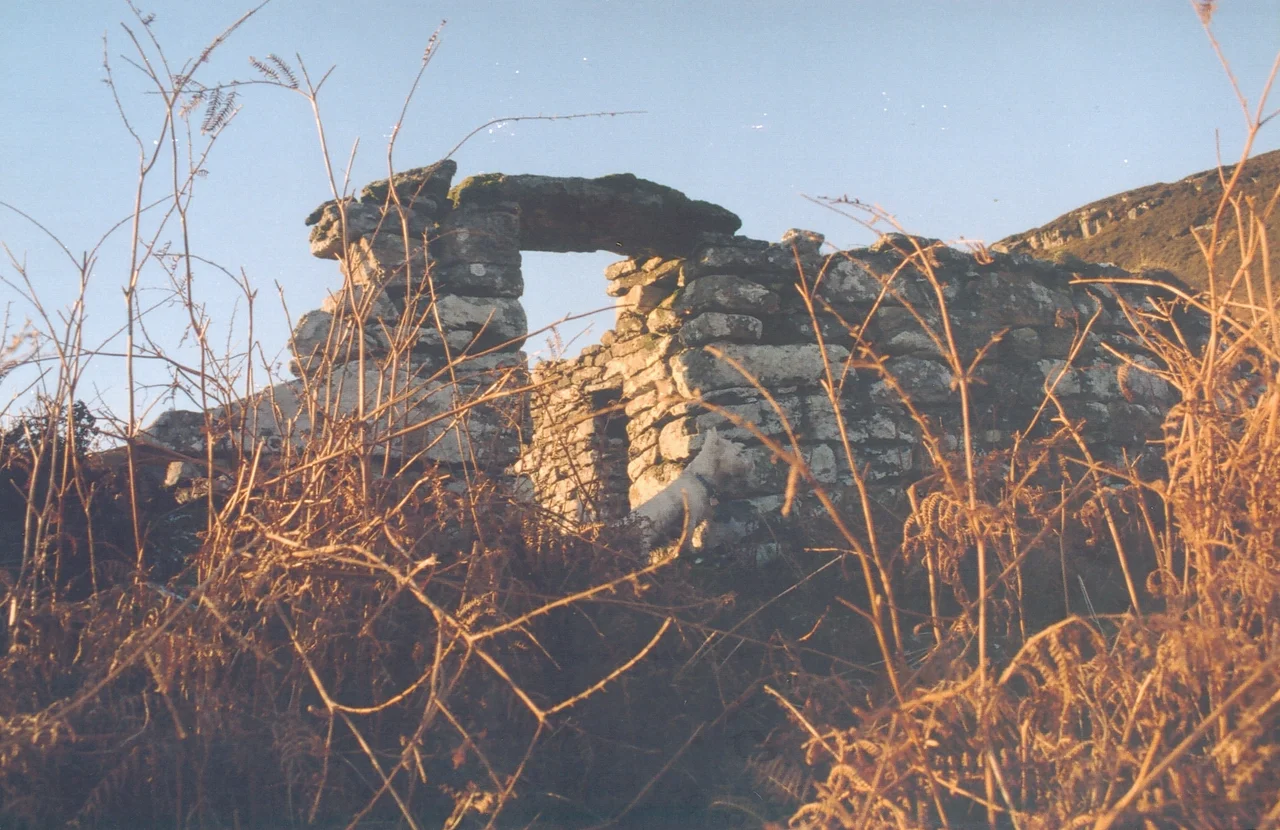

Boreraig
Boreraig lies in a green, fertile glen, sheltered and south-facing - the kind of ground that has fed people for as long as people have farmed in the Hebrides. In 1851 the Scottish census recorded approximately one hundred and twenty men, women, and children living here in twenty-two households, spread across ten landholdings of six acres each. Most were crofters and agricultural labourers; the census taker also noted a few weavers, a fisherman, and a house carpenter. Many were related, and a great many shared the surname MacInnes. Two years later, in 1853, the agents of Lord MacDonald forced every household out to make way for sheep.
The Last Sheltered Glen
The MacInnes families and their neighbours had lived in Boreraig for generations - records held now at the Clan Donald Centre at the Armadale Museum of the Isles track croft tenancies back to 1823, and the social patterns long predate that. The village was what historians call a baile, a pre-crofting township: shared grazing, intermingled small plots, houses clustered together for warmth and company. The walls of those houses still stand to wallhead height in places, the field walls remain remarkably intact, and you can walk between them today on the popular circular route from Kilchrist. What you cannot do is hear the children, the looms, or the fishing talk - all of that was taken away in 1853 and scattered across the world.
The Sponsored Emigrations
The Boreraig evictions coincided with the high-water mark of the Highland and Island Emigration Society - a scheme that, during its few years of operation, resettled some 5,000 highlanders and islanders in Australia. By 1853 the HIES had accepted at least eight of Boreraig's 22 households - nearly half the village - for sponsored emigration. In 1852, families from three households sailed on the Araminta, the Allison, and the Ontario. Late that same year, five more Boreraig households were assigned berths on HMS Hercules. Fever broke out aboard. Passengers were dying before the ship reached Ireland. The records are sparse and matter-of-fact, the way disasters often are when they happen to people whose names the official ledger barely bothered to learn correctly.
Those Who Stayed Close
Not every Boreraig family went overseas. Clan Donald records show that approximately seven of the households listed as 1852 tenants eventually re-established themselves as crofters in other villages on Skye and nearby - taking new ground where they could, rebuilding within a culture and language they could still hear around them. Scottish General Registry Office records confirm the pattern. Some families went south to the Lowlands or to Glasgow, where the ships and the factories needed labour. Others took up the HIES berths and made new lives in the long heat of Australia. The cleared village itself lost its last residents in 1877. The ground that fed those hundred and twenty people now belongs to the Scottish Government, which has owned this part of Strath Swordale for years.
What the Walls Remember
Walk into Boreraig today and you walk into what archaeologists call a deserted township - one of many on the west coast and Hebrides, each with its own specific history of compulsion and loss. The largest ruin is the house and steading built for the tacksman, the better-off tenant farmer whose lease covered the village. Around it stand the smaller dwellings, the field walls, the remains of a promontory dun, and an anchorage where small boats once drew up. The path from Kilchrist takes you past Boreraig to neighbouring Suisnish and Kilbride, two more cleared villages within walking distance. The Highland Clearances are sometimes described in general terms - acres of sheep, miles of empty coast - but Boreraig is the specific version: twenty-two households, six-acre crofts, a couple of weavers, a fisherman, a carpenter, and a glen that has been quiet now for nearly 150 years.
From the Air
Coordinates 57.1772°N, 5.94083°W on the north shore of Loch Eishort, southern Isle of Skye in the parish of Strath. From 2,500-3,500 ft AGL the ruins are visible as low stone walls in a green, south-facing glen at the head of the loch. Beinn na Caillich rises to the north; the Cuillin ridge dominates to the west. Nearest fields: Plockton (EGPO) 20 nm northeast, Oban (EGEO) 55 nm south. Best access from the air is via Broadford. The cleared villages of Suisnish and Kilbride lie within 2 nm to the west, similarly recognisable by walled enclosures without buildings.
Nearby Stories
- Arisaig 5.3 km away
- Talisker distillery 9.7 km away
- Loch Torridon 11 km away
- Uig 12 km away
- Neptune's Staircase 16 km away
- Glen Affric 18 km away
- Corrieshalloch Gorge 34 km away
- Coll 39 km away