
Bowen Road
The road was colloquially called "Third Road" by Hong Kong residents for the simple reason that it was the third east-west route from the shore. First Road was Queen's Road. Second Road was Kennedy Road. Bowen Road, running along the hillside above Wan Chai and Happy Valley, marked the southern edge of Victoria City — the colonial settlement at Hong Kong Island's heart. The fact that it exists at all is an accident of engineering: it was built on top of an aqueduct.
Water First, Road Second
Hong Kong Island had no reliable fresh water supply in its early colonial decades. The solution was the Tai Tam Reservoir, built in the Tai Tam Valley on the island's southern side. An aqueduct carried the water from Tai Tam through Wong Nai Chung Gap and Happy Valley to Central, tracing the island's natural contours. When the time came to build a road at that elevation, the aqueduct's path became the road's foundation.
Bowen Road runs from Magazine Gap Road, near the Peak Tram rail, to the junction with Stubbs Road, Tai Hang Road, and Wong Nai Chung Gap Road. It is named after Sir George Bowen, an Ulsterman who served as Hong Kong's 9th Governor from 1883 to 1885. A boundary stone once stood at the Stubbs Road junction, marking the official limit of Victoria City. The road passes several schools along its length and remains closed to through traffic for most of the day, which is how it kept its character while the rest of Mid-Levels built upward.
The Stone That Promises Happy Marriages
About twenty minutes' walk from Stubbs Road, just off the main path, stands Lover's Stone — a 9-metre-high granite monolith that tradition holds has the power to grant happy marriages to those who worship at it. The practice of visiting the stone to pray for romantic fortune is documented in local folklore, drawing visitors seeking a blessing that more rational interventions have failed to provide.
The monolith also commands a view of Victoria Harbour. From this elevation — roughly 100 metres above sea level — the harbour opens out to the north, with Kowloon on the far shore. On clear days, the view extends to the hills of the New Territories. The combination of the folklore and the scenery has made Lover's Stone one of those spots that locals know about and visitors occasionally stumble upon, which may be the best kind of landmark a city can offer.
The Unexplained Killings
Since 1989, Bowen Road has been the site of a persistent, unresolved series of animal poisonings. By the end of October 2009, there had been 72 documented cases of dog poisoning on the road, with 22 dogs killed after eating poisoned chicken left on the path. The killer, or killers, used a commonly available but highly potent insecticide, leaving cooked chicken as bait along a route extremely popular with dog walkers, particularly among Hong Kong's expatriate community.
The case acquired a degree of notoriety when it touched government. Chris Patten, the last British Governor of Hong Kong, nearly lost his Norfolk terrier Whisky to poisoned chicken on Bowen Road. The dog survived, but the near-miss drew national press attention. The SPCA investigated repeatedly, and the reward for information was raised from HK$30,000 to HK$150,000. Neither figure produced a result. Police believe the killer remained active as recently as 2008. Speculation about motive has included the possibility that dog owners, by allowing their pets off-leash near the Chinese graves accessible from the road, offended someone — but no explanation has been confirmed, and no one has been charged.
A Road That Stayed Itself
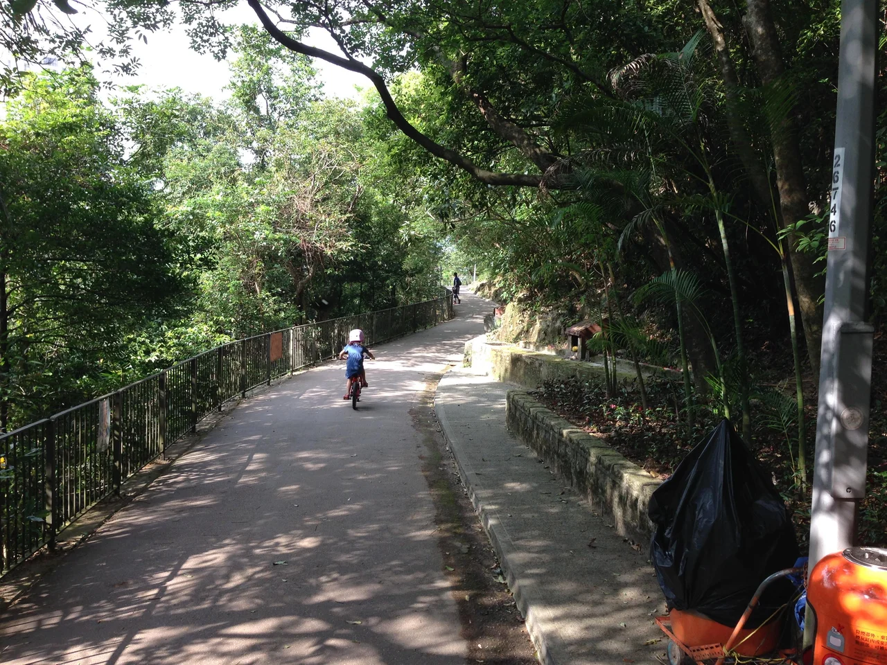
What makes Bowen Road distinctive in a city of constant transformation is how little it has changed in purpose. Victorian engineers built the aqueduct to move water. Colonial planners built the road to move people. Modern Hongkongers use it to run, walk dogs, and breathe. The route's closure to most vehicles means the ambient noise level drops noticeably once you leave the junctions at either end — an unusual quality in one of the world's densest cities.
The hillside position gives the road its character: shade from the trees, the sounds of birds and traffic mingled at different distances, glimpses of the harbour between the vegetation. At dawn, when joggers outnumber everyone else, Bowen Road has the feeling of a city choosing, briefly, to be quiet. The aqueduct it was built to serve has long been superseded by modern infrastructure. The road above it endures.
From the Air
Bowen Road runs along the Mid-Levels of Hong Kong Island at approximately 22.27°N, 114.17°E, roughly 100 metres above sea level on the northern slopes above Central and Wan Chai. Approaching from the northwest at 2,000–3,000 feet, the terraced Mid-Levels residential area is clearly visible beneath Victoria Peak, which rises to 552 metres. Victoria Harbour lies to the north. Hong Kong International Airport (VHHH) is approximately 28 km to the west on Lantau Island. The Happy Valley racecourse is a distinctive oval visible just east and below Bowen Road's eastern end.
Nearby Stories
- Lok Ma Chau Loop 2.3 km away
- Portas do Cerco 2.3 km away
- Kweilin Incident 17 km away
- Wanshan Archipelago Campaign 34 km away
- Nanxiong Formation 115 km away
- Battle of Nanpeng Island 148 km away
- Heyuan 169 km away
- Cape Maobitou 632 km away