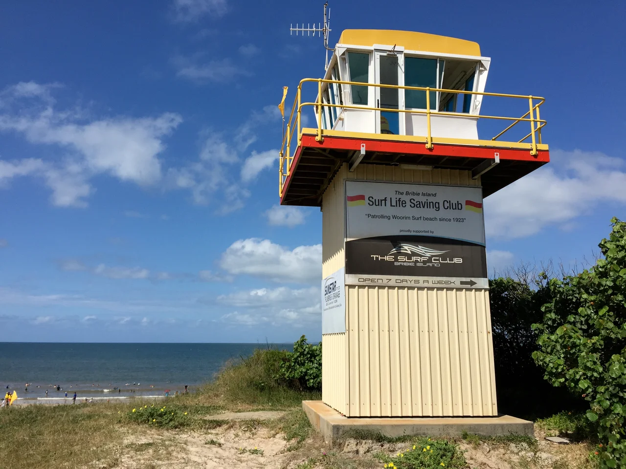

Bribie Island
For roughly twenty years, one of Australia's greatest modernist painters lived here in a hut he built himself, with no electricity, no running water, and a roof that leaked. Ian Fairweather had drifted to Bribie Island in 1953 after surviving a near-fatal sixteen-day raft voyage from Darwin toward Timor. He was sixty-one, Scottish-born, and done with the world's expectations. On this long, low spit of sand at the top of Moreton Bay, he painted in self-imposed poverty until his death in 1974, producing works now considered among the finest this country has made. The island has a way of attracting people who want to disappear into it.
Yarun, the Sand Island
Long before any European set eyes on it, this was Yarun -- the name the Joondoburri people gave to the smallest and most northerly of the three great sand islands that shelter Moreton Bay. Thirty-four kilometres long and barely eight at its widest, Bribie is built entirely of windblown sand, its dunes stitched together by eucalypt forest, banksia heath, and dense mangroves along the calm western shore. The ocean side, screened by Moreton Island and its sandbanks, sees only a gentle surf. The local people, part of the broader Gubbi Gubbi nation of south-east Queensland, numbered perhaps 600 to 1,000 before contact. By 1891, none remained on the island. A name on a map -- Yarun -- is one of the few threads still tying the place to the people who knew it first.
The Skirmish
In July 1799, the explorer Matthew Flinders anchored off the western shore in the colonial sloop Norfolk, convinced he had reached the mainland. With him was Bungaree, an Aboriginal man from the Broken Bay region near Sydney -- a gifted diplomat far from his own country. The meeting on the beach began peaceably enough, until one of the Djindubari men reached for Flinders' hat. Flinders refused to give it up. As the Europeans withdrew to their boat, a spear flew; Flinders fired his musket in reply and wounded a man on the shore. He named the place Point Skirmish. Bungaree's name endures here too, slightly altered: the southern town of Bongaree carries it still, a quiet memorial to a man who walked between two worlds and was trusted by both.
Guns in the Dunes
When the Second World War reached the Pacific, Bribie became Brisbane's shield. From 1939 the army built Fort Bribie at the island's northern tip, mounting two six-inch guns -- weapons that had once armed a First World War cruiser -- to cover the North West Channel, the deep-water doorway into Moreton Bay. After the Japanese captured Kokoda in 1942, occupying Australian territory for the first time, dread settled over Queensland. More batteries went up at Skirmish Point in the south, and naval crews in concrete huts watched undersea cables for the magnetic signature of submarines. Today the emplacements crumble in the lantana, and the relentless sea has done what no enemy could: on 2 January 2022, ex-Cyclone Seth and a king tide tore a 200-metre passage clean through the northern spit, slowly cutting the old fortress adrift.
The Quiet Life
Most of Bribie is still wild -- a national park covering nearly a third of the island, fringed by pine plantation and, in the south, by the easygoing towns of Bongaree, Woorim, Bellara, and Banksia Beach. The bridge that arrived in 1963 was, at the time, the longest pre-stressed concrete bridge in Australia, and it turned a remote retreat into a place where retirees outnumber children and the median age runs well above the national figure. People come for the fishing off Bribie Jetty, the calm beaches of the lee shore, the surf at Woorim, and the same thing Fairweather came for: a slower, smaller, salt-air existence at the very edge of the bay, with the Glass House Mountains floating blue on the western horizon.
From the Air
Bribie Island lies at roughly 26.97S, 153.13E, the northernmost of Moreton Bay's three sand islands, about 35nm north of Brisbane. From the air it is unmistakable: a long, thin, north-south sliver of sand separated from the mainland by the narrow Pumicestone Passage, with extensive pale mangrove flats along its western edge and a continuous surf beach on the east. Look for the recent breakthrough channel near the northern tip, where the spit has been severed, and the bridge crossing to Bellara at the urbanised southern end. The Glass House Mountains rise sharply on the western horizon as a navigation reference. Nearest airports: Brisbane (YBBN) approximately 30nm south, Caboolture (YCAB) approximately 15nm south-west, Caloundra (YCDR) approximately 8nm north. Coastal sea breezes and afternoon cloud build-up are common in summer.
Nearby Stories
- Matthew Flinders 1.6 km away
- Maroochy Air Crash 6.7 km away
- Cressbrook Homestead 19 km away
- 2010-2011 Queensland Floods 53 km away
- Cape Byron 154 km away
- Childers Palace Backpackers Hostel fire 168 km away
- Cape Byron Light 184 km away
- HMS Porpoise (1799) 533 km away