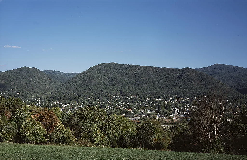

Buena Vista, Virginia
The city sign on Route 60 reads, depending on which decade you arrive in, 6,002 happy citizens and 3 old grouches. The grouches are unnamed. The happy citizens, according to the 2020 census, actually number 6,641. The sign has not been corrected. In Buena Vista, the joke is older than the data.
The name came from the Mexican-American War. In February 1847, American troops under Zachary Taylor fought Mexican forces at the Hacienda Buena Vista in Coahuila, and afterward American towns started naming themselves after the engagement the way later generations would name towns after moon landings. Buena Vista, Virginia, took the name in 1888, when the place was still called Hart's Bottom by people who had been there longer than the railroad.
Hart's Bottom to Boom Town
Before it was Buena Vista, this hollow at the foot of the Blue Ridge was a half-dozen mills along the river the locals called North. A Civil War-era survey from 1863 found the Paxton and Majors properties grinding grain and counted little else. Then the railroads arrived: the Richmond and Alleghany along one bank, the Shenandoah Valley along the other, with the old James River Canal between them carrying water power instead of barges. Benjamin C. Moomaw founded a tannery at the junction. Within a few years the tannery had been joined by a paper and pulp mill, a saddle factory, a cashmere mill, brickworks, a wagon works, an egg crate factory, an iron furnace, a glass foundry, a boiler factory, and two banks. The town was chartered in 1890 and granted an independent city charter on February 15, 1892, separating it politically from surrounding Rockbridge County. For a brief period it was one of the busiest small industrial towns in Virginia.
The Flood of Sixty-Nine
On August 20, 1969, the Maury River gauge at Buena Vista read 31.23 feet. Flood stage was 17 feet. The cause was Hurricane Camille, which had killed hundreds along the Gulf Coast a few days earlier and then drifted inland to dump its remaining rain on western Virginia. The downtowns of Buena Vista and downstream Glasgow vanished under more than five feet of water. People who were children that summer still describe the smell afterward, river mud and tannery sludge and the inside of houses that had been the inside of a river for two days. Sixteen years later, in 1985, the convergence of three storm systems including Hurricane Juan did it again. After that, the Army Corps of Engineers built the James C. Olin Flood Control Project, completed in 1997. It is a 2.5-mile levee wall, and on top of the wall is a walking trail called the River Walk. The town now strolls along the line that used to be where the water came in.
What the Buildings Remember
The 1890 Buena Vista Hotel was built to lodge investors who never quite arrived in the numbers expected. It became Main Hall at Southern Virginia University and now houses administrative offices on a campus run with Latter-day Saint values in the heart of Confederate-monument country, a juxtaposition Buena Vista has learned to live with. The Buena Vista Colored School, listed on the National Register, names what the schools were called when this region's Black children were taught separately. The Old Courthouse is the public library now. Glen Maury Park, across the Maury on the city's western edge, has a two-story wooden pavilion built so visitors can see 360 degrees of mountain in every direction. At sunset in fall the view picks up every color the Blue Ridge knows how to make.
The Sons of the Town
Charlie Manuel grew up here. He went to Parry McCluer High, played every sport on offer, and went on to manage the Philadelphia Phillies to a World Series title in 2008. Gary Jennings, born in Buena Vista, became the best-selling historical novelist whose 1980 book Aztec turned a small-town Virginia kid into a chronicler of the Mexica empire. The town is also the city of license for a classic-hits radio station whose frequency 96.7 covers a good slice of the valley with the same songs Jennings would have heard on transistor radios. Politically, Buena Vista was a Democratic stronghold for most of the twentieth century, swung in the 1950s, and has voted Republican by increasing margins since 2000.
Geography of a Small Place
Buena Vista sits at 37.73 degrees north, 79.35 degrees west, surrounded on every side by Rockbridge County. The Maury River forms part of its western boundary. U.S. 60 runs through the north side, leading six miles northwest to Lexington, which holds VMI and Washington and Lee, and 26 miles east across the Blue Ridge to Amherst. U.S. 501 begins here and runs south through the James River gorge to Lynchburg, 38 miles away. The whole independent city covers about 17.6 square kilometers. From the air it reads as a grid of brick streets in a green bowl, the river curling around one side, the levee wall a thin white line where the river used to belong.
From the Air
Buena Vista lies at 37.73 degrees north, 79.35 degrees west, in a Blue Ridge hollow along the Maury River. Lynchburg Regional Airport (KLYH) is 30 nm east-southeast and Shenandoah Valley Regional (KSHD) lies 40 nm north up the valley. The town is best seen at 4,000 to 6,000 feet AGL in late afternoon light, when the brick grid of downtown picks up warm tones against the green ridge. Watch for the visible line of the Olin levee wall along the river, which makes the geography of the 1969 flood obvious from altitude.
Nearby Stories
- The Omni Homestead Resort 3.7 km away
- Appomattox-Buckingham State Forest 5.6 km away
- Randolph College 9.3 km away
- Hollins University 16 km away
- Albemarle County, Virginia 18 km away
- Alleghany County, Virginia 20 km away
- Elliott Knob 22 km away
- Murder of Hannah Graham 27 km away