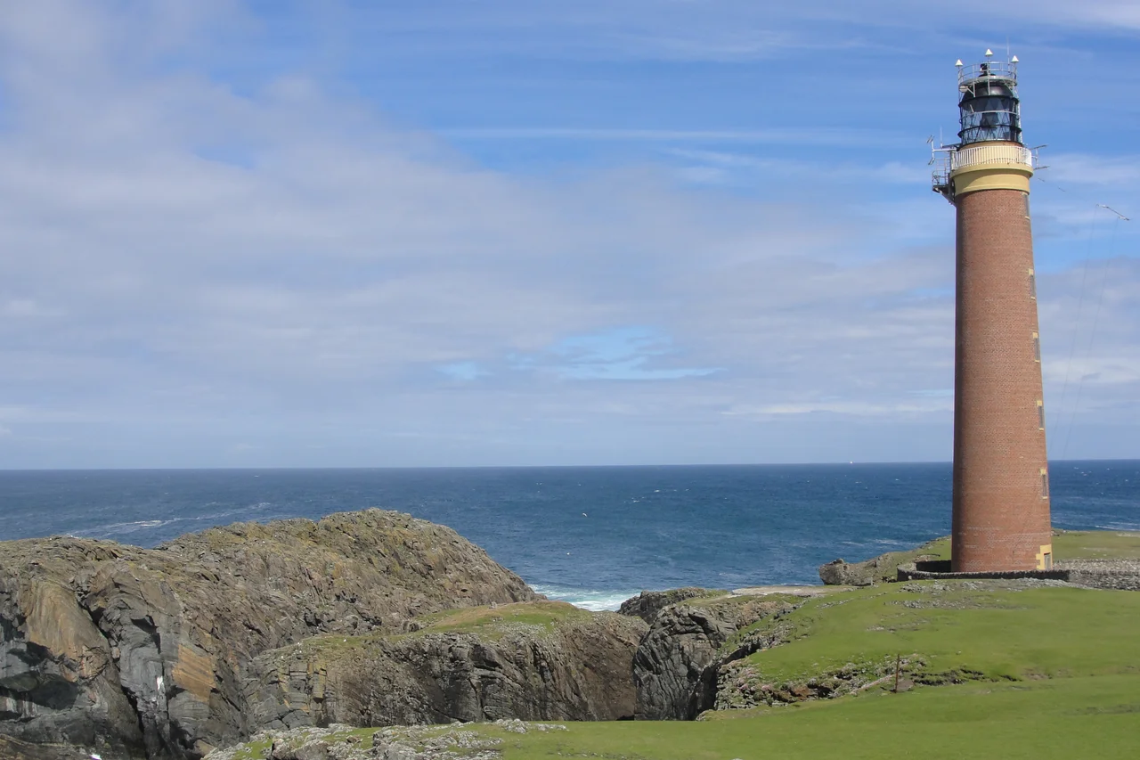

Butt of Lewis
The wind here has its own reputation. The Butt of Lewis - Rubha Robhanais in Gaelic - is one of the windiest places in the United Kingdom, by some local accounts the windiest of all. The headland is the most northerly point of Lewis, a blunt cliff thrust into the Atlantic where two seas meet: the Minch to the south, the open ocean to the north. Heavy swells come in unbroken from a thousand miles of fetch. A red-brick lighthouse stands at the edge. A natural arch called the Eye of the Butt sits a short walk to the southwest. Beyond all of it, there is nothing but water until the coast of Labrador.
Promontory of the Tail
The Gaelic name is Rubha Robhanais, meaning Robhanais Point. Robhanais - anglicised in older usage as Rowaness - comes from the Old Norse Rófunes, the promontory of the tail. The Norse named the long thin headland because that is exactly what it looked like to them in their longships: a tail pointing out into the sea. A thousand years later the name still holds. The nearest populated place is the village of Eoropie, about a mile to the south; the Butt itself is uninhabited, accessible by a short road, lashed with wind for most of the year.
The Windiest Place
It is claimed that the Butt of Lewis is one of the windiest locations in the United Kingdom. The geography makes the claim plausible: a blunt cliff facing northwest into the open Atlantic, with no land to break the wind for the entire transit from Greenland. Gales here come in fast and stay long. Spray reaches the lighthouse lantern in serious weather, and the road in is often closed by drifting sand or seaweed kicked up by the surf. The headland is a place to visit on a calm day if you can find one, and to respect at every other time.
Red Brick and Old Code
The lighthouse on the cliff was built by David Stevenson - and possibly with his brother Thomas Stevenson - in 1862. It is unusual among Scottish lighthouses for being constructed of red brick rather than stone, and for being left unpainted; the brick has weathered to a deep rust over more than a century and a half of Atlantic salt. The present optical equipment was installed in 1905, according to a plaque in the lightroom. The lighthouse was the radio link station for the keepers on the isolated Flannan Isles in the early 1930s, relaying messages from the remote rock back to the mainland; that role ended in 1971 when the Flannans were automated. The Butt itself was automated in 1998, one of the last manned lights in Scotland.
The Eye of the Butt
The road to the lighthouse passes Port Stoth, a sheltered cove that once served as a small landing place. Southwest from the lighthouse along the coast is a natural arch in the cliff called the Eye of the Butt - a slot eroded through Lewisian gneiss, framing a window of sea and sky. The best view is from the Habost machair, the sandy grassland inland. The cliffs here are made of some of the oldest rock in Europe, formed in the Precambrian up to three billion years ago. The arch is a piece of that ancient rock that the Atlantic has been working on for an unfathomable amount of time, and the work continues.
Pigmies and Pottery
The Butt has its archaeological mysteries too. A small island just offshore was excavated by antiquarians sometime before 1905; they found bones and pottery on a site that local tradition called the Pigmies' Isle. The bones were found to be from animals, not the diminutive humans of folklore. The Royal Commission on the Ancient and Historical Monuments of Scotland surveyed the isle in 1928, and found that part of the structures had collapsed since the earlier excavations. A 2005 survey added more structures to the record. Whatever lived or worshipped here in the centuries before written history left fragments behind, and the cliff and the wind are taking those fragments back slowly.
From the Air
The Butt of Lewis is at 58.52°N, 6.26°W on the northernmost cliff of Lewis. From 2,000-5,000 feet AGL the unpainted red-brick lighthouse on the green and grey cliffs is unmistakable, marking the boundary between The Minch (south) and the open North Atlantic (north). Stornoway airport (EGPO) is about 25nm south-southeast. Beyond the Butt, no land until northern Iceland. This is officially among the windiest places in the United Kingdom - sustained 40+ knot winds are routine, and turbulence near the cliffs can be severe at low altitude. The Eye of the Butt arch lies just southwest along the coast, best visible at low altitudes in calm conditions.
Nearby Stories
- Callanish IV 2.2 km away
- Siadar Wave Power Station 14 km away
- The Minch 19 km away
- Enard Bay 20 km away
- Stoer Head Lighthouse 26 km away
- HMS Bullen 45 km away
- HMS King Edward VII 113 km away
- The Laki Eruption: The Volcano That Changed World History 854 km away