.jpg)
Caldy
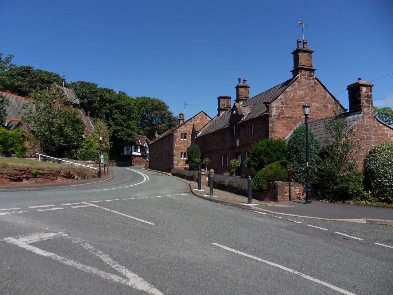
Most of Caldy is hidden. Drive the B5140 between West Kirby and Heswall and the long red sandstone walls along the road keep going for half a mile at a time, with iron gates that open into curving gravel drives toward houses you will never see. The village hides itself the way old money hides: with hedges, with discretion, with a single agreed-upon material. The walls and houses are local red sandstone, quarried out of Caldy Hill above the village. The result is a north-of-England village that looks more like a Cotswold one in red. The 1,290 people who lived here at the 2001 census, of a total West Kirby & Thurstaston ward population of 12,869, were and largely remain among the wealthiest residents of Merseyside.
Calders in Domesday
The first written mention of Caldy is in the Domesday Book of 1086, where it appears as Calders, owned by Hugh of Mere. For most of the centuries that followed, it stayed exactly what Domesday described: a small farming township in the West Kirby parish of the Wirral Hundred. The population in 1801 was just 92. By 1851 it had crawled to 142. By 1901 it was still only 202. What Caldy did have, even as a quiet farming hamlet, was Caldy Hill, a National Trust expanse of sandstone heath that looks westward over the Dee Estuary to the hills of North Wales. The hill is what made the village findable, and eventually what made it desirable.
How a Village Was Built
The transformation came late and on purpose. In the early twentieth century the Caldy Manor Estates Company bought the farm land and parcelled it into building plots, with strict covenants on materials and layout. The decision to require local sandstone for new walls and many of the new houses is what gives Caldy its consistency, even where the houses themselves are mock-Tudor or Arts and Crafts or unapologetically modern. By 1951 the population had passed 600, and the village had become what the estate company set out to make it: one of the north of England's most exclusive residential addresses. Many of the houses in the village centre still date from this early-twentieth-century expansion, with later mansions tucked behind them on land that had been pasture two generations earlier.
Lowry, Stapledon, Clarke
Caldy's residents have leaned literary and scientific more than aristocratic. The poet and novelist Malcolm Lowry, author of Under the Volcano, spent his childhood here, as did his brother Wilfrid, who would go on to play rugby for England. The philosopher and science-fiction author Olaf Stapledon, whose Last and First Men imagined humanity across two billion years of evolution, lived in Caldy from 1940 until his death in 1950. Sir Cyril Clarke, the physician and geneticist who developed the use of anti-D immunoglobulin to prevent rhesus disease in newborns and who was also a passionate lepidopterist, lived here for many years until his death in 2000. Three Caldy residents, three very different ways of looking at the universe, all of them done from a sandstone house behind a hedge.
Footballers and Managers
More recently the village has filled with footballers. Robbie Fowler kept a house here while playing for Liverpool. Rafael Benítez, manager of Liverpool from 2004 to 2010, lived in Caldy and famously referred at a press conference to John the milkman, who delivered to a number of Premier League houses on the same morning round, as a kind of folk authority on the Merseyside derby. The footballers' arrival is part of a wider pattern: from the late twentieth century onward, Caldy became a quiet rich suburb for Liverpool's commuting and celebrity population. Houses change hands at prices that the rest of the Wirral notices in the property pages of the Liverpool Echo. The local rugby club at Paton Field competes in the second tier of the English game; Caldy Cricket Club fields four sides on Saturdays in the Liverpool and District Competition. Both are loved out of proportion to the size of the village.
The Wirral Way
Caldy had its own railway station once, on the Hooton-to-West Kirby branch of the Chester and Birkenhead Railway. It closed in 1954, taking with it the daily commute that had built the village a generation earlier. The trackbed was reborn in the 1970s as the Wirral Way, the long-distance footpath and cyclepath that now runs the length of Wirral Country Park. Walk it on a summer evening and you pass through fields, woodland, and the back gardens of Caldy that nobody can see from the road, with the Dee Estuary widening to the west and the Welsh hills behind it. The trains are gone. The peace they once interrupted has come back.
From the Air
Caldy lies on the western flank of the Wirral Peninsula, at 53.36°N, 3.16°W, about 3.5 km south-southeast of the Irish Sea at Hoylake and on the eastern side of the Dee Estuary. The village sits at roughly 44 m elevation, with Caldy Hill rising behind it. Best viewed from 1,500-3,000 ft. Hawarden (EGNR) is 9 nm south; Liverpool John Lennon (EGGP) is 14 nm east-southeast. Look for the dense canopy of mature trees and the red sandstone walls between the white-sand beaches of Hoylake and the Dee.
Nearby Stories
- RAF Wrexham 3.3 km away
- Birkdale Palace Hotel 3.7 km away
- Turton Tower 4.1 km away
- Tatton Park 5.6 km away
- Abergele Rail Disaster 9.6 km away
- Diglake Colliery Disaster 13 km away
- Ysbyty Ifan 16 km away
- Celtic Array 62 km away