California Central Valley Grasslands
Tulare Lake was once the largest freshwater lake west of the Mississippi. Fed by snowmelt from the Sierra Nevada, it covered more than 600 square miles of the southern San Joaquin Valley in wet years, its shores thick with tule reeds and its waters dark with migrating waterfowl. Today it is a cotton field. The lake's disappearance is the single most dramatic change in a transformation that has remade the entire Central Valley, but it is far from the only one. The California Central Valley grasslands ecoregion, covering 46,275 square kilometers from Red Bluff in the north to the Tehachapi Mountains in the south, was once a mosaic of native bunchgrasses, seasonal wetlands, vernal pools, oak savannas, and riparian forests. Most of it is now farmland. What remains tells a story of extraordinary ecological richness, and of how quickly a landscape can be rewritten.
Walled by Mountains, Shaped by Water
The Central Valley is a geological trough, 450 miles long and 40 to 60 miles wide, hemmed in by the Sierra Nevada to the east and the Coast Ranges to the west. Its floor is flat or gently rolling, sloping toward the rivers that once braided across it without constraint. The Sacramento River drains the northern half, flowing south; the San Joaquin River drains the southern half, flowing north. They meet in the vast inland delta east of San Francisco Bay. Before dams and levees straightened these rivers, annual floods deposited rich alluvial soil across the valley floor and recharged the wetlands, vernal pools, and seasonal lakes that defined the landscape. The valley's Mediterranean climate, with cool wet winters and hot dry summers, created growing conditions unlike anywhere else on the continent. Native perennial bunchgrasses like purple needlegrass thrived during the rainy season, going dormant in summer. The entire grassland ecosystem was tuned to this rhythm of flood and drought.
The Green Invasion
The grasslands that now blanket the valley floor are mostly imposters. European annual grasses, introduced during the Spanish colonial period, have displaced the native perennials across most of the ecoregion. Species like wild oats, soft chess, and ripgut brome germinate with the first autumn rains, grow rapidly through winter, set seed in spring, and die by summer, leaving behind a brown stubble that fuels wildfires. This cycle favors the annuals over the slower-growing native bunchgrasses, which need multiple seasons to establish. The transformation was swift and thorough. Within a few decades of European contact, introduced grasses had colonized nearly the entire valley. Overgrazing by cattle accelerated the shift, as livestock preferentially ate the native grasses and left the less palatable invaders standing. Today, native grasslands survive only in fragments, mostly on rocky outcrops, alkaline flats, or protected refuges where conditions discourage the introduced species.
Flowers in Vanishing Pools
The most fragile and distinctive habitats in the ecoregion are its vernal pools. These seasonal wetlands form in shallow depressions where underlying clay or hardpan prevents water from draining, creating pools that fill with winter rain and dry completely by late spring. Each pool supports a community of plants and animals found almost nowhere else, including fairy shrimp species so geographically restricted that individual pool complexes harbor unique genetic lineages. When the pools begin to dry in March and April, wildflowers germinate in concentric rings around the receding waterline. The effect can be spectacular: carpets of goldfields, lupines, California poppies, and purple owl's clover spreading across the grasslands in blooms so vivid that they are visible from aircraft. John Muir, crossing the valley in the 1860s, described it as the floweriest piece of world he had ever walked through. The blooms still appear each spring, especially in the Carrizo Plain and the Antelope Valley south of the main valley floor, but their extent has diminished as vernal pools are plowed under or paved over.
What the Valley Lost
The list of what has vanished from the Central Valley reads like an inventory of a different continent. Tulare Lake, Buena Vista Lake, and Kern Lake are dry. The tule elk that once grazed in herds of hundreds of thousands were reduced to a single pair by 1870. Grizzly bears, which gave California its state flag emblem, were hunted to extinction in the valley by the 1920s. Pronghorn antelope, once common on the grasslands, disappeared from the region entirely. More than 95 percent of the valley's original wetlands have been drained, and the native grasslands that survived plowing have been overrun by introduced species. Yet the valley has not been emptied. The managed refuges along the San Joaquin River still host millions of wintering waterfowl. Tule elk have been reintroduced to scattered sites. Vernal pool preserves protect the rarest wildflower communities. The ecoregion endures, diminished but not erased, its remaining fragments a reminder that the richest grassland in the American West was here long before the orchards and the cotton fields.
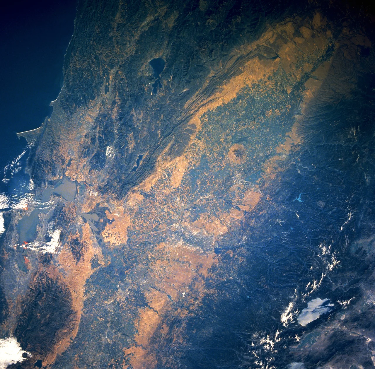
From the Air
The California Central Valley grasslands ecoregion stretches roughly 450 miles from Red Bluff to the Tehachapi Mountains, centered around 37.0N, 120.3W. From cruising altitude, the valley is unmistakable: a vast flat expanse flanked by the Sierra Nevada to the east and the Coast Ranges to the west, its floor a patchwork of irrigated agriculture, orchards, and scattered remnant habitats. The best views of remaining native grasslands and vernal pool complexes are found in the wildlife refuges along the San Joaquin River (San Luis NWR, Merced NWR) and in the Carrizo Plain National Monument to the southwest. Wildflower blooms are visible from 3,000-5,000 feet AGL in March and April. Major airports along the valley include Fresno Yosemite International (KFAT), Sacramento International (KSMF), and Bakersfield Meadows Field (KBFL).
Nearby Stories
- Six Blocks That Bet on Walking 6.1 km away
- Merced Assembly Center: 133 Days Behind the Wire 7.2 km away
- Alkali Sink Ecological Reserve: Holding Ground for a Ghost 11 km away
- The Lifeline of Madera County 15 km away
- Twelve Thousand Bolts 28 km away
- Mount Hamilton (California) 63 km away
- Salinas and Steinbeck Country 64 km away
- Crossley telescope 73 km away