
Cambrian Mountains
On the eastern slope of a 2,467-foot hill in mid-Wales, two of Britain's great rivers start within a mile of each other and then spend the next 200 miles flowing to entirely different stretches of coast. Pen Pumlumon Fawr, anglicised as Plynlimon, gives birth to the Severn and the Wye from the same boggy upland. The Severn runs east to Bristol; the Wye drifts south to Chepstow. Stand on the summit and you stand on a hydrological hinge. This is the heart of the Cambrian Mountains, a range that mid-Wales has somehow kept obscure despite occupying its entire spine, and the locals like it that way.
The Desert That Made Wales
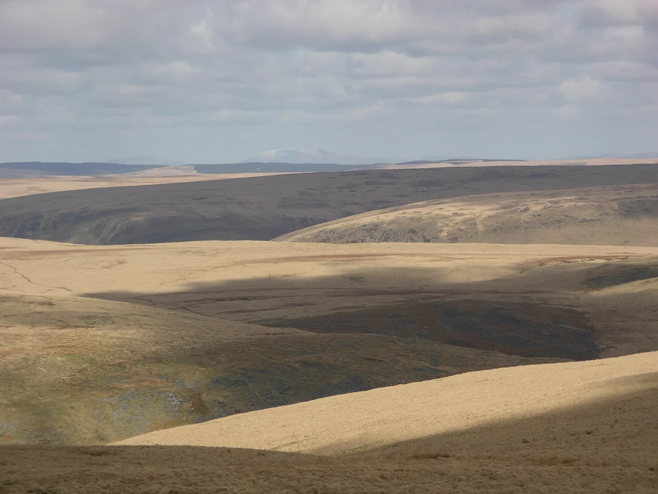
The English call it the Desert of Wales, which says more about English expectations of wilderness than about anything botanical. It is not a desert. It is one of the wettest places in the British Isles, soaked by Atlantic fronts that hammer up the slopes of Plynlimon. What makes it feel desert-like is its emptiness. The Ordovician and Silurian mudstones underneath produce rounded grassy summits without the spectacular crags of Snowdonia to the north or the wooded escarpments of the Brecon Beacons to the south. There are very few villages. There are even fewer people. Walking the Cambrian Way, the long-distance footpath that traces the high ground, you can go a full day in some sections without meeting another walker. The local Welsh name, Elenydd, sounds gentler. It comes from the river Elan, which itself disappears into the Elan Valley reservoirs that water Birmingham.
Source of the Severn
The Severn rises in a peat bog at about 2,000 feet on the eastern flank of Plynlimon and flows for 220 miles to the sea. It is the longest river in Great Britain. The Wye rises only a short distance away on the same hillside and flows 134 miles to the same estuary by a more southerly route. Pilgrims and walkers come up the hill specifically to see the two source points, marked by simple wooden posts in the peat. There is no drama at either spot. There is only a slow seep of water from the moss, and then a thin runnel, and then a brook, and then the river you eventually meet a hundred miles downstream as it cuts through Worcester or curls past Symonds Yat. Hold a finger in the cold water and you are touching the start of two rivers that have shaped half a country.
The National Park That Wasn't
In 1972 the Countryside Commission published an order designating 467 square miles of the Cambrian Mountains as Wales's fourth national park. It would have stretched from Machynlleth in the north to Llandovery in the south, taking in Plynlimon and the whole sweep of Elenydd. The decision was reversed within a year. All five county councils objected. So did five of the seven district councils, the National Farmers Union, the Country Landowners Association, Plaid Cymru, and the Campaign for the Protection of Rural Wales. The Secretary of State for Wales, Peter Thomas, cited massive evidence of objections and refused even a public inquiry. It was the first time such a recommendation had ever been rejected. The reasons were practical. Farmers feared restrictions on hill grazing. Welsh nationalists feared an English-administered park bringing English tourists. Whatever the motives, the Cambrians remained undesignated, and arguably remained themselves.
Water and Wind
What the mountains do produce, in industrial quantities, is water and electricity. The Elan Valley reservoirs were carved out of the southern Cambrians starting in the 1890s to slake Birmingham's thirst, drowning whole farms and chapels in the process. Llyn Brianne, further south, supplies South Wales. Clywedog and Nant y Moch reservoirs hold back the upper Severn and feed hydroelectric schemes. More recently the high tops have sprouted wind farms, most contentiously at Cefn Croes, a 39-turbine array built between Aberystwyth and Llangurig in 2005 against fierce local protest. The Cambrians have always been a place where England takes what it needs from Wales, water in the 19th century, electricity in the 21st, and the resentment built into that exchange shapes Welsh politics to this day. Fly over the range in clear weather and the pattern reads itself: empty green hills, silver fingers of reservoir, and the white blades turning on the ridge tops, all of it draining downhill to power somewhere else.
From the Air
The Cambrian Mountains run north-south through mid-Wales, centred on 52.42 degrees N, 3.50 degrees W. The highest summit, Plynlimon (Pen Pumlumon Fawr), reaches 2,467 ft / 752 m. Expect rapidly changing weather, low cloud on the summits, and high rainfall on the western slopes facing the Atlantic. Best appreciated at 3,500-5,500 ft AGL to clear the summits with margin. The range hosts wind farms (notably Cefn Croes south of the A44) and reservoirs (Nant y Moch, Clywedog, Elan Valley, Llyn Brianne) - check NOTAMs for turbine and reservoir-related airspace. Nearest airfields: Welshpool (EGCW) on the eastern flank, Aberporth (EGFA) on the coast to the west, Haverfordwest (EGFE) to the southwest, Shawbury (EGOS) further east.
Nearby Stories
- Cymer Abbey 3.3 km away
- Builth Castle 7.6 km away
- St Mary Magdalene's Church, Battlefield 9.3 km away
- Caratacus' last battle 9.5 km away
- Borth Lifeboat Station 13 km away
- Museum of Cider 18 km away
- Battle of Maserfield 24 km away
- Talley Abbey 27 km away