
Canovee
The locals call Canovee an island, though no sea touches it. The River Lee curls around its northern shore. The Kame River runs along the east. The Aghthying Stream marks the west. What sits between them is roughly twenty-one square kilometres of rolling pasture, sixteen townlands, and a quiet rural region halfway between Macroom and Cork city that has been a discrete unit of land for at least a thousand years. The Irish call it Cannaway. The English maps started writing Canovee in the seventeenth century. Either name will get you there. Both refer to the same patch of mid-Cork that has been an island in the imagination of its people since long before anybody drew it on a map.
What the Surveyors Found
In 1656, four years after Oliver Cromwell finished his campaign in Ireland, the Civil Survey arrived to record what was left. The surveyors measured Canavoy Parish at ten and a half plowlands, bounded east by Aglish, south by Moviddy, west by Kilmurry, and northwest and north by the Lee. They walked it in length from Carrigadrohid to a little ford called Ahanaboy, two miles south. They found the parochial church still standing near the river, though only its walls remained. On the north side, also in ruins, sat the walls of a large ancient house belonging to the chief proprietor of the island, the Long family. The soil they pronounced cold and indifferent good for tillage, if manured with lime or sea sand, which lay remote from it. Here and there were timber wood and coppices. Most of the houses were thatched cabins. Most were not valuable.
The Longs of the Island
John Long of Mount Long held most of Canovee in the 1650s. He was, in the language of the survey, an Irish Papist and deceased, his lands now subject to confiscation. He owned Lehenagh, valued at twenty-four pounds. He owned Cooldrum, Coolnacarriga, Classis and Coolnasoon together, worth fifty-three pounds. He owned Monallig and Killinardrish, with a grist mill on the premises, worth five pounds sterling. The Long family had been erenaghs for Canovee, hereditary stewards of church lands stretching back to the early medieval church. By the time the surveyors arrived, that long stewardship was being unwound. The Lord of Muskerry, also marked Irish Papist, held Mahallagh and Loughleigh and Nettleville Demesne, where a hundred pounds of timber wood grew. The land would change hands. The river would not.
A Pleasant Seat on the Lee
By 1788, when the Compleat Irish Traveller passed through, Canovee had softened into something gentler. At Mahallagh, five miles east of Macroom, was a pleasant seat on the south bank of the Lee. In the parish of Canaboy was another, graced with a handsome house, good gardens, large orchards, fish ponds, and a great number of planted trees. Shandangan a mile southwest had its own pretty seat, with gardens drained from bog and cut into ponds, an orchard, and a deer park. The Penal Laws had stripped Catholic landowners of most of their holdings, and the new proprietors built in the fashion of the day: water, walks, trees in lines, fish moving lazily through ornamental ponds. The same fields that had carried Long family cattle in 1656 now carried gentlemen's deer. The change was complete and largely invisible from the river.
Carrigadrohid on the Rock
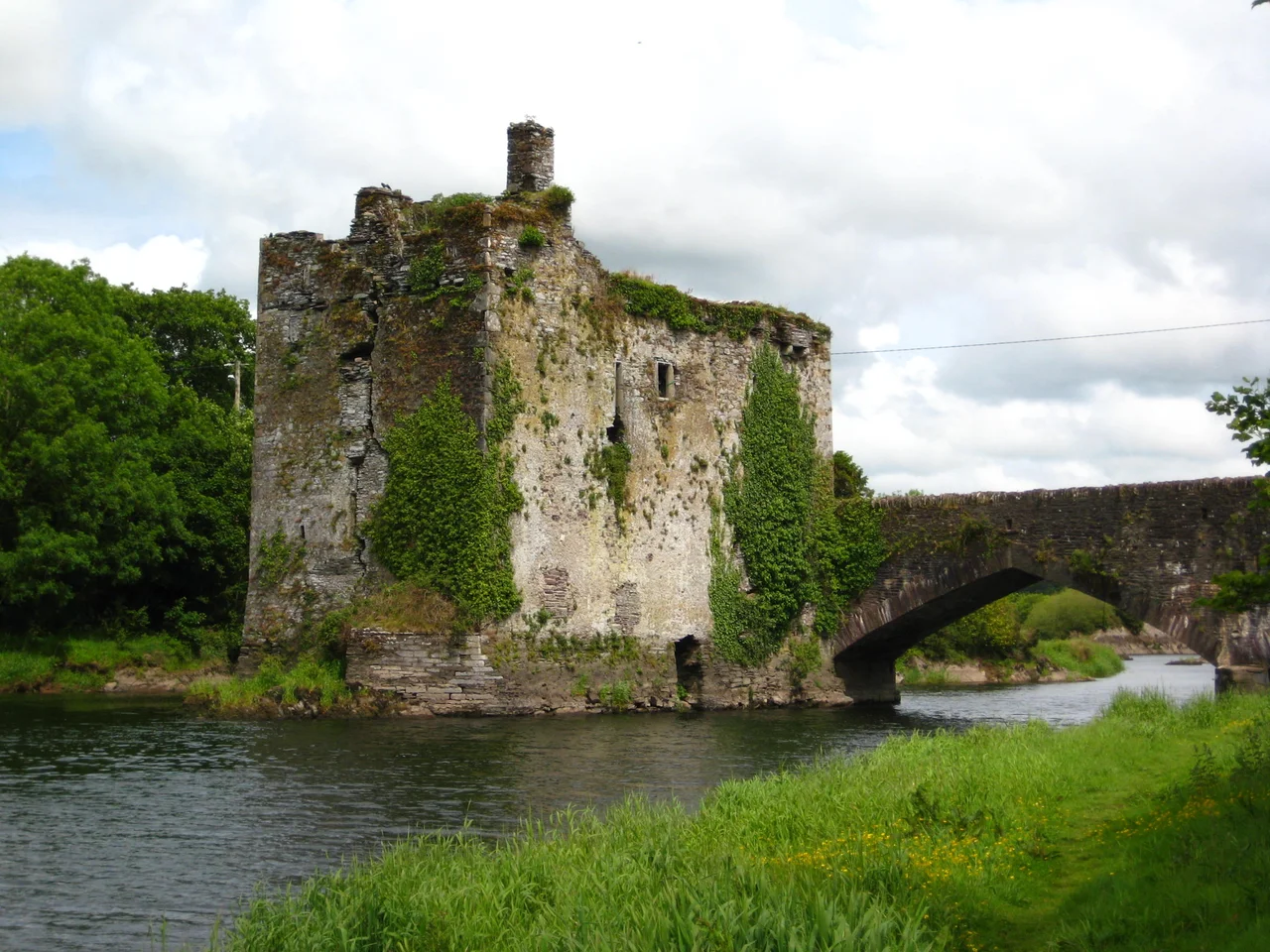
On the northern boundary, just where the Lee bends, the village of Carrigadrohid carries a castle described in the 1656 survey as situated on a rock in the midst of the River Lee, valued at one hundred pounds. The bridge across the river was timber and out of repair, but passable on foot. The castle is famous for one moment in the Cromwellian conquest: in 1650, after Macroom Castle fell to Lord Broghill's troops, Bishop Boetius MacEgan was offered his freedom if he could persuade the Carrigadrohid garrison to surrender. He arrived at the castle, looked up at the defenders, and shouted the opposite. They were to hold out. He was hanged from a tree on the spot. That castle is still on its rock. The bridge has been rebuilt several times. The garrison surrendered shortly afterward.
An Island That Stayed
The 2011 census counted 595 people living on the island of Canovee, 293 men and 302 women, in an area of 21.6 square kilometres. The population had risen 13.8 percent since 2006. Most still farm. The civil parish remains the administrative unit, with sixteen townlands whose Irish names map onto the older Gaelic landscape: Cuil na Carraige (corner of the rock), Cuil na Seamrog (corner of the shamrocks), Maigh Shalach (dirty plain), Ratha O nDubhain (fort of the Dubhains). The Long family's old house is gone. The grist mill at Carrigadrohid is gone. But the rivers still draw the boundary they always drew, and the locals still describe themselves as living on an island, even though anyone with a map can see the road runs in and out.
From the Air
Located at 51.89 degrees N, 8.86 degrees W in mid-Cork, in the Lee valley between Macroom and Cork city. The civil parish is bounded north and northwest by the River Lee, east by the Kame River and a tributary, and west by the Aghthying Stream, giving it the genuine appearance of an island when viewed from altitude. Cork Airport (EICK) lies about 25 km east-southeast. Best viewed at 2,000-4,000 feet from the south or west, with the patchwork of small dairy fields visibly enclosed by the river bends. Carrigadrohid castle is the most striking visual landmark, a square tower on a rocky outcrop in the middle of the Lee just to the north.
Nearby Stories
- Páirc Uí Chaoimh 4.9 km away
- Clonakilty 7.9 km away
- Killarney National Park 8.7 km away
- Carrigeenamronety Hill 9.7 km away
- Ahakista 13 km away
- Tralee 16 km away
- Ballybeg Priory 20 km away
- Walter Siepmann 23 km away