
Cape Collinson
Lieutenant Thomas Bernard Collinson arrived in Hong Kong in 1843 with a surveyor's instruments and a mandate to map an island that the British had only just acquired. Between 1843 and 1846, he walked and measured Hong Kong Island's terrain, producing some of its earliest accurate charts. He went on to serve in New Zealand, rose to Major-General, and died in 1902. The easternmost point of Hong Kong Island still carries his name — Cape Collinson, or Hak Kok Tau in Cantonese — a headland where the harbour gives way to the open waters of Tathong Channel and the island's urban density relaxes into green slopes and sea cliffs.
The Surveyor Who Named a Cape
Collinson's three years mapping Hong Kong Island were part of the enormous administrative project of converting a trading acquisition into a functioning colony. Royal Engineers officers like Collinson were the instruments of that transformation — measuring coastlines, identifying harbours, assessing terrain for fortifications and roads. He surveyed Hong Kong Island when it was still a settlement measured in hundreds of inhabitants, not millions. The cape at the island's eastern tip was eventually designated in his honour, joining a long list of Hong Kong landmarks — Pottinger Peak, Bowring Promenade, Bonham Strand — named for the officers and officials who shaped the colony's early decades. It is a naming convention that speaks to who controlled the maps, and who was invisible to them.
Rock Carving and Lighthouse
Cape Collinson carries older evidence than any colonial surveyor's work. In October 2018, an ancient rock carving was discovered on a cliff face about 11 metres above sea level near the cape. It is now a declared monument of Hong Kong — one of a group of prehistoric rock carvings found around the territory's coastline, their creators unknown, their age estimated in the thousands of years. The cape also holds a lighthouse, reached via Cape Collinson Path, a hiking trail that runs east from Siu Sai Wan Promenade to the headland. Hikers on the Pottinger Peak Country Trail can connect south from the promenade through Shek O Country Park to Big Wave Bay. For a place at the urban edge of one of the world's most densely populated cities, the cape preserves something genuinely wild.
The City of the Dead at Pottinger Peak
The slopes west of Cape Collinson, near Chai Wan under the shadow of Pottinger Peak, hold an unusual concentration of cemeteries. They opened in the years after the Second World War, absorbing the dead of a city that had no more room. The Cape Collinson Chinese Permanent Cemetery opened in 1963. So did the Cape Collinson Muslim Cemetery, also known as the Chai Wan Muslim Cemetery — testament to the Muslim communities that have been part of Hong Kong's population since the earliest years of the colony. The Holy Cross Roman Catholic Cemetery opened in 1960. The Sai Wan War Cemetery, opened in 1946, holds the dead of the Battle of Hong Kong and the Japanese occupation — soldiers and civilians for whom the fighting ended on Christmas Day 1941. A crematorium operates in the area as well. These cemeteries lie some distance from the cape itself, arranged along Cape Collinson Road as it climbs from Chai Wan toward the east coast.
Edge of the Urban World
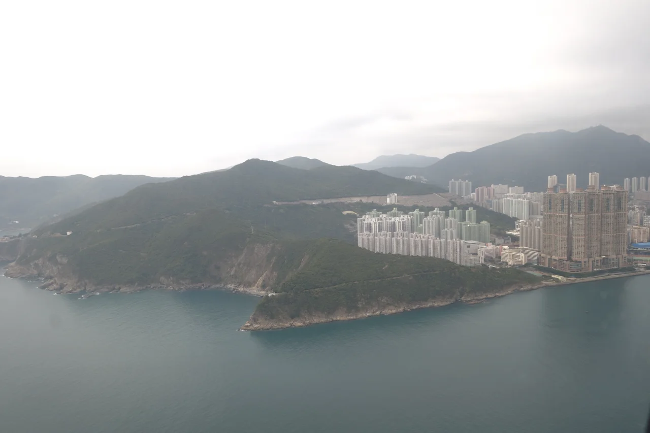
Cape Collinson Road begins in Chai Wan, one of the easternmost MTR stations on Hong Kong Island, and climbs through the slope of Pottinger Peak before descending to the cape's coastline. The road passes the Cape Collinson Correctional Institution in Tso Tui Wan before reaching the water. Between the suburban density of Chai Wan and the lighthouse at the cape's tip, the landscape transitions from housing estates and container terminals to something that feels, unexpectedly, remote. The Leaping Dragon Walk connects the promenade north to Siu Sai Wan; the Pottinger Peak Country Trail continues south. At the cape itself, the channel between Hong Kong Island and the Tathong archipelago opens up, the water traffic of one of the world's busiest ports moving through it continuously. Collinson's surveys helped make that traffic possible.
From the Air
Cape Collinson sits at 22.25°N, 114.25°E, marking the easternmost point of Hong Kong Island where it faces Tathong Channel. At 2,000–3,500 feet, the cape's headland profile is distinct from the air — a rocky promontory separating the calmer harbour waters from the more open channel to the east. Pottinger Peak (312 m) rises immediately to the west and serves as a reliable visual reference. Primary airport is VHHH (Hong Kong International Airport) on Lantau Island, approximately 35 km west-southwest. Approaching from the south along Tathong Channel, the lighthouse at the cape is visible in clear conditions.
Nearby Stories
- Lok Ma Chau Loop 2.3 km away
- Portas do Cerco 2.3 km away
- Kweilin Incident 17 km away
- Wanshan Archipelago Campaign 34 km away
- Nanxiong Formation 115 km away
- Battle of Nanpeng Island 148 km away
- Heyuan 169 km away
- Cape Maobitou 632 km away