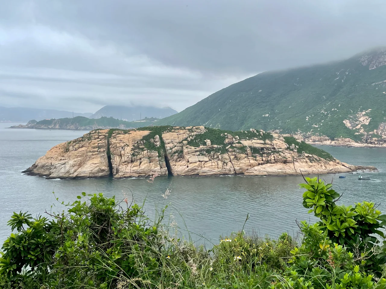

Cape D'Aguilar
Two names competed for this headland for most of the nineteenth century. On British charts it became Cape D'Aguilar, honoring the general who commanded Hong Kong's colonial garrison. On Chinese maps it was Tylong Head — 大浪頭, Big Wave Head — a name that described what you could expect from the water here. The Chinese name captured something the British one did not: a warning. The cape at the southeastern corner of Hong Kong Island is exposed, rough-watered, and final. After it, there is only open sea.
Two Names for One Place
The name Cape D'Aguilar appeared first in a British survey of 1845, conducted by Lieutenant Collinson and Sir John Francis Davis. Major-General George Charles d'Aguilar commanded the colonial garrison in Hong Kong's early years, and the cape at the island's southeastern extreme was named in his honor — a standard colonial practice of attaching British names to Asian geography.
The Chinese name, Tylong Head (大浪頭, Big Wave Head), almost certainly predates the British survey by generations. It came from the nearby village of Hoktsuewan (鶴嘴灣), and it described the headland's exposure to swells rolling in from the South China Sea without obstruction. The name Cape D'Aguilar was formally confirmed in the Hong Kong Government Gazette on 12 April 1935. The Chinese name quietly persisted alongside it.
What the Cape Holds
The cape is the southernmost point of D'Aguilar Peninsula, in Hong Kong's Southern District. Access is by a single road — Cape D'Aguilar Road — which runs along the eastern side of the peninsula from Shek O. Off the cape lie two small islands collectively called Kau Pei Chau (狗髀洲), and a narrow channel called Sheung Sze Mun (雙四門) sits close by.
Among the unexpected sights at the cape is what researchers call the Bones of Miss Willy: a whale skeleton on display in front of the Swire Institute of Marine Science, operated by the University of Hong Kong. The skeleton is mounted outside the research facility, where it has become one of the more unusual landmarks on the Hong Kong coastline. The institute sits within the Cape D'Aguilar Marine Reserve, a protected area that covers both the land and the adjacent waters.
Caves and Batteries
The geology of the cape creates dramatic features along the waterline. The Crab's Eye is a sea cave cut into the rock face off Cape D'Aguilar Road, connected by underground passage to a second cave called the Thunder Cave. When swells enter the Thunder Cave and compress against the interior walls, the sound can be heard from a distance — the caves breathing with the rhythm of the sea.
Nearby, the ruins of the Bokhara Battery stand as a different kind of relic. An artillery battery installed for the defense of Hong Kong, its guns were positioned to cover the eastern sea approaches. The battery saw action — and saw the limits of what guns could accomplish — during the Battle of Hong Kong in December 1941, when Japanese forces attacked the territory. What remains of the battery today is the stonework: emplacements, walls, and the outline of positions that once looked out over the same water the cape still faces.
The Marine Reserve
Cape D'Aguilar is environmentally protected as part of the Cape D'Aguilar Marine Reserve, one of Hong Kong's most significant protected coastal areas. The reserve was established to safeguard the marine biodiversity of waters that are among the territory's least disturbed — a consequence of the cape's relative inaccessibility and the restriction of fishing and collecting within the reserve boundaries.
The waters around the cape host a range of marine life unusual for a coastline so close to one of Asia's most densely populated cities. Researchers at the Swire Institute have documented species diversity here that reflects what the region's coastal ecosystems looked like before intensive development. The cape's combination of exposed rocky shoreline, sea caves, and clear water creates habitat for organisms that have largely disappeared from more accessible parts of Hong Kong's coast. Walking the access road at low tide, the rock pools reward patience: small crabs, urchins, anemones, and the constant movement of water through channels that the sea has been carving for millennia.
From the Air
Cape D'Aguilar sits at approximately 22.208°N, 114.261°E, at the southeastern tip of Hong Kong Island. The headland is clearly identifiable from the air as the point where the island's southern coast terminates before open water. D'Aguilar Peak (531 m) rises to the north and provides a useful landmark for orientation; the cape itself sits at low elevation at the end of the peninsula. The nearest airport is Hong Kong International Airport (VHHH) on Lantau Island, roughly 27 km to the northwest. At 2,000–3,500 feet, the full length of D'Aguilar Peninsula is visible, with Repulse Bay and Deep Water Bay to the west, Shek O to the northeast, and Lamma Island across the channel to the southwest. The Kau Pei Chau islets are visible just offshore. Weather around the cape can be windy and haze is common in summer months.
Nearby Stories
- Shek Pik 1.7 km away
- Tung Ping Chau 4.8 km away
- Hong Kong 12 14 km away
- Wanshan Archipelago Campaign 16 km away
- Pearl River Delta 18 km away
- Battle of Penghu 478 km away
- Penghu Air Raids 487 km away
- Cape Maobitou 596 km away