.jpg)
Shek Pik
Somewhere beneath the still surface of Shek Pik Reservoir, the terraced paddy fields of four villages lie submerged. The farmers who worked them — about 260 people — were resettled to Tsuen Wan apartment blocks or relocated to nearby rural land when the dam was completed. The valley they left behind had been continuously inhabited since at least the Ming Dynasty (1368–1644), and tradition holds it even longer: that a clan fleeing the Mongol advance at the end of the Southern Song (1127–1279) took refuge here and never left. Today the reservoir dominates a basin ringed by Lantau's green hills, while the South China Sea glitters at the valley's open southern end through three small bays.
Stone Marks on an Ancient Shore
Long before the farmers arrived, someone else was here. Neolithic carvings cut into the rock face near Tung Wan — geometric patterns etched by hand thousands of years ago — went unrecorded by outsiders until 1939, when researcher Chen Kung-chiek heard about them from local villagers and came to look. He found one carving near the upper beach, west of Tung Wan, and a second on the opposite side of the valley. That second stone has since been split by lightning and now lies face-down, its carvings hidden from view, perhaps permanently. The first survived. Known as the Lower Shek Pik Rock Carving, it sits roughly 300 metres from the coastline and was declared a monument of Hong Kong in 1979 — a small official acknowledgment of an extremely long human presence on this shore. What the carvings meant to their makers, no one now knows.
A Valley That Fed Itself
For centuries, the villages of Shek Pik Valley — Shek Pik Wai at the valley head, Fan Pui, Kong Pui, and the hamlet of Hang Tsai — were largely self-sufficient. The flat valley floor and surrounding foothills were terraced for paddy rice. Fishing supplemented the harvest. A Hau Wong Temple served as the focal point of community life, and a Hung Shing Temple stood at Chung Hau bay. The communities were small and relatively isolated, connected to the rest of Lantau by coastal paths rather than roads. Colonial records, temple documents, and clan histories all confirm the settlements' deep roots, though the exact date of founding remains uncertain. What is clear is that people worked this valley continuously for centuries before the twentieth century brought decisions made far away.
The Price of Water
Hong Kong's postwar population was growing faster than its water supply. The colonial government looked to Lantau's uninhabited valleys as reservoir sites, and Shek Pik's enclosed basin was well suited. The villages were cleared. Most of the Shek Pik Wai residents moved to five-storey apartments in the new Shek Pik New Village in Tsuen Wan — a sharp transition from rural Lantau to the urban New Territories. The Fan Pui villagers made a different choice: many moved to a new rural settlement at Tai Long Wan, just west of the reservoir, where remodeled and formerly abandoned fields gave them roughly the same acreage of rice paddy they had farmed before. Some families from both villages settled near the Mui Wo ferry pier. The reservoir the displacements enabled now supplies water to communities across Hong Kong.
What the Valley Holds Now
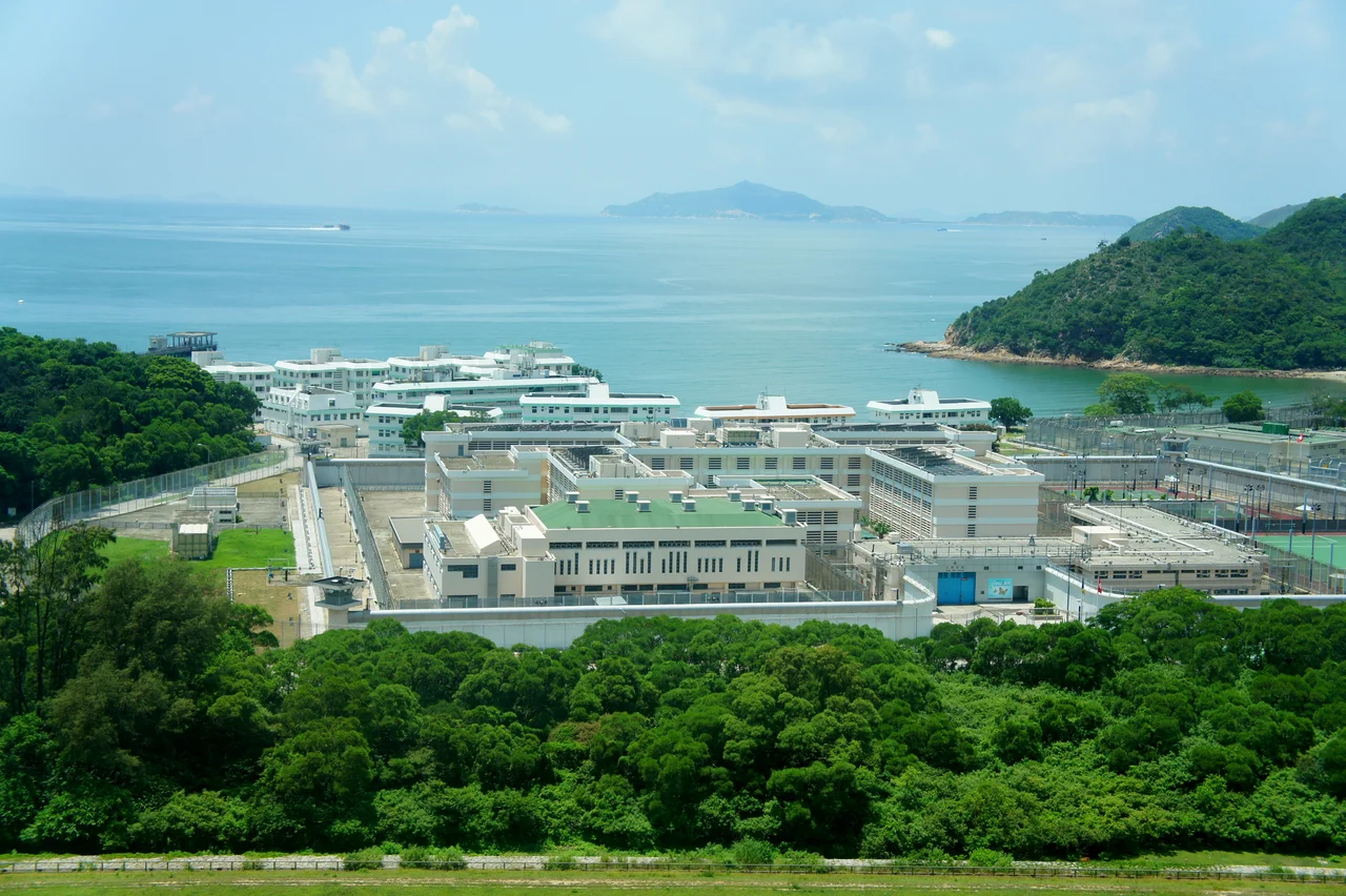
The southern coastline of Shek Pik — the part the reservoir did not touch — retains a quieter character. Three bays open onto the South China Sea: Tai Long Wan to the west, Chung Hau in the middle, and Tung Wan to the east, where the Hong Kong Red Cross Shek Pik Camp has operated since 1968. A beach at Tung Wan and another at Tai Long Wan serve hikers who come through on the Lantau Trail, which links its Stage 8 to Stage 9 across this stretch of coast. The institutional presence is hard to miss: Sha Tsui Detention Centre, a minimum-security facility for young male offenders, was established in 1972, and Shek Pik Prison — a maximum-security institution — followed in 1984. The valley that once fed a farming community now holds a reservoir, a beach camp, and two correctional facilities, all within a few kilometers of those half-buried rock carvings.
Reaching the Edge of Lantau
Access to Shek Pik requires commitment. From the east, South Lantau Road connects Mui Wo to the reservoir; from the north, Tai O Road and Keung Shan Road lead down from the fishing village of Tai O. There are no MTR stations, no quick connections to the city. That relative remoteness is part of why the valley retained its farming character as long as it did, and why it feels, even now, like a margin of the world rather than a suburb of Hong Kong. Standing above the reservoir at dusk, with the South China Sea visible beyond the hills and the terraced hillsides long grown over, it takes some effort to imagine the valley as it was — but the rock carvings at Tung Wan, silent and geometric, suggest the depth of time that underlies the quiet.
From the Air
Shek Pik lies on the southwestern coast of Lantau Island at 22.22°N, 113.90°E. The reservoir is clearly visible from the air as a large body of water enclosed by green hills, with the South China Sea shoreline directly south. Approach from the east via South Lantau Road or from the northwest via Tai O. Recommended viewing altitude: 1,500–3,000 ft for a clear view of the reservoir basin, the three southern bays, and the coastal trail corridor. Nearest airports: VHHH (Hong Kong International, on northern Lantau, approximately 15 km northeast) and VMMC (Macau International, approximately 45 km west-southwest). The rock carving site near Tung Wan is not visible from altitude but the bay itself is easily identified as the easternmost of the three southern inlets.
Nearby Stories
- Tai Tau Chau (Southern District) 0.7 km away
- Lai Chi Wo 3 km away
- Wanshan Archipelago Campaign 3.2 km away
- Pearl River Delta 3.7 km away
- Battle of Yamen 13 km away
- Jiangmen 15 km away
- Hong Kong 12 32 km away
- Battle of Nanpeng Island 114 km away