.jpg)
Tai Tau Chau (Southern District)
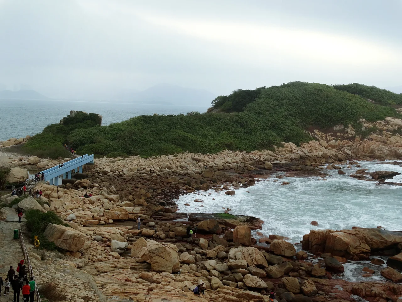
Geology made Tai Tau Chau an island; erosion is still deciding whether it should stay one. The rocky outcrop off the Shek O Headland on southern Hong Kong Island was once part of the same continuous formation as the headland itself. Over millennia, waves worked through the weakest seams in the rock until they broke through entirely, leaving a narrow gap and the sediment bar — a tombolo — that now ties island to headland at low tide and severs them at high. The footbridge that spans the gap has been rebuilt after typhoons. The tombolo needs no rebuilding. It is patient in the way geology is patient.
What Erosion Made
Tai Tau Chau is a small place with a precise geography. To its east lies the Tathong Channel; to the west, Island Bay and then Shek O Wan, which the charts call Rocky Bay for reasons obvious to anyone who has tried to anchor there. South of Tai Tau Chau sits another island, Ng Fan Chau, smaller still. The tombolo connecting Tai Tau Chau to Shek O Headland is one of Hong Kong's geological curiosities — a gravel bar deposited by competing currents, uncovered twice a day by the tide, covered again before anyone can linger on it for long. When Typhoon Mangkhut struck in 2018, it destroyed the footbridge that offered a drier alternative crossing. The bridge has since been rebuilt, but the storm also broke the wastewater pipe that ran along its deck, and treated effluent from Shek O Preliminary Treatment Works briefly reached the nearby beach. The pipe has been repaired. These are the maintenance rhythms of an island connected to the city by a thread.
The Water Between
For much of the 1970s and into the 1980s, the waters around Tai Tau Chau and Shek O were a known point of arrival for people crossing illegally from mainland China. Hong Kong then operated under what became known as the Touch Base Policy: anyone who managed to reach the urban centre without being caught by police could apply for a Hong Kong identity card. The threshold created a desperate calculus — reach the city, and you had a future; be caught at the coast, and you were returned. On 11 October 1979, a boat from Guangdong Province sank near the island. By 15 October, police had accounted for 22 survivors they caught or rescued, 9 bodies recovered from the water, and 16 people still unaccounted for. A few had swum to Shek O Beach and tried to make their way into the city. The rest were presumed drowned. Three years later, in 1982, another group of 15 people arrived by sampan. The Touch Base Policy was ended in 1980, closing the legal pathway that had made the dangerous crossings worthwhile. The sea crossings continued anyway, for reasons that policies do not easily reach.
The Island on Foot
Today Tai Tau Chau is a hiking destination, part of the Shek O Headland Picnic Area administered by the Leisure and Cultural Services Department. The island has footpaths but no facilities; the appeal is the walk itself, the views back across the South China Sea, and the satisfaction of standing somewhere the city cannot quite follow. Rock climbers have been drawn to the cliffs since at least the 1970s — a climber was injured on the island's cliffs in 1977, another rescued in 1990. The cliffs are serious enough to require rescue services when things go wrong, but popular enough that people keep coming. The footbridge crossing is the island's only practical access. Come at high tide and the tombolo is submerged; the bridge is the only way. Come at low tide and you can watch the sea floor of the channel briefly, incompletely, appear.
From the Air
Tai Tau Chau lies at approximately 22.230°N, 114.259°E, off the southeastern coast of Hong Kong Island near Shek O. From the air at 1,500–3,000 feet, the island is clearly visible as a rocky outcrop connected to Shek O Headland by the thin line of the footbridge — look for the dark cliffs and the pale gravel bar of the tombolo at the connection point. The Dragon's Back ridge running northeast from Shek O is the dominant terrain feature in this area and provides excellent orientation. Hong Kong International Airport (VHHH) is approximately 30 km to the west-northwest. The Tathong Channel runs along the island's eastern face, leading north toward Victoria Harbour. Visibility is best in the cool, dry months from November through February.
Nearby Stories
- Shek Pik 1.7 km away
- Tung Ping Chau 4.8 km away
- Hong Kong 12 14 km away
- Wanshan Archipelago Campaign 16 km away
- Pearl River Delta 18 km away
- Battle of Penghu 478 km away
- Penghu Air Raids 487 km away
- Cape Maobitou 596 km away