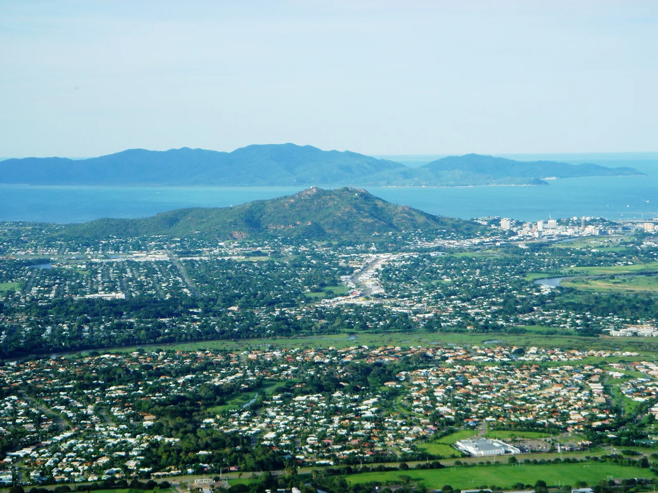

Castle Hill, Townsville
In 1980, a group of students from Heatley State High School hauled buckets of soil up the slopes of Castle Hill, trying to make it taller. The hill stands 286 metres above Townsville, just fourteen metres shy of the 300-metre threshold that, by one convention, separates a hill from a mountain. The students wanted to close the gap and raise money for an assembly hall while they were at it. The earth washed away, the title never changed, and Castle Hill remains, technically, a hill. It is also the most commanding natural feature for hundreds of kilometres along the Queensland coast, a slab of bare pink granite that the whole city arranges itself around.
Cutheringa, Before the Maps
Long before any surveyor sketched it, this monolith had a name: Cutheringa, also written Cootharinga or Cooderinga. The Wulgurukaba of Garumbilbarra, the Traditional Owners of this country, hold the hill in deep spiritual significance, and it features in their Dreaming. Much of that knowledge was never written down by outsiders, but the name endured against long odds. Today Cutheringa is one of only two Aboriginal place names that survive across the whole Townsville region; the other is Pallarenda, the cape a few kilometres up the coast. When Andrew Ball, one of the first Europeans to explore the Ross River in April 1864, looked at the rock, he reached for home instead, naming it for a hill he thought resembled one near Dublin or on the Isle of Man. Two names, two ways of seeing the same stone.
The Climb Everyone Makes
Ask anyone in Townsville about Castle Hill and they will tell you they have walked it, driven it, or watched the sun come up from it. A bitumen road winds 2.6 kilometres from the northeastern slopes to the Hynes Lookout, perched on the second of the summit's three peaks. From up here the city unspools below, Cleveland Bay opens out, and Magnetic Island floats on the horizon like a green afterthought. Roughly three hundred plant species cling to the thin lithosol soils and bare rock. The surface is so exposed that the hill reads almost as a single piece of stone from a distance. Joggers grind up the road at dawn; visitors linger at dusk. It is less a tourist attraction than a civic ritual.
The Saint and the Bunker
Look at the northern cliff face and you will spot a stick figure with a halo, painted enormous across the granite: 'The Saint', the logo of the Simon Templar character, daubed there by an unknown hand and stubbornly maintained for decades as a piece of Townsville folklore. The hill carries other marks of human use. Water reservoirs and three radio masts crown the summit, serving aviation, police, ambulance and emergency services. On the northernmost peak squats a low concrete bunker, an observation post built in 1942, when Townsville was a forward base bracing against the threat of Japanese attack and lookouts scanned the sea from this natural watchtower.
Carrying the Founder Up the Hill
There is one more monument here, and its journey was an odd one. Robert Towns, the Sydney merchant whose name the city bears, died in 1873 and was buried in Balmain. He never actually lived in Townsville. When his Sydney cemetery was cleared for parkland in 1940, his memorial was offered to the Townsville council, and not everyone wanted it; one councillor argued Towns had done nothing for the place and that the city carried his name by sheer luck. The truth is harder still. Towns's fortune was built partly on the labour of South Sea Islander men and women, recruited from Pacific islands under coercion and sometimes outright kidnapping to work his Queensland cotton ventures. The monument sat in storage for years before being placed atop Castle Hill in 1949, where it still stands, a marker as complicated as the man it remembers.
From the Air
Castle Hill (Cutheringa) sits at 19.258°S, 146.801°E, rising 286 m directly above downtown Townsville. It is one of the most reliable visual landmarks on the North Queensland coast: an isolated pink granite dome immediately inland of Cleveland Bay, with Magnetic Island 8 km offshore to the north and Townsville's grid wrapping its lower slopes. Three radio masts and water reservoirs mark the summit. Best appreciated from lower altitudes in clear tropical conditions; afternoon cloud can build over the ranges inland. The nearest major airport is Townsville Airport (IATA TSV, ICAO YBTL), roughly 4 km to the northwest. Garbutt and the RAAF base share that field. Magnetic Island's small airstrip lies across the bay.
Nearby Stories
- Ayr 13 km away
- SS Yongala 34 km away
- Great Palm Island 35 km away
- Bindal People 50 km away
- Cardwell UFO Festival 83 km away
- Hinchinbrook Island 113 km away
- Porcupine Gorge 215 km away
- Samarai 998 km away