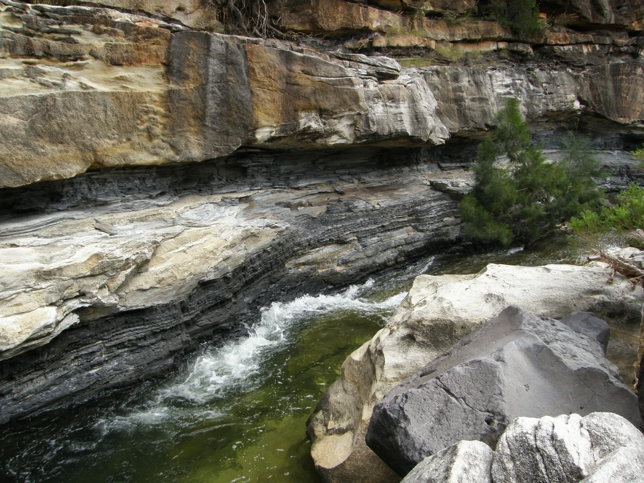

Porcupine Gorge
From the road across the dry tableland north of Hughenden, you would never guess it was there. The mitchell-grass plains run flat to the horizon, broken only by scattered gums and the shimmer of heat. Then the ground simply opens. Porcupine Gorge falls away beneath your feet, a chasm cut more than a hundred metres into the rock, its walls banded in red, ochre, gold, and bleached white. Australians call it the Little Grand Canyon, and from the lookout rim the comparison feels earned. Far below, a thread of permanent water glints between the cliffs, the patient tool that carved all of this from solid stone.
The Patience of Water
The gorge is the work of a single creek, often called Galah Creek or Porcupine Creek, doing one thing for an unimaginably long time. In the dry season it is a gentle string of waterholes scattered along the gorge floor, easy to wade and cool to swim. In the wet, it transforms. Storm runoff funnels off the surrounding plateau and channels into the chasm, and the creek becomes a raging cascade with the cutting power to deepen the canyon it has already excavated up to forty metres below the immediate plateau. To descend the walking track from the rim, dropping roughly 120 metres toward the water, is to climb down through the very process of erosion, watching the layers change as you go. The Pyramid, an isolated monolith of multicoloured sandstone, rises from the gorge floor where the canyon widens, a freestanding landmark left behind as the water cut around it.
Reading the Walls
Those colourful walls are a library of deep time, and the gorge slices clean through hundreds of millions of years of Queensland's past. The oldest layers at the base, the Betts Creek Beds, formed in a coastal swamp during the Permian period, when forests of the seed-fern Glossopteris grew, died, and rotted into the dark muck that would slowly compress into coal. You can still find their fossil leaves pressed into the mudstone. Rising sea levels then buried that swamp under river sand, laid down through the Triassic and Jurassic as the Warang and Blantyre sandstones, channel after channel of grit recording ancient rivers that ran here when dinosaurs walked the continent. Where mineral-rich groundwater once seeped through cracks, it leached iron from the stone, which is why the same sandstone shifts from deep red to yellow to ghostly white as your eye travels up the cliff. The whole sequence is finally capped, in places, by a layer of rock baked hard by ancient volcanic basalt that flowed across the top.
Yirandali Country
Long before it had a name on any map, this gorge was a place of life and meaning for the Yirandali people, the Traditional Owners of the country around Hughenden, whose language is also recorded as Yirandhali or Pooroga. In a hard, dry land, a permanent source of water and shade like Porcupine Gorge was precious beyond measure, a reliable refuge when the surrounding plains baked. Their presence is written into the rock itself: at a spot in the gorge known locally as 'the Tattoos,' Aboriginal rock drawings remain on the stone. The Yirandali welcome visitors to their traditional country and ask, simply, that the place be treated with the respect it has always been owed. To walk the gorge today is to move through a landscape that has been valued, watched over, and lived in for a very long time.
Into the Cool
Today the gorge is protected within Porcupine Gorge National Park, which sprawls across more than 5,400 hectares and runs for over 25 kilometres along the creek. For travellers crossing the long, hot inland, it arrives like a secret. The lookout sits about 60 kilometres north of Hughenden, with a camping area and the steep walking track a little further on, dropping hikers down into the green heart of the canyon. After the open glare of the savannah, the gorge floor is another world entirely: shaded, echoing, alive with birdsong, the cliffs honeycombed with overhangs and the waterholes mirroring the painted walls. Sandstone weathers slowly into strange shapes here, and flash floods keep carving. The canyon is not finished. It is simply caught, for now, in the middle of being made.
From the Air
Porcupine Gorge lies at roughly 20.41°S, 144.43°E, about 60 km north of Hughenden in North West Queensland, reached by road via the Kennedy Development Road. From the air it is a dramatic and unmistakable feature: a sharp, dark gash slicing through an otherwise flat, pale tableland, running broadly north-south for more than 25 km along the creek, with the freestanding Pyramid monolith visible where the canyon widens. There are no high peaks to navigate by; the gorge itself is the landmark, best spotted by the abrupt shadow line of its cliffs against the surrounding plain. The nearest significant airfield is Hughenden (YHUG) to the south; Richmond (YRMD) lies to the west and Charters Towers (YCHT) well to the east. Dry-season visibility (May to October) is typically excellent and the low waterholes show as bright glints on the gorge floor; the summer wet season can fill the creek into a torrent and bring convective storms and turbulence over the heated plateau. Low morning or late-afternoon sun deepens the colour banding of the walls.
Nearby Stories
- Great Northern Railway (Mt Isa line) 98 km away
- Mining Works on Towers Hill 148 km away
- Day Dawn Mine Remains 154 km away
- Combo Waterhole 203 km away
- Charters Towers Stock Exchange Arcade 203 km away
- Mount Cornish Homestead 204 km away
- Georgetown: The Piece of North America in the Outback 214 km away
- Edgbaston Reserve 221 km away