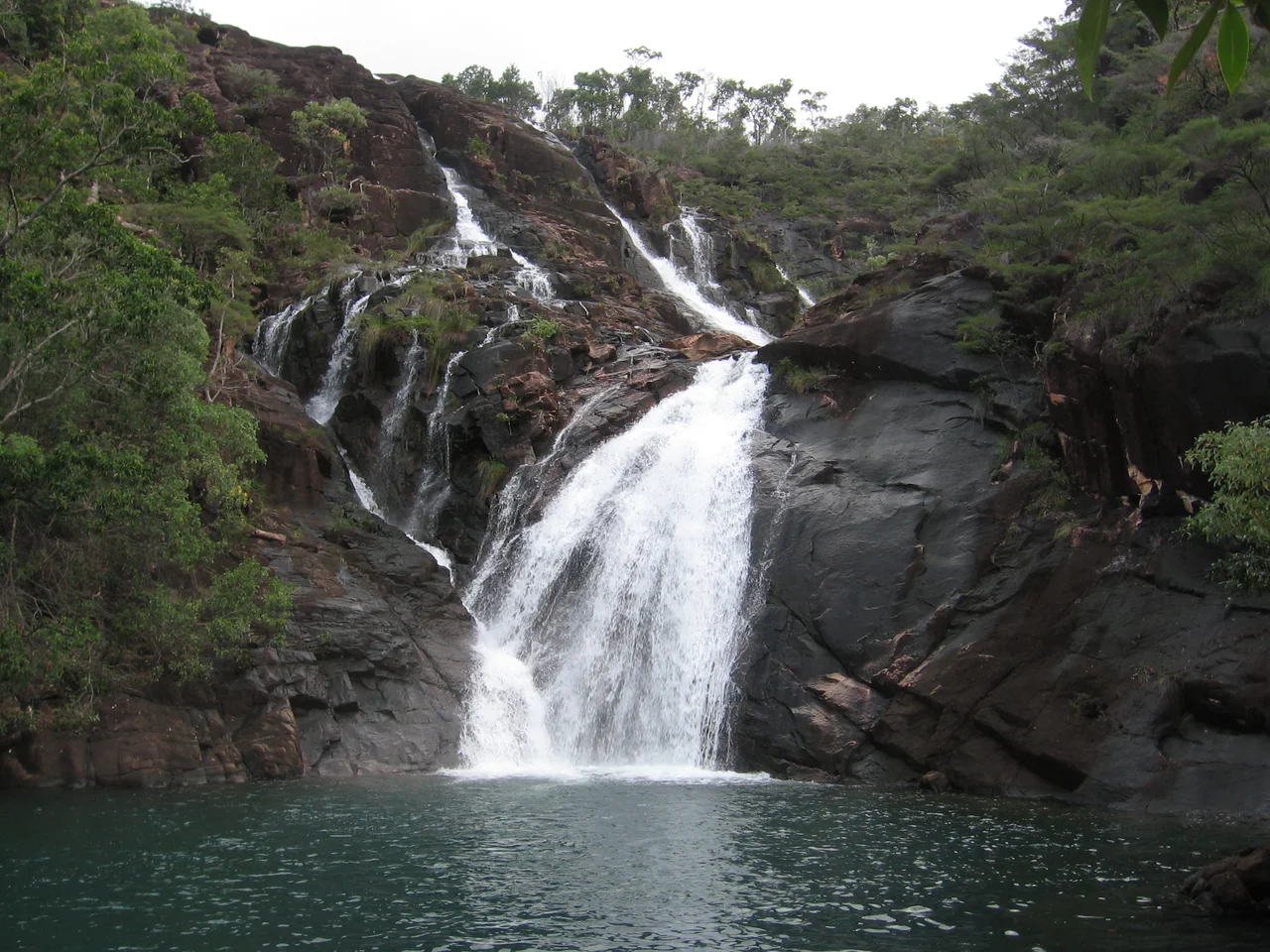

Hinchinbrook Island
From the mainland at Cardwell, Hinchinbrook looks less like an island than a piece of the continent that decided to stand apart. Cloud snags on its granite summits; rainforest pours down its flanks to meet mangrove and sea. To the Bandjin and Girramay peoples, its Traditional Owners, this is Munamudanamy, and the Biyaygiri knew the island itself as Pouandai. It is the largest island on the Great Barrier Reef and the largest island national park in Australia - and it is, almost in its entirety, wilderness. A single abandoned resort aside, the whole of it is protected. There are no roads. To know Hinchinbrook, you have to walk it.
A Mountain Range the Sea Cut Off
Hinchinbrook is the high spine of an old coastal range, built from late Palaeozoic granite uplifted as great fault blocks while the land between them sank. When the last Ice Age ended around 18,000 years ago and the sea climbed, it flooded the valley behind the range and severed the island from the mainland - the narrow Hinchinbrook Channel that now separates them is the drowned valley of the Herbert River. The peaks that survived are dramatic. Mount Bowen crowns the island at 1,121 metres, with The Thumb, Mount Diamantina and Mount Straloch all rising above 900. Curiously, no coral reefs grow in the waters immediately around the island, most likely because so much fresh water pours off its rain-soaked slopes.
Channel, Mangrove and Dune
The wildness here is not only vertical. Along the western shore, the Hinchinbrook Channel is fringed by some of the most robust mangrove estuaries in Australia - roughly 164 square kilometres of them - a labyrinth of tidal forest where saltwater crocodiles rule and sea kayakers are warned off. In the shallow tidal flats of Missionary Bay, at the island's north, dugongs graze offshore seagrass beds, and the beach stone-curlew thrives along sands where, crucially, vehicles are banned. The great dune barrier at Ramsay Bay tells its own slow story: built of wind-blown sand in two episodes, the older dunes partly drowned by a rising sea thousands of years ago, the newer ones laid down within the last nine centuries.
The People of Pouandai
Aboriginal people lived on this island for thousands of years; shell middens and stone fish traps still mark their presence along the shores. Early contact with British navigators in 1815, 1819 and 1843 was, by the sailors' own accounts, largely friendly. That did not last. After the township of Cardwell was founded across the channel in 1864, relations collapsed. Native Police expeditions swept the island - in 1867, and again in 1872, when troopers hunting the killers of two fishermen carried off three Aboriginal children; a visitor recorded that one of the children was assaulted by police, and that settlers spoke openly of slaughtering whole camps of men, women and children. Through such violence the island's people were reduced to a handful of survivors. A missionary who arrived in 1874 abandoned his post, having learned of the massacres and met almost no one in nine months. These were not statistics. They were families, custodians of a country they had held for millennia, and their descendants - the Bandjin and Girramay - help care for Munamudanamy still.
Walking the Thorsborne
Modern Hinchinbrook is defined by a single trail. The 32-kilometre Thorsborne Trail traces the island's eastern coast, threading rainforest, creek crossings, beaches and the foot of Mount Bowen, and is widely rated among the finest wilderness walks in Australia. Numbers are strictly limited and camping is by permit only, which is why the trail stays wild. It carries the name of Arthur Thorsborne, who with his wife Margaret spent decades defending this coast - the couple began annual surveys of the migratory pied imperial-pigeon colonies on the nearby Brook Islands back in 1965. Their fight helped keep development off the island. The reward for walking quietly through what they protected can be a giant tree frog in the leaf litter, a curlew on an empty beach, or simply the silence beneath those granite peaks.
From the Air
Hinchinbrook Island lies at roughly 18.23 degrees South, 146.23 degrees East, off the Cassowary Coast of far north Queensland, immediately east of Cardwell and north of Lucinda. It is an unmistakable visual landmark and an excellent navigation waypoint: a large, mountainous granite island separated from the mainland by the slender Hinchinbrook Channel, its summits - Mount Bowen at 1,121 m the highest - frequently cloud-wrapped while the channel's mangroves spread along the western shore. The nearest small airfields are Cardwell/Dallachy (YCDW), Tully (YTUY) and Ingham (YIGM), with sealed major airports at Townsville (YBTL) and Cairns (YBCS). Skies are clearest in the dry winter months; the summer wet season brings monsoon cloud, heavy rain and the regional tropical cyclone risk.
Nearby Stories
- Hull River Aboriginal Settlement 7.5 km away
- The Great Barrier Reef: The Living Structure Visible from Space - Now Dying 47 km away
- Orpheus Island National Park 48 km away
- Cyclone Yasi 79 km away
- Magnetic Island 79 km away
- Rocky Creek World War Two Hospital Complex 83 km away
- Undara Volcanic National Park 100 km away
- Porcupine Gorge 247 km away