
Undara Volcanic National Park
Around 190,000 years ago, the ground here split open and bled. A volcano the Ewamian people would later call Undara poured out one of the largest lava flows from a single vent that the planet has produced in the past few million years. The molten rock surged down ancient riverbeds, and where the surface cooled and crusted over while the liquid interior kept racing on, it left something extraordinary behind: hollow stone tunnels, kilometres long, running like veins beneath the savanna. The name fits. Undara means 'a long way' in the Ewamian language, and the lava travelled it - the longest flow stretching roughly 160 kilometres from where it began.
How a River of Fire Leaves a Cave
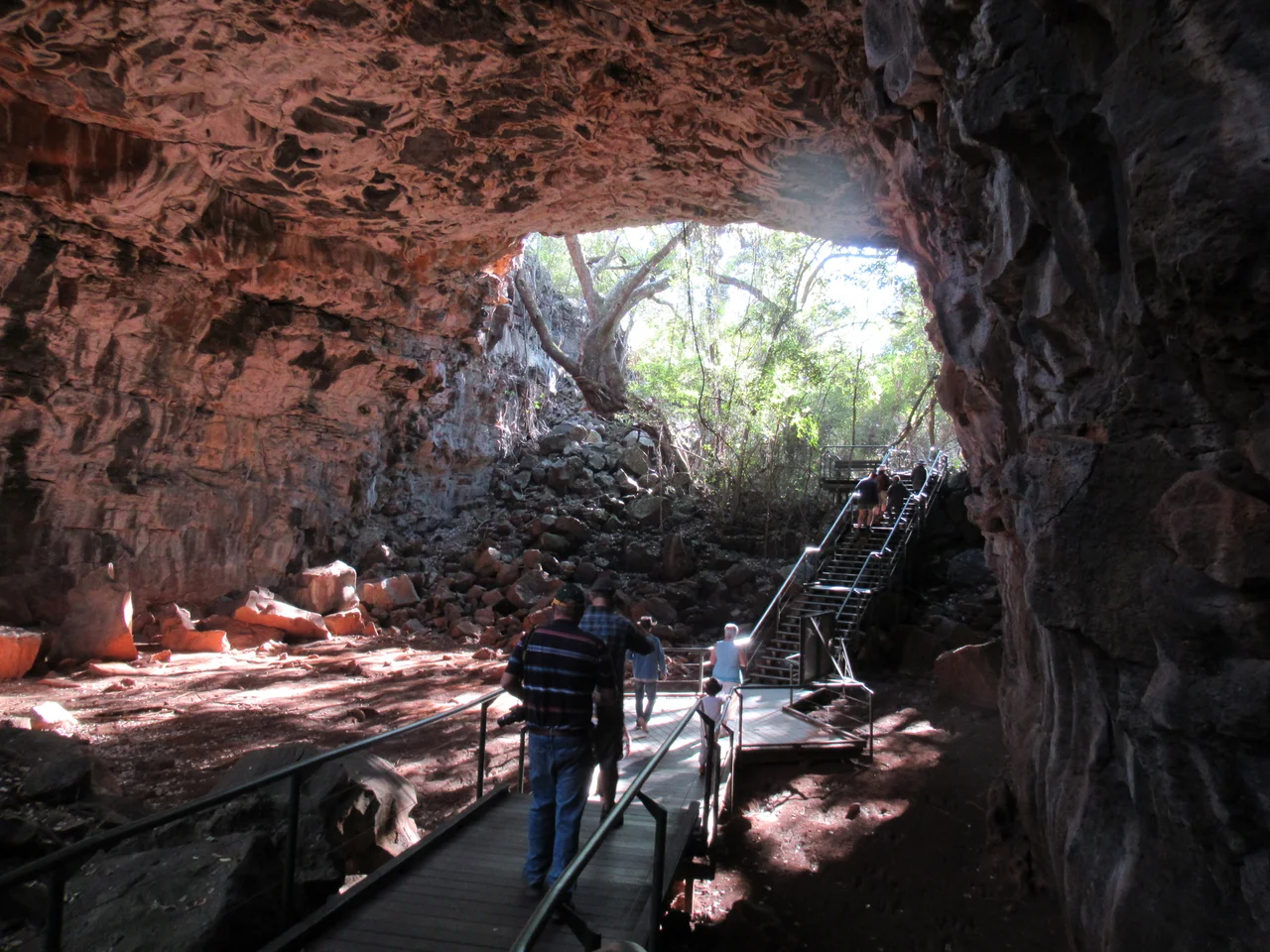
The physics is deceptively simple. When lava floods a channel, its outer skin meets the air and hardens into a roof while the molten core beneath stays hot and mobile. When the eruption finally wanes, that liquid drains away downhill and keeps going, leaving the crusted shell standing empty - a tube. At Undara, the scale of this process became staggering. The volcano expelled enough lava to bury about 1,550 square kilometres of the surrounding Atherton Tableland, and the tubes it left rank among the longest and best-preserved on the planet. Walking into one today, you step out of the harsh tropical light into a vaulted corridor of dark basalt, the ceiling arching overhead like the nave of a cathedral that no architect designed.
A Province Built by Volcanoes
Undara does not stand alone. It is the showpiece of the McBride Basalt Province, a roughly 5,500-square-kilometre region pocked with 164 identified eruption centres - volcanoes, vents and cones, each a place where the earth once opened. From the rim of Kalkani Crater, one of the few features visitors can explore without a guide, the evidence spreads out in every direction. A shield volcano called Silent Hill rises in the distance; the scoria cone of Rangaranga Hill marks the horizon; and a pale ribbon of vegetation traces the buried path of a lava tube across the plain. The volcanics here are geologically young, all of them less than eight million years old, with the most recent activity in the broader region dated to just 7,000 years ago - a heartbeat in the planet's history.
Life in the Dark and the Green
The collapsed sections of these tubes have become unexpected gardens. Where the ceiling has fallen in, sunlight and trapped moisture turn the depressions into pockets of dense green vine thicket, lush islands of rainforest with deep affinities to the ancient flora of Gondwana, surrounded by parched woodland. The rare white-flowered onion vine grows in these hidden refuges. Deeper inside, the darkness teems with its own residents. Four species of insect-eating microbat shelter in the caves, and their nightly departures draw barking owls, snakes and other hunters to the cave mouths. Bayliss Cave is reckoned among the most biologically diverse caves in the world, home to 52 recorded resident species, including the richest assemblage of cave arthropods documented anywhere in north Queensland.
Custodians and Cattle
Long before Europeans arrived, this was Ewamian country, and it remains so. European settlers moved in during the 1860s, running cattle across the basalt plains; the Collins family, who settled the area in 1862, eventually built the visitor operation that became the Undara Experience. The tubes were well known to outsiders by 1891, but for decades they were visited haphazardly, with no protection. Guided tours began only in 1989, and the national park itself was declared to safeguard the fragile underground world. Today access to most tubes is by guide alone - not bureaucratic caution but genuine necessity. The landscape hides collapsed pits, some tubes pool with dangerously high carbon dioxide, and the maze of identical-looking gullies can swallow the unwary whole.
From the Air
Undara Volcanic National Park sits at 18.20 degrees South, 144.60 degrees East, in the Gulf Savannah roughly 275 km southwest of Cairns and 437 km northwest of Townsville. From altitude in clear, dry-season conditions, look for the dark basalt sheet of the McBride Province and the pale, sinuous lines of vegetation that trace buried lava tubes across otherwise uniform woodland; Kalkani and Undara craters are the most prominent vents. The nearest sealed major airports are Cairns (YBCS) and Townsville (YBTL), with small airstrips at Mount Surprise, 58 km away by road. Best visibility is April to August, the cooler dry months; the wet season from October to late March brings haze, cloud and monsoonal storms.
Nearby Stories
- The Etheridge Line: The Town That Took a Train Hostage 28 km away
- Mbabaram language 75 km away
- Golden Gumboot 83 km away
- Paronella Park 86 km away
- Mount Spec Road and Little Crystal Creek Bridge 127 km away
- Orpheus Island National Park 193 km away
- Palmer River Gold Company Dredge 235 km away
- Great Northern Railway (Mt Isa line) 285 km away