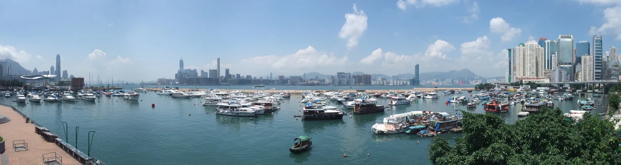

Causeway Bay Typhoon Shelter
On 18 September 1906, a typhoon struck Hong Kong and destroyed 3,653 boats. Fifteen thousand people died, most of them fishermen. The Hong Kong Government had been warned. A legislative council member named Gershom Stewart had proposed expanding the existing shelter in December 1903. The motion passed. The money never materialized. The Chamber of Commerce asked questions in 1904. More questions in 1906. No response. Then the typhoon came, and the government finally listened to what it had been told.
The Shelter the 1874 Storm Demanded
The original typhoon shelter predates even the 1906 disaster. It was built after the 1874 typhoon, positioned at what is now the site of Victoria Park, to give fishing boats somewhere to ride out storms. Completed in 1883, it had a breakwater only 427 metres long and cost HK$96,500. For nearly three decades that small arc of protected water was all Hong Kong offered its fishing community against the typhoons that roll in from the South China Sea with clockwork regularity. The sea doesn't negotiate. When the 1906 storm came, the inadequacy of that original shelter became visible in the sheer count of the dead — people who worked on boats, who lived on boats, who had nowhere safe to go when the weather turned lethal.
Expansion After Catastrophe
In March 1908, eighteen months after the storm, the government finally carried out the expansion that had been proposed and ignored for years. Workers deepened the shelter by three metres and expanded it to 30 hectares. The scale of that enlargement — from a modest breakwater to a 30-hectare refuge — reflected the scale of what had been lost and what could not be lost again. Over subsequent decades the shelter shrank as land reclamation pushed the shoreline outward, eventually stabilizing at roughly 17 hectares. The bay that once gave Causeway Bay its name had largely vanished beneath the landfill that now carries Victoria Park, the Cross-Harbour Tunnel approach, and the elevated Island Eastern Corridor. What remains of the original water is the shelter itself, holding its shape between Kellett Island and the highway interchange to the east.
A Protected Corner in a Transformed Harbour
The shelter today is bounded on the west by the Cross-Harbour Tunnel's Hong Kong Island entrance and on the east by the Island Eastern Corridor — a stretch of elevated expressway that traces what was once open shoreline. To the south, Victoria Park occupies land that was sea when the shelter was first built; a street nearby called Shelter Street is the last trace of the original geography. The Royal Hong Kong Yacht Club uses the waters of the shelter, and the famous Noonday Gun — fired daily by Jardine Matheson and mentioned in Noël Coward's song 'Mad Dogs and Englishmen' — stands at the harbour edge nearby. The Excelsior Hotel and the Central–Wan Chai Bypass are the other landmarks that define the shelter's urban surround.
What Remains in the Water
In 2022, the harbourfront section alongside the shelter was redeveloped and expanded as part of the broader Victoria Harbour waterfront project, giving the public new access to a shoreline that had long been cut off by roads. The shelter's water quality tells a different story about its century of use. A 2005 government environmental report identified the Causeway Bay Typhoon Shelter as having exceptionally high levels of tributyltin — an antifouling compound used on boat hulls — exceeding one thousand times the baseline concentration measured in the East Lamma Channel. A century of vessels sheltering in a confined basin has left its mark in the sediment. The shelter remains, as it has been since 1908, a working piece of harbour infrastructure: not picturesque, not entirely clean, but present — proof that after enough people die, warnings eventually get acted on.
From the Air
The Causeway Bay Typhoon Shelter sits at approximately 22.2857°N, 114.1850°E on the northeast shore of Hong Kong Island. At 1,500–2,500 feet, the shelter is clearly identifiable as a roughly rectangular patch of calm water bounded by the elevated expressway of Island Eastern Corridor to the east and the Cross-Harbour Tunnel approach to the west. Victoria Park's greenery immediately to the south provides an excellent visual reference. Hong Kong International Airport (VHHH) lies approximately 18 nautical miles to the west; the Kai Tak approach corridor — now a development site — is about 3 nm to the north across the harbour. The gap between Hong Kong Island and Kowloon here narrows to roughly 1 nm, making the shelter visible as a distinct sheltered water feature even at higher altitudes.
Nearby Stories
- Lok Ma Chau Loop 2.3 km away
- Portas do Cerco 2.3 km away
- Kweilin Incident 17 km away
- Wanshan Archipelago Campaign 34 km away
- Nanxiong Formation 115 km away
- Battle of Nanpeng Island 148 km away
- Heyuan 169 km away
- Cape Maobitou 632 km away