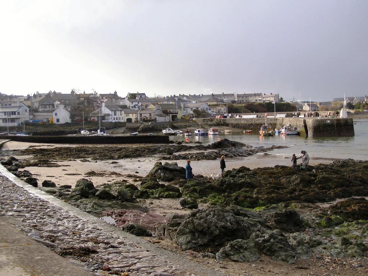

Cemaes
Walk east from the village of Cemaes for half a mile, climb a stile in the churchyard wall, and the view is one of the strangest in Wales: an empty squat-towered church standing alone on a headland, with the Isle of Man visible across the water to the north, the hills of the Lake District to the east, and on a clear day the Mountains of Mourne in Ireland on the far horizon. The church is Llanbadrig - the church of St Patrick. Local tradition has it that the future patron saint of Ireland was shipwrecked here in the 5th century on his way to convert the Irish, washed ashore on the small offshore island still called Ynys Badrig - Patrick's Island - and recovered in a cave below the cliff. He is said to have founded the church in thanks in AD 440. It is the only church in Wales with a plausible direct link to the saint himself.
The Most Northerly Village in Wales
Cemaes sits at the head of a sheltered bay opening directly onto the Irish Sea, the northernmost settlement of any size in the country (the tiny hamlet of Llanbadrig itself sits slightly further north on the headland, but Cemaes is the working village). The name comes from the Welsh cemais, meaning a bend or loop in a river - a description of the meanders of the Afon Wygyr as it reaches the sea. Earlier in its history the village was called Castell Iorwerth, after a 13th-century Welsh prince. Around 1,357 people lived in the Llanbadrig community at the 2011 census. The bay is a partly National Trust-owned Area of Outstanding Natural Beauty, and the harbour - rebuilt after storms in 1828 and 1889 - is still in working order.
Salted Herring and Lloyd George
Between the late 18th and early 20th centuries, Cemaes ran two industries that the modern village barely remembers. Salted herring were caught, cleaned and packed for export in significant quantities; the harbour pier was rebuilt twice to handle the trade. A nearby brickworks produced bricks that were tramway-shipped down to the pier on a narrow-gauge line and loaded directly onto coasters. Both industries collapsed early in the 20th century. Tourists replaced them. From the Victorian era onwards, painters and writers came for the harbour, the cliffs, and the quiet, and Lloyd George - the Welsh Liberal who would become Prime Minister - liked it enough to visit repeatedly. The village hall, built by Liverpool builder David Hughes in 1898, still stands. Hughes' grand house, Wylfa Manor, built in 1896, was demolished to make way for the Wylfa nuclear power station - which itself ceased generation in 2015 and now sits under the village's car park, awaiting demolition.
The Rocks That Were Indescribable
The cliffs around Cemaes expose some of the oldest and most studied rocks in Wales - the Mona Complex, around 600 million years old, full of contorted folds and chaotic mixtures that geologists have been arguing about for over a century. The Welsh geologist Edward Greenly, who literally wrote the book on Anglesey geology in 1919, called the Cemaes mélange 'a many coloured mélange that is really indescribable, and must therefore be seen in the field to be envisaged.' That description has stuck. The whole north coast is now an officially designated geological heritage area, and the cliffs from Llanbadrig west to Cemlyn are among the few places where you can walk along an exposed ancient ocean floor without scuba gear.
Terns, Porpoises, and a Titanic Survivor
Wildlife around Cemaes is more abundant than the small village suggests. Porpoises come up to breathe along Wylfa Head. Atlantic mackerel, flatfish and red crabs come into the harbour for any patient line. Just along the coast at Cemlyn, the only breeding colony of Sandwich terns in Wales runs to around 1,500 pairs every summer. Among the village's notable former residents was Thomas William Jones, an able seaman who survived the sinking of the Titanic in April 1912 - one of the relatively few crew who came home. The Cemaes Heritage Centre, in the village, tells these stories: Stone Age nomads, Welsh princes, Lloyd George's holidays, the lost shipbuilders, the herring fishers, and the men and women whose lives the small bay quietly held.
From the Air
Cemaes village at 53.41°N, 4.45°W, on the north coast of Anglesey. From the air the bay is a sheltered crescent immediately east of Wylfa Head, with the distinctive box-form of the decommissioned Wylfa nuclear power station a clearly visible landmark. Llanbadrig Church stands alone on the headland east of the village. Ynys Badrig (Middle Mouse) lies 1 nm offshore. Nearest airports: Anglesey/Valley (EGOV) 11 nm southwest, Caernarfon (EGCK) 21 nm south. On a clear northwesterly the Isle of Man is visible 40 nm to the north; Ireland's Mountains of Mourne show 75 nm to the northwest.
Nearby Stories
- Llandudno Lifeboat Station 3.8 km away
- Glynllifon 6.1 km away
- German submarine U-1024 9.4 km away
- Irish Sea Bridge 11 km away
- Ysbyty Ifan 12 km away
- Irish Sea 18 km away
- Celtic Array 18 km away
- Birkdale Palace Hotel 56 km away