Central Panay Mountain Range
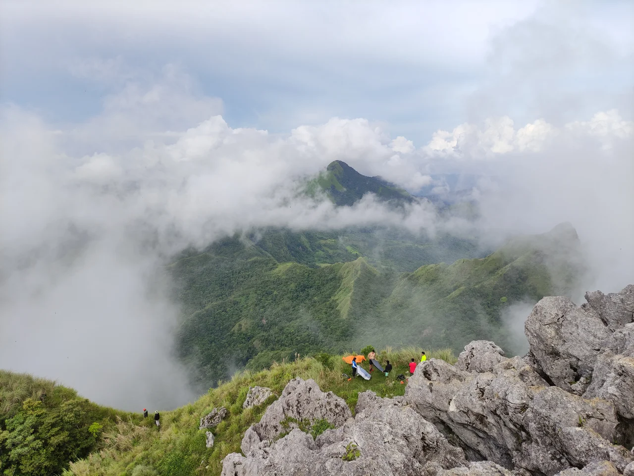
Every river on Panay Island begins in the same place. The Panay River, 169 kilometers long and the island's greatest watercourse, starts in these mountains. So does the Jalaur at 141 kilometers, the Aklan at 97, and dozens of others that branch through four provinces before reaching the sea. The Central Panay Mountain Range is the hydrological engine of western Visayas -- a north-south wall of peaks stretching from the vicinity of Ibajay in Aklan to the southern tip of Antique near Anini-y. At its summit, Mount Madja-as rises to 2,117 meters, the highest point on the island. Below the mossy forests and cloud cover, a world of waterfalls, rice terraces, caves, and endangered species unfolds across terrain that most visitors to the Philippines never see.
A Mountain for Every Province
The range occupies the eastern portions of Antique, western Iloilo, western Capiz, and western Aklan -- effectively claiming territory in every province on the island. Mount Madja-as anchors the system at 2,117 meters, followed by Mount Nangtud at 2,074 meters and E.B.J Peak at 1,985 meters. The list continues for over ninety named peaks, descending gradually until the mountains dissolve into the coastal plains. This geographic dominance means the range controls weather patterns, agricultural productivity, and water supply for the entire island. The rivers it generates irrigate thousands of hectares of riceland and provide drinking water for multiple municipalities. When Panay residents turn on a tap or flood a rice paddy, they are drawing on water that fell as rain on these peaks.
The Terraces Time Built
Tucked into the mountain slopes are clusters of rice terraces -- the largest and oldest in the Visayas. The Antique Rice Terraces, as they are collectively known, include systems at San Remigio, Laua-an, Tibiao, Valderrama, and Barbaza, among others. Unlike the famous Banaue terraces of northern Luzon, these Visayan counterparts receive far less tourist attention, yet they represent the same extraordinary engineering: hillsides carved into stepped pools that cascade down mountainsides, holding water and soil in place through gravity and careful stonework. The terraces speak to centuries of indigenous agricultural knowledge, adapted to the specific soil and rainfall conditions of each valley. Some are still actively farmed, their irrigation channels fed by the same mountain streams that have sustained them for generations.
Where Giant Flowers Bloom
The forests of the Central Panay Mountain Range harbor species found nowhere else on Earth. Most dramatic among them is Rafflesia speciosa, a globally endangered parasitic flower that produces blooms up to 80 centimeters across -- one of the largest flowers in the world. It has no stems, no leaves, no roots of its own; it lives entirely within the tissues of tropical vines, emerging only to produce its enormous, foul-smelling bloom. The range also supports Philippine dipterocarp trees including white lauan and apitong, along with fruit trees like antipolo (breadfruit) and malapaho. The Sibalom Natural Park, located within the range, protects 5,511 hectares of what is considered one of the last remaining lowland rainforests on Panay -- a fragment of an ecosystem that once covered the entire island.
Water Falling Everywhere
The mountain range hosts an extraordinary concentration of waterfalls, with over forty named cascades scattered across its drainages. Tarugan Falls and Nadsadjan Falls in Igbaras, Bugtong Bato Falls in Tibiao, Bolinao Falls in Valderrama -- the list reads like a catalog of gravity and water finding every possible path downhill. Many of these falls remain difficult to reach, requiring hikes through forest and across river crossings that keep casual tourism at bay. The caves are equally numerous: Igbaclag Cave in San Remigio, Kulapnitan Cave in Igbaras, and others penetrate the limestone karst that underlies portions of the range. Together with the Bucari Pine Forest in Leon, Iloilo -- an unusual highland pine ecosystem in a tropical island setting -- these features make the Central Panay Mountain Range one of the most ecologically diverse areas in the Philippines, hidden in plain sight on an island most travelers cross only to reach Boracay.
From the Air
Located at approximately 10.763N, 122.139E, the Central Panay Mountain Range runs north-south through the center of Panay Island. Mount Madja-as (2,117m / 6,946ft) is the highest peak. Visible from cruise altitude as the mountainous spine of the island. Nearest airports include Iloilo International (RPVI) to the east and Kalibo International (RPKB) to the north. Caution: terrain rises significantly above typical island elevations. Mountain weather can produce rapid cloud formation.
Nearby Stories
- Silay 30 km away
- Jalaur Dam 34 km away
- Kanlaon Volcano 50 km away
- Guimaras Oil Spill 52 km away
- Cuyo, Palawan 68 km away
- Gigantes Islands 91 km away
- Coron, Palawan 187 km away
- San Vicente, Palawan 261 km away