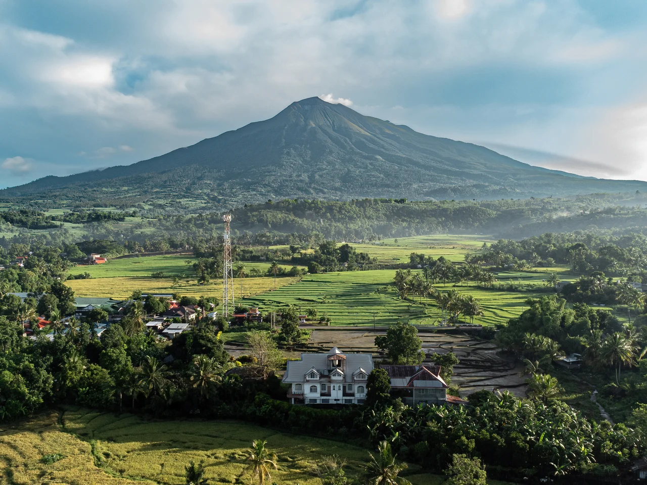
Kanlaon Volcano
The name means 'belongs to Laon,' and Laon means 'the ancient one.' Long before volcanologists catalogued its eruptions, the Visayan peoples understood Mount Kanlaon as the domain of their supreme creator deity, a goddess of agriculture, justice, and the deep ordering of the world. At 2,465 meters, it is the highest peak on Negros Island and in the entire Visayas, an andesitic stratovolcano that ranks as the 42nd-highest island peak on Earth. It is also, stubbornly and spectacularly, active.
The Goddess in the Mountain
In the indigenous belief systems of the Visayan peoples, Kanlaon is not merely a geological feature. It is sacred ground. The prefix kan means 'belonging to,' and Laon is the ancient creator goddess revered across multiple Visayan ethnic groups, including the Aklanon, Capiznon, Cebuano, Hiligaynon, Karay-a, Suludnon, and Waray. Her name itself derives from the Visayan word laon, meaning 'ancient' or 'old.' She was regarded as the supreme deity presiding over creation, agriculture, and justice. The volcano bearing her name straddles the border between Negros Occidental and Negros Oriental, approximately 30 kilometers southeast of Bacolod. During the late Spanish colonial period, officials briefly tried to rename it, but the original name persisted. Mountains outlast the ambitions of administrators.
Fire on the Ring
Kanlaon sits on the Pacific Ring of Fire, and it behaves accordingly. The volcano is one of the most active in the Philippines, with a documented history of eruptions stretching across centuries. Its eruptions tend toward the explosive, producing ash columns, pyroclastic flows, and sulfurous emissions that can affect communities across multiple provinces. The volcano's slopes support a national park, Mount Kanlaon Natural Park, whose forests and watersheds provide critical resources to surrounding communities. But the park's boundaries offer no protection from what lies beneath. The geological record is clear: Kanlaon has erupted, is erupting, and will erupt again. Living near it means accepting that bargain.
June 2024
On June 3, 2024, PHIVOLCS raised Kanlaon's alert level from 1 to 2 after an explosive eruption from the summit vent at 6:51 in the evening. The eruption produced an incandescent plume that rose 5,000 meters above the vent, a column of fire visible across much of Negros. A pyroclastic density current, the fast-moving flow of superheated gas and volcanic debris that is among the deadliest volcanic phenomena, traveled approximately two to three kilometers down the south and southeastern slopes. The eruption lasted six minutes. In the aftermath, sulfurous odors and ashfall spread across surrounding municipalities. Sulfur contamination rendered water supplies in La Carlota, Negros Occidental, unsafe to drink. Volcanic haze drifted as far as Bicol, hundreds of kilometers to the east. Muddy stream flows swept through villages in La Castellana. Mandatory evacuations were ordered, and five barangays in Canlaon City were forced to flee. Forty-three volcanic earthquakes were recorded in the days that followed.
Trails Through Sacred Ground
In 2016 and 2017, the first marked hiking trails were established on Kanlaon's slopes, a project led by Mendel University in cooperation with the University of St. La Salle and the Department of Environment and Natural Resources, financed by the Czech Embassy in Manila under the Czech Aid Development program. Three color-coded trails use the colors of the Philippine flag. The Red Trail runs from the village of Guintubdan to Buslugan Falls. The Yellow Trail leads to Oro Falls and the Margaja Valley. The Blue Trail climbs to an observation post offering sweeping views of the volcano's upper reaches. A full summit trail was also marked from Guintubdan to the top. These trails wind through dense tropical forest, past waterfalls and volcanic formations, into terrain that shifts between pastoral beauty and geological menace. Hikers ascending Kanlaon walk through the domain of the ancient one, on ground that has no interest in staying still.
From the Air
Coordinates: 10.412N, 123.132E, on the island of Negros in the central Philippines. Kanlaon is unmistakable from altitude: the highest peak in the Visayas at 2,465 meters, its summit often wreathed in clouds or volcanic haze. The volcano straddles Negros Occidental and Negros Oriental, approximately 30 km southeast of Bacolod. Nearest major airports: RPVB (Bacolod-Silay Airport) approximately 35 km northwest, RPVD (Sibulan/Dumaguete Airport) approximately 90 km southeast. The summit crater and any active plumes are visible from cruising altitude. During periods of elevated activity, ash clouds may be present.
Nearby Stories
- Lizares Mansion 15 km away
- Hacienda Rosalia 23 km away
- 2012 Negros Earthquake 26 km away
- Fort San Pedro (Iloilo) 28 km away
- Japanese Cruiser Abukuma 98 km away
- November 2023 Mindanao Earthquake 532 km away
- Balut Island 591 km away
- Sinking of MV Sewol 2624 km away