.jpg)
Central Sulawesi: Where the Earth Remembers
Someone carved a face into granite here, thousands of years ago, and no one knows why. The statue stands in the Bada Valley, nearly five meters tall, its features worn smooth by rain and time. It has no mouth. Over 400 megaliths like it are scattered through the highlands of Central Sulawesi, some shaped like humans, others hollowed into great stone urns called kalamba. Archaeologists have dated them as far back as 3000 BC, but who made them, and what they meant, remains an open question. Central Sulawesi keeps its secrets close.
The Crossroads of Everything
Sulawesi is one of those rare places where the biological rules change. The Wallace Line, an invisible boundary running through the Indonesian archipelago, separates Asian fauna from the creatures of Oceania. Central Sulawesi sits squarely in the transition zone, and its forests hold animals found nowhere else on Earth: the babirusa, a pig with tusks that curve backward through its own skull; the anoa, a miniature buffalo barely a meter tall; and the maleo, a bird that buries its eggs in volcanically heated sand and walks away. Lore Lindu National Park, about 60 kilometers south of the capital Palu, protects the largest native mammal habitat on the island. At least 230 bird species live here, along with spectral tarsiers whose enormous eyes have watched the forest for millions of years.
Kingdoms, Conquerors, and Coffee
By the 13th century, kingdoms had risen across Central Sulawesi: Banawa, Tawaeli, Sigi, Banggai. Islam arrived in the 16th century, carried north by the powerful Gowa kingdom of South Sulawesi. The Dutch followed in the 17th century, building fortifications in Parigi to combat piracy. Three centuries of colonial rule ended only when Japanese forces landed at Luwuk in May 1942. Today the province is perhaps best known for something gentler. Coffee plantations climb the highlands of Sigi and Poso, planted during the colonial era and now producing distinctive robusta beans. In the remote town of Pipikoro, farmers harvest kopi toratima, a naturally fermented coffee processed not through animal digestion like the famous kopi luwak, but through the nibbling of bats, rats, and squirrels. The resulting brew is slightly savory, with an aroma that locals describe as unmistakably theirs.
The Ground Gives Way
On September 28, 2018, the earth beneath Central Sulawesi broke. A magnitude 7.5 earthquake struck the narrow neck of the Minahasa Peninsula, 77 kilometers from Palu. A tsunami followed, waves reaching four to seven meters, slamming into coastal settlements along the Gulf of Palu. Then came something rarer and more terrifying: massive soil liquefaction. In the Petobo district and the village of Balaroa, the ground itself became fluid. Entire neighborhoods slid and sank, buildings swallowed by earth that had turned to mud. At least 4,340 people died. More than 70,000 homes were damaged, and the total destruction reached an estimated US$1.71 billion. The liquefaction event was considered one of the largest ever recorded. Central Sulawesi had survived colonial occupation, wartime invasion, and sectarian violence between 1999 and 2001 that killed over a thousand people. The earthquake reminded the province that the most dangerous forces here come from below.
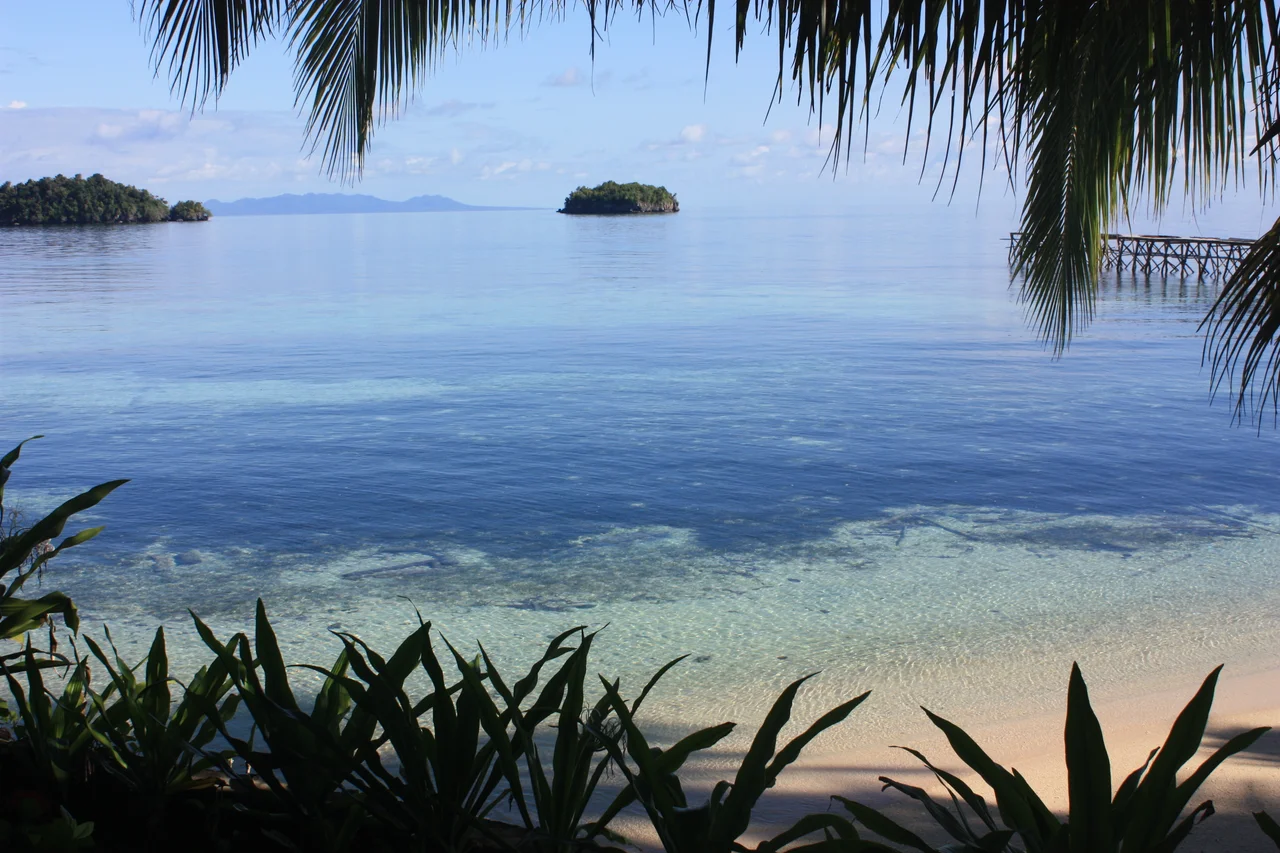
Islands at the Edge of the Known
Off Central Sulawesi's coast, the Togean Islands stretch across the Gulf of Tomini, 56 islands ringed by the only place on Earth where barrier reefs, atolls, and fringing reefs exist together. Lake Poso, Indonesia's third-largest lake, lies in the highlands with water so clear it seems impossible, its banks lined with white sand more commonly found on ocean beaches. The Sombori Islands in the southeast offer views from Tebing Kahyangan that visitors compare to Raja Ampat. Central Sulawesi spans over 61,000 square kilometers, making it the largest province on Sulawesi, yet it remains one of the least visited. Its 3 million inhabitants speak 22 distinct languages. Its mountains hold cave paintings at least 40,000 years old, as ancient as any found in Europe. Its rivers produce nearly 800,000 tons of seaweed annually. Everything about this province operates at a scale that defies its obscurity.
A Bowl of Kaledo
To understand Central Sulawesi, you might start with a bowl of kaledo. This traditional soup from Donggala Regency arrives as cow's trotters in a fiercely spicy broth, served with steamed rice and a straw for sipping marrow from the bones. A squeeze of lime cuts through the richness. It is hearty, resourceful, and unapologetically itself, which is a fair description of the province that invented it. Kapurung, sago doused in a yellow sauce of fish broth, mango slices, and shrimp, represents Palu. Milu siram, a corn soup dense with fish, fills kitchens across the capital. The food here draws on what the land and sea provide, and both provide abundantly. Central Sulawesi is a place that has been shaped by tectonic violence and human resilience in roughly equal measure. The stone faces in the Bada Valley still have no mouths. They do not need them. The land speaks for itself.
From the Air
Central Sulawesi's capital Palu sits at approximately -0.9°S, 119.8°E in a narrow valley along the Gulf of Palu. The main airport is Mutiara SIS Al-Jufrie Airport (WAFF) in Palu. The province's distinctive spider-shaped coastline is visible from cruising altitude. Lore Lindu National Park lies about 60 km south of Palu in mountainous terrain reaching over 2,000 meters. The Togean Islands are visible in the Gulf of Tomini to the east. Seven airports serve the province: Ampana, Buol, Luwuk, Morowali, Palu, Poso, and Tolitoli. Expect tropical weather with rainfall ranging from 800 to 3,000 mm annually.
Nearby Stories
- Kepulauan Togean: The Islands Where Jellyfish Forgot How to Sting 55 km away
- The Spirit Boats of Pokekea 66 km away
- New Year's Rupture: The 1996 Sulawesi Earthquake 78 km away
- Mount Colo: The Volcano That Saved an Island 81 km away
- The Hidden Archipelago of Tomini 81 km away
- The Island That Shouldn't Exist 87 km away
- Cutting the Orchid in Half: The Proposed Sulawesi Canal 89 km away
- The Nickel Furnace of the Electric Future 187 km away