
Chek Lap Kok
Before the runways, before the terminals, before Cathay Pacific City and AsiaWorld–Expo and the Ngong Ping cable car, Chek Lap Kok was an island of about 200 people and a Tin Hau Temple built from its own granite. People had been coming and going for 6,000 years — the Middle Neolithic, when the Pearl River Delta was being settled in the silences between later recorded history. Then the colony needed a new airport.
What the Island Was
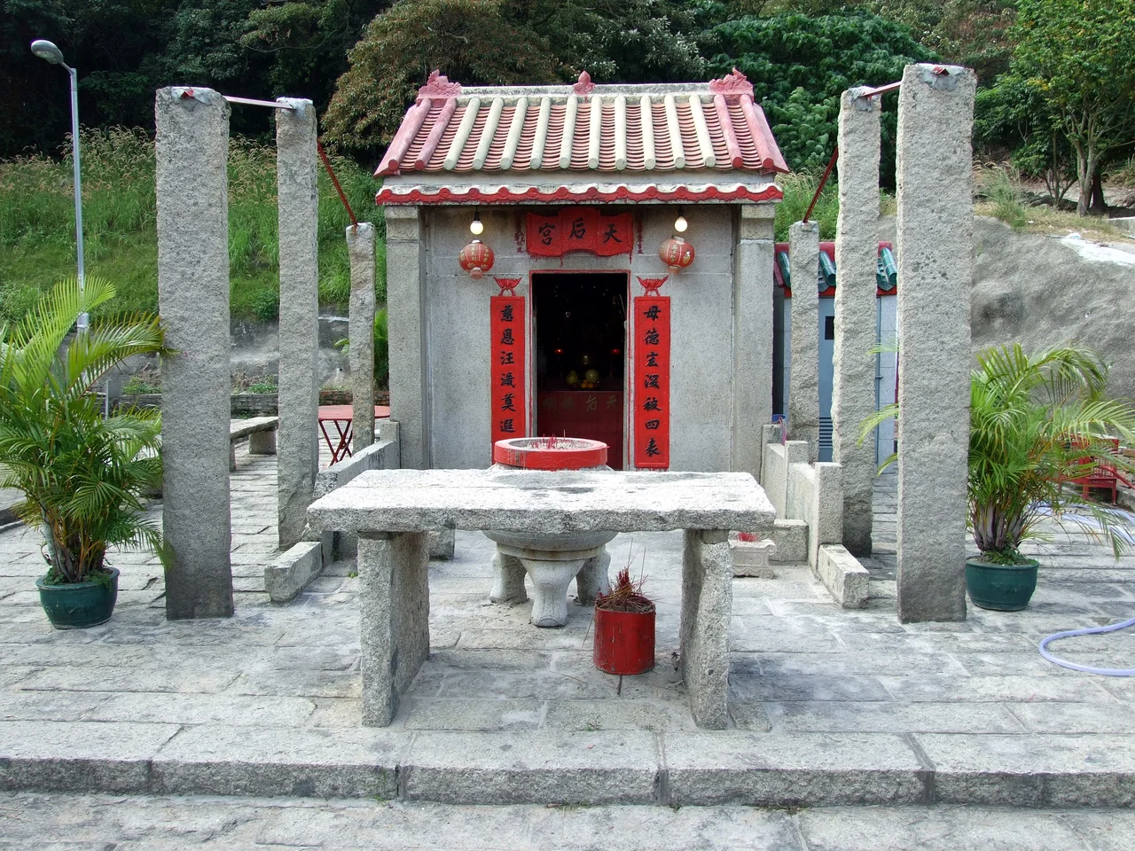
In 1911, when colonial census-takers counted the population of Chek Lap Kok, they found 77 people. The number of males was 55. The island was hilly, about 4 km long, with an area of roughly 3 square kilometres, rising from waters off the northern coast of Lantau Island. It was not a dramatic place. Farmers and fishing families worked it in modest numbers that rose in the 1950s and declined again as Hong Kong's economy pulled people toward the urban core. By the early 1990s, when the announcement came that a new international airport would be built here, about 20 families remained. The original villages were relocated to Chek Lap Kok New Village near Tung Chung on Lantau. The Tin Hau Temple, built in 1823 from granite quarried on the island, was dismantled in 1991 and rebuilt stone by stone in 1994 at its new location.
The Frogs Went First
Before construction began in earnest, ecologists identified something on the island that needed particular care: Romer's tree frog, Philautus romeri, a species found only in Hong Kong, no larger than a fingertip. The entire island population was captured and relocated to new habitats on Lantau before the earthmoving started. This was not a small gesture — it was a deliberate acknowledgment that a 6,000-year-old place does not disappear cleanly. Archaeological surveys had been conducted starting in the late 1970s, and the island yielded evidence of its long human history. The construction that followed was monumental: Chek Lap Kok was partially leveled, joined to the adjacent smaller island of Lam Chau (which was fully leveled), and the combined landmass reclaimed outward to reach its current 12.48 km² — more than four times the original island's area.
The Airport Island
Hong Kong International Airport opened for commercial aviation in 1998, replacing Kai Tak and its famously nerve-wracking runway approach over densely populated Kowloon. It is still commonly called Chek Lap Kok Airport to distinguish it from its predecessor. The airport platform today holds not just the terminals and runways but an entire ecosystem of aviation-adjacent infrastructure: Cathay Pacific City, the airline's global head office; HAECO, the maintenance and engineering operation; and Hong Kong SkyCity, which includes AsiaWorld–Expo, a convention and exhibition centre that opened in 2005. A third runway is being built as part of the Hong Kong International Airport Master Plan 2030. The island that had 77 people in 1911 now processes tens of millions of passengers a year.
What Was Kept
One peninsula in the southern part of Chek Lap Kok was not leveled. Scenic Hill, as it is called, remained intact and became the site of the Airport Island Angle Station for the Ngong Ping 360 cable car, which runs across to Lantau and the Tian Tan Buddha. The Ancient Kiln Park — preserving the remnants of historical kilns found during the airport's archaeological surveys — also sits on the island, a small deliberate space within the enormous infrastructure. The granite Tin Hau Temple, moved and rebuilt, watches over the new village nearby. Romer's tree frogs still live on Lantau, in habitats engineered for their survival. These are not enormous compensations for the erasure of a place 6,000 years in the making, but they are real.
From the Air
Chek Lap Kok is located at 22.305°N, 113.922°E in the western waters of Hong Kong's New Territories, just north of Lantau Island. It is the site of VHHH (Hong Kong International Airport), the primary international airport for the region, with two parallel runways clearly visible from the air and a third under construction. Approaching from the east at 4,000–6,000 feet, the airport platform is unmistakable — a flat, rectangular island extending into the Pearl River estuary. Scenic Hill protrudes from the southern edge as a small green elevation amid the runways. Tsing Ma Bridge connects the airport to the mainland road and rail network to the northeast. Lantau Island rises to the south.
Nearby Stories
- Lok Ma Chau Loop 2.3 km away
- Portas do Cerco 2.3 km away
- Kweilin Incident 17 km away
- Wanshan Archipelago Campaign 34 km away
- Nanxiong Formation 115 km away
- Battle of Nanpeng Island 148 km away
- Heyuan 169 km away
- Cape Maobitou 632 km away