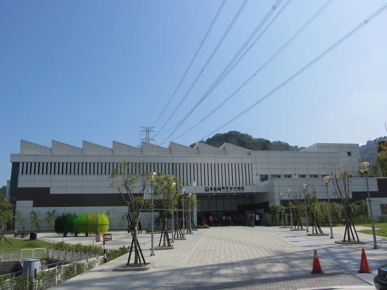

Chelungpu Fault Preservation Park
At 1:47 in the morning on September 21, 1999, the Chelungpu Fault ruptured. The earthquake — magnitude 7.6 — lasted less than a minute. When it was over, approximately 2,400 people in Taiwan were dead, more than 100,000 homes were damaged or destroyed, and the fault itself had pushed the earth's surface upward in places by several meters, leaving a visible scar across the landscape of central Taiwan. The Chelungpu Fault Preservation Park exists because of that night. It preserves the fault scarp — the physical evidence of what the earth did — and it asks visitors to stand in the presence of something that was both a geological event and a human catastrophe.
The Night of the 921
In Taiwan, the earthquake is known simply as the 921 — the date, September 21, standing in for the full weight of what happened. The Chelungpu Fault, a thrust fault running through the foothills of central Taiwan, had been accumulating stress for a very long time. When it released in the early hours of that Wednesday morning, communities across Nantou and Taichung counties bore the immediate impact. The towns that stood near the fault experienced its force most directly: buildings pancaked, roads cracked open, hillsides moved. The human cost was concentrated among people who had been asleep, who had no warning, who were inside structures that the force of that rupture could not spare. More than two thousand families lost someone. The grief that followed was Taiwan-wide.
Finding the Fault
In November 2002, three years after the earthquake, Dr. Chen Wen-shan — a professor of geology at National Taiwan University — was conducting research into the major earthquakes that had struck Taiwan when he identified something significant: the original Chelungpu Fault trace, precisely as the earthquake had exposed it, preserved in the ground at Zhushan Township in Nantou County. The fault was not simply a line on a map. It was a physical rupture, a place where the thrust fault had pushed one section of crust over another and left the evidence in the earth itself — trench layers offset, the stratigraphy of the ground interrupted and displaced. The discovery created an opportunity: preserve this, and future generations would be able to see what an earthquake fault actually looks like.
What the Park Holds
The Chelungpu Fault Preservation Park opened for public testing in January 2013 and formally began regular operations on May 1 of that year, a decade and a half after the earthquake that created it. The park is administered as a subordinate institution of the National Museum of Natural Science. At its center is the Fault Trench Preservation Hall, which displays the thrust fault as the earthquake left it — exposed in cross-section, the displaced layers of the earth laid out in a way that makes the mechanics of seismic rupture visible and comprehensible. The Geoscience Hall extends the educational mission with exhibits on fossils, stratigraphy, and the broader science of earthquakes and plate tectonics. The park is not only a geological exhibit. It is also, unmistakably, a place of memory.
Science and Memory, Side by Side
There is a particular kind of seriousness that settles over a place built where something terrible happened. The Chelungpu Fault Preservation Park carries that quality. The geology is real — the fault is real, preserved exactly as the earthquake left it, open to scientific interpretation and study. But the earth that the park protects is also the earth that moved beneath people's homes in the middle of the night in 1999, that ended lives and altered others permanently. Standing at the fault scarp, looking at the offset layers of soil and rock, it is possible to understand both things at once: the long, impersonal time of geology, and the very personal, very human time of a single catastrophic minute. The park does not resolve that tension. It holds it.
From the Air
The Chelungpu Fault Preservation Park is located at approximately 23.79°N, 120.71°E in Zhushan Township, Nantou County — in the foothills where Taiwan's western plains begin to give way to the central mountain range. The terrain transitions noticeably here from the flat alluvial plain to the east. At 4,000 to 6,000 feet, the fault-line foothills and the beginning of the Nantou highlands are visible. The nearest major airport is RCMQ (Taichung International Airport), approximately 40 kilometers to the northwest. In clear conditions, the scale of the Chelungpu Fault zone — running through the hill country between the plain and the mountains — can be appreciated from altitude as the topographic expression of seismic history.
Nearby Stories
- Alishan 5.8 km away
- Cultural Heritage Park 10 km away
- Taroko National Park 10 km away
- Ruisui Tropic of Cancer Marker 12 km away
- Taixi, Yunlin 14 km away
- Lintianshan Forestry Culture Park 16 km away
- High-Heel Wedding Church 22 km away
- Taiwan Strait 87 km away