
Cheraw, South Carolina
John Birks Gillespie was born here on October 21, 1917, the youngest of nine children, in a small house in Cheraw, South Carolina. His father, a bricklayer and amateur bandleader, kept musical instruments around the house and beat John Birks regularly. The father died when the boy was ten. By twelve, he was playing trombone in school. By fourteen, trumpet. He left Cheraw for the Laurinburg Institute across the state line, then for Philadelphia, then for the bandstands where, alongside Charlie Parker and Thelonious Monk, he reinvented American music as bebop. He went by Dizzy. And he came back to Cheraw whenever he could.
Dizzy's Town
Cheraw markets itself as 'The Prettiest Town in Dixie,' a slogan that predates the era when the nickname became uncomfortable. But the most important thing about Cheraw isn't its prettiness — it's that this is the town that produced Dizzy Gillespie, the jazz trumpeter who, with Charlie Parker, founded the bebop style that transformed 20th-century music. A bronze statue of Gillespie stands in Town Green Park, his trumpet's distinctive upward-bent bell catching the sun. He returned often, and the town's annual South Carolina Jazz Festival keeps his music in the air every fall.
The Cheraw People
Before the town, there was the tribe. The Cheraw lived near the waterfall hill at the fall line of the Pee Dee River, in the place that would later take their name. By the 1730s, infectious diseases carried inadvertently by European traders had devastated them. Survivors joined the Catawba Confederacy for safety. By the time of the American Revolution, only a few scattered Cheraw families remained in the area, though their name continued — left on the land like a fingerprint after the body had moved on. Welsh Baptist settlers from Pennsylvania and Delaware claimed the land in the 1730s. By 1750, Cheraw was one of only six South Carolina places marked on English maps.
The First to Secede
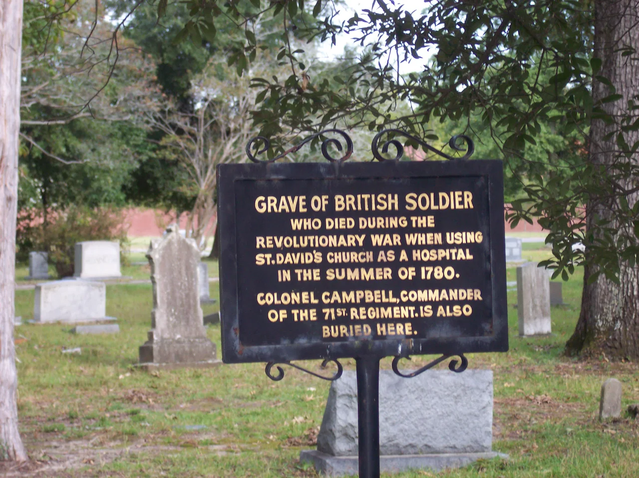
On November 19, 1860, the first public meeting calling for South Carolina's secession took place at the Chesterfield County Courthouse. A Cheraw lawyer named John A. Inglis attended, then introduced the resolution that became South Carolina's secession ordinance, and chaired the committee that wrote it. Five months later, the Civil War began. In March 1865, Sherman's army came through Cheraw on its march north from Savannah, occupied the town for several days, and then moved on. Most of the town survived, including St. David's Episcopal Church — built in 1768 as the last Anglican parish chartered in South Carolina under George III, and used by both sides as a hospital during the Revolution.
Steamboats and Cotton
In 1819, the first steamboat made it up the Pee Dee to Cheraw, opening river trade to Georgetown and the coast. The town incorporated in 1820. Cotton, corn, tobacco, rice, and indigo all moved through the warehouses on the riverfront. Cheraw became the largest cotton market between Georgetown and Wilmington, and the town's bank — the largest in South Carolina outside Charleston — grew rich on the trade. The Kershaw family had laid out the original street grid in the 1760s, planning a town they wanted to call Chatham. People kept calling it Cheraw. By 1830, every street was lined with American elms. By 1850, Cheraw was a prosperous river town.
Riverside, Sandhills, and Sound
Cheraw State Park, founded in the 1930s, was the first state park in South Carolina built by the Civilian Conservation Corps. The Sandhills State Forest borders it. Both protect the rare longleaf pine ecosystem that once stretched from Virginia to Texas. The Pee Dee River still runs at the fall line, where the Piedmont meets the coastal plain. And in Town Green Park, the statue of Dizzy Gillespie tilts that famous trumpet skyward — the same instrument the boy bought when his hometown school couldn't afford trombones anymore. Every fall, jazz musicians come to Cheraw to play in his memory, on the streets of the town he never quite left behind.
From the Air
Cheraw sits at approximately 34.70°N, 79.90°W in eastern Chesterfield County, at the fall line of the Pee Dee River. From cruising altitude, the town reads as a compact grid west of the river, with the cluster of Cheraw State Park and Sandhills State Forest extending southwest. The Pee Dee River makes a distinctive curve through the area. Nearby airports include Cheraw Municipal/Lynch Bellinger Field (KCQX) about 4 miles south of the town, Hamlet Municipal (NC) to the north, and Florence Regional (KFLO) about 41 miles south. The countryside is mixed pine forest, longleaf savanna, and agricultural land.
Nearby Stories
- Battle of Hayes Pond 8 km away
- Lynches River 12 km away
- Hartsville, South Carolina 13 km away
- Battle of Camden 14 km away
- Delta Force 18 km away
- Richmond County, North Carolina 21 km away
- Battle of Torrence's Tavern 32 km away
- Tabor City, North Carolina 63 km away