.JPG)
Chester City Walls
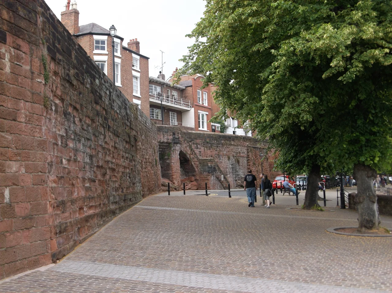
You can walk all the way around. That is the surprise. Almost every other walled city in Britain - York, Canterbury, even London - lost its circuit somewhere along the way to railways and roads and the slow nibble of modern development. Chester did not. The walls run for nearly two miles, more than 2.95 kilometres of elevated walkway, and a person who steps onto them at Eastgate in the morning can be back at Eastgate by lunchtime without ever once descending to street level. Every gate has been carried over. Every breach has been bridged. The walls themselves are Roman, Saxon, Norman, medieval, and modern by turns, and at any given hundred-yard stretch you may be standing on stones laid in the second century, repairs from the tenth, and concrete poured in 1966 - all of them carrying the same purpose forward.
Why the Romans Built Them
Around AD 74 or 75, the Roman legion Legio II Adiutrix established a fortress at the strategic point where the River Dee swung in a wide bend and the land lay flat enough for a parade ground. They built the first defences in the standard Roman fashion: a three-metre earth rampart on a six-metre base, topped with a wooden palisade, surrounded by a ditch with a sharp V-shaped profile. Square wooden towers stood at intervals of about 160 metres, rising perhaps seven and a half metres into the air. The four sides had gates - the north and east gates standing exactly where Northgate and Eastgate stand today, nearly two thousand years later. Around AD 100 the legion began rebuilding the walls in stone, sandstone blocks set on a chamfered plinth up to a walkway nearly five metres above the base, capped with a carved cornice and a parapet. They did not finish. The work was abandoned in the early second century, perhaps because Hadrian's Wall demanded their attention, and was not completed for another hundred years.
Aethelflaed's Burh
Then, for almost five hundred years, the historical record goes silent. The Romans left Britain in 410. What happened to Chester's walls between then and the early tenth century is largely unknown - they were probably still standing, mostly intact, because they were too solid to fall down on their own. In 907, Aethelflaed - the Lady of the Mercians, daughter of Alfred the Great - refounded Chester as a burh, an Anglo-Saxon fortified town, as part of the slow reconquest of the Danelaw. Her builders repaired the northern and eastern sections of the Roman walls and probably extended a defensive line south to the river. They used whatever stone they could find, including Roman tombstones, in their repairs - a habit of medieval builders that would later give archaeologists a hundred years of work pulling fragments of Latin inscriptions out of the walls.
The Medieval Circuit Completes
After the Norman Conquest, William's earls extended the walls westward and southward to incorporate the new castle. Three new gates were added - the Watergate in the west wall, and the Shipgate and Bridgegate on the south. By around 1162, the medieval circuit was complete: a continuous loop of curtain wall punctuated by gates and towers, with a ditch running outside it. Then in 1265, during the Second Barons' War, Chester Castle was besieged, and afterwards the city dug a much deeper ditch outside the walls - more than two metres deep where the old one had been barely one. The walls were now a serious military defence and would remain so for another four centuries. Funding came from murages, royal grants of taxation on goods passing in and out of the city. The hereditary sergeants who collected tolls at the gates also kept the watches. It was never enough. Breaches occurred in 1569, 1608, and 1629. By 1641 the walls were officially described as ruinous, just before the Civil War made them matter again.
From War to Walk
Chester sided with King Charles I, and the walls were fortified and then heavily damaged during the long siege of 1644 to 1646. When the war ended, so did their military purpose. In 1707 the City Assembly voted a thousand pounds to repair and re-flag the walkway with an unfortified parapet - to convert a battlefield, in effect, into a promenade. The gates were rebuilt with wider arches for traffic and the walkway was carried over them: Eastgate in 1768, Bridgegate in 1781, Watergate in 1788. The famous Eastgate Clock, which sits on top of the rebuilt Eastgate and is said to be the most photographed clock face in England after Big Ben, was added later still, in 1899. By the early eighteenth century, walking the walls was already a tourist activity. John Wesley walked them. Samuel Johnson walked them. The Wishing Steps, where local legend says you must run up and down without breath to have your wish granted, were built in 1785 for the use of well-dressed walkers picking their way along the southeast circuit.
The Modern Wall and Its Worries
The circuit is not perfect. In the 1840s the Chester and Holyhead Railway cut through the northwest corner. In 1938 Newgate was built to let traffic flow east-west, and in 1966 the concrete pedestrian bridge of St Martin's Gate replaced a substantial breach in the north wall caused by the Inner Ring Road. Walkers still cross them all without descending. Almost every section of the walls is now a Grade I listed building, with only one short stretch listed at the lower Grade II*. But age is age. Part of the wall collapsed near Eastgate in 2008 and the repaired section only reopened in 2010. Since 2011, a section between Morgan's Mount and Northgate Bridge has been closed because the masonry was moving and had to be propped. In January 2020, another southeastern section came down during nearby development work. The walls survive by being continually re-walled. Standing on them at sunset, looking down on Roman streets and medieval rows and Victorian terraces all at once, you can feel the long single thread - the same defensive line, repaired across two thousand years by the people who happened to live inside it.
From the Air
Located at 53.19 degrees north, 2.89 degrees west, encircling Chester city centre. Best viewed from 2,000 to 3,500 feet, where the near-rectangular circuit of the walls is clearly visible defining the medieval core against the surrounding Victorian and modern expansion. The Eastgate Clock and the cathedral are the most prominent landmarks. Hawarden (EGNR) is 4 nautical miles west, Liverpool John Lennon (EGGP) to the north, RAF Shawbury (EGOS) to the south. The walls are free to walk year-round and the full circuit takes most visitors about ninety minutes.
Nearby Stories
- Goodison Park 1.5 km away
- First Battle of Middlewich 2.4 km away
- Whittington Castle 4.2 km away
- Worsley 9.5 km away
- Gwrych Castle 14 km away
- Lilleshall Abbey 22 km away
- Cymer Abbey 31 km away
- Celtic Array 70 km away