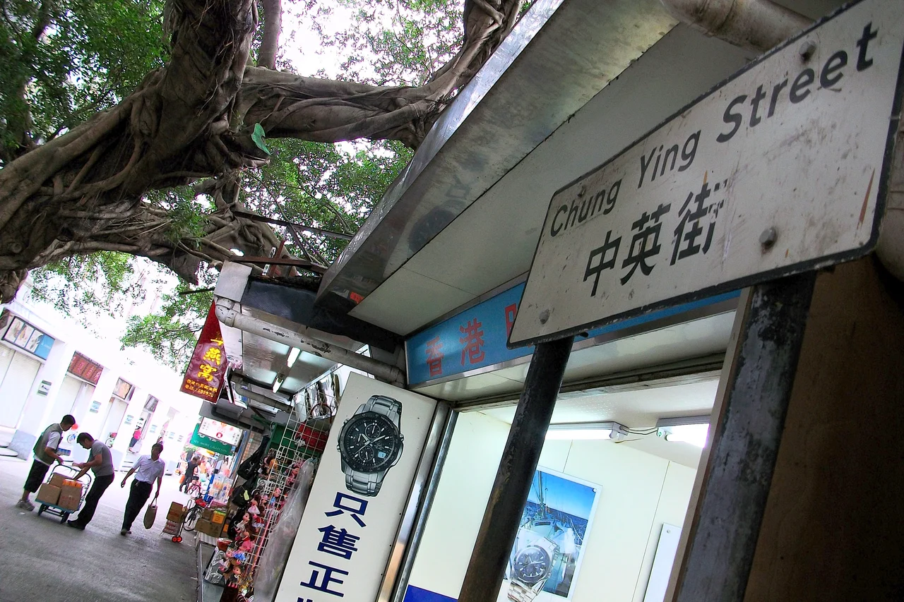

Chung Ying Street
The name says it all, if you read Cantonese: Chung means China, Ying means England. Chung Ying Street in Sha Tau Kok is perhaps the only road on Earth whose centerline is an international boundary — one side Hong Kong, the other Shenzhen. To walk its length is to stand in both worlds at once, on a strip of ground whose strange existence was carved out by colonial treaties, dried up by a vanished river, and preserved by the slow inertia of geopolitics.
A River That Disappeared
In 1899, when the Qing dynasty signed the Second Convention of Peking and leased the New Territories to Britain, the negotiators needed a boundary. At Sha Tau Kok, a shallow stream served the purpose. The British surveyors marked the high-water line and declared it the border. The river, indifferent to empire, kept flowing — but not for long. The stream grew shallower through the early twentieth century and had dried entirely before World War II arrived. Where water once ran, shopkeepers on both banks edged their stalls forward. The dried riverbed gradually filled with commerce. The lane they created was first called Chung Hing Street, then renamed Chung Ying Street — China-England Street — acknowledging in two syllables the peculiarity of its situation. The border did not move. The river simply ceased to matter.
Boom, Closure, and the Frontier Closed Area
For a few decades, Sha Tau Kok thrived. The town on the border grew busy with the ordinary activity of people who live near two jurisdictions and find ways to profit from the difference. Then the postwar refugee crisis changed everything. Hundreds of thousands of people fled mainland China into Hong Kong after 1949, and the colonial government, alarmed by the pressure on the border, declared much of the northeastern New Territories a Frontier Closed Area. Sha Tau Kok fell inside the restricted zone. Entry from the Hong Kong side required a special permit. The town that had buzzed with cross-border commerce went quiet. Chung Ying Street, once a hive of traders, became a place that most Hong Kong residents could not easily visit.
The Shopping Street That Time Made Famous
The street found a new purpose in the 1990s, when it was China — not Hong Kong — that was relatively closed. Mainland Chinese tourists who had rarely seen imported goods discovered Chung Ying Street as a place where foreign watches, clothing, and jewellery were available in the open air. The novelty was genuine: stand on the Chinese side, point at something on the Hong Kong side, and buy it without crossing a formal border post. The street became a tourist attraction built on regulatory asymmetry. But that advantage eroded as China opened up. The policy shift that allowed mainland residents to apply directly for Hong Kong visitor permits made the street's particular geography less commercially useful. Foot traffic declined. The Chinese government built a museum about the street's history, hoping nostalgia might draw what commerce no longer could.
Visiting Today
Access to Chung Ying Street remains carefully managed on both sides. Hong Kong residents need a permit to enter the Frontier Closed Area from the Hong Kong side; the rules specify access based on genuine need rather than tourism. Mainland visitors can join organized tours through the Shenzhen entrance. Since 2018, there is no fee for the tour permit, but appointments must be made in advance, and visiting hours are restricted. The result is a place that is simultaneously a living street — small shops still operate — and a monument to the particular strangeness of a border that runs down the middle of a road. The line itself is marked with stones. You can stand on one and look left into one legal system, right into another, and down the center of a lane that a dried-up river inadvertently created.
Two Names, One Street
Locals in Sha Tau Kok have their own name for this place: Zhongying Jie on the mainland side, the same characters read differently on the Hong Kong side. The museum nearby frames the street's story as one of colonial history and national sovereignty. Visitors who come for the history tend to linger: there is something genuinely disorienting about standing on a pavement that is simultaneously in two places. The painted center line does what rivers, treaties, and armies tried to formalize — it marks the edge of one world and the beginning of another, in a lane barely wide enough for two people to pass.
From the Air
Chung Ying Street lies at approximately 22.547°N, 114.226°E, within the Sha Tau Kok / Shatoujiao border zone where Hong Kong's New Territories meet Shenzhen's Yantian District. From the air at 3,000 feet, the bay of Sha Tau Kok Hoi is visible to the east, and the tight cluster of the border township is identifiable directly below the coast. The nearest major airport is Hong Kong International (VHHH), approximately 45 km to the southwest. Shenzhen Bao'an International (ZGSZ) lies roughly 50 km to the northwest. The Frontier Closed Area — visible as a zone of low density between Sha Tau Kok and the rest of Hong Kong — is a notable navigational landmark when approaching from the south.
Nearby Stories
- Hong Kong Disneyland 4.1 km away
- Mount Guanyin (Dongguan) 7 km away
- 2024 Lixinsha Bridge Collapse 7.4 km away
- Portas do Cerco 12 km away
- Lotus Hill 15 km away
- Nanxiong Formation 78 km away
- Heyuan 130 km away
- Checheng Fu'an Temple 629 km away