
Cloncurry Airport
Few airfields anywhere have a deeper claim on aviation history than this red-dirt aerodrome on the edge of Cloncurry. From here, in 1928, the first Flying Doctor took to the air. Through here, six years earlier, ran one leg of the very first scheduled Qantas service. And from here, in the dark months of 1942, American bombers and Australian airmen flew out to hold the line against an advancing enemy. The terminal is modest and the runway unremarkable to look at - but the ground beneath it helped invent the way an entire continent reaches itself.
Where Qantas Found Its Feet
Qantas - Queensland and Northern Territory Aerial Services - was founded in nearby Winton in 1920, the brainchild of returned wartime aviators who saw that the only practical way to cross the vast Queensland outback was over it. On 2 November 1922 the fledgling airline flew its first scheduled service, an airmail run from Charleville to Cloncurry, with an 84-year-old pioneer named Alexander Kennedy boarding at Longreach as its very first paying passenger - his ticket, No. 1, was issued for the Longreach-to-Cloncurry leg. Cloncurry sat at the far end of that pioneering route, and the aerodrome became a fixture of the early airline's operations. The original Qantas hangar still stands at the field, the words 'Queensland and Northern Territory Aerial Service' painted above its doors - a weathered signboard from the dawn of Australian commercial flight.
The Mantle of Safety
It was the isolation that mattered most. In a land where a station hand could die of a burst appendix simply because the nearest doctor was three hard days away, Reverend John Flynn imagined a 'mantle of safety' stretched across the outback by aircraft and radio. Cloncurry's airfield made it real. With Qantas leasing him a biplane named Victory for two shillings a mile, Flynn launched the Aerial Medical Service here in May 1928. On 17 May the first flight left this strip for Julia Creek, pilot Arthur Affleck navigating by compass alone, a doctor in the seat behind him. That service became the Royal Flying Doctor Service, and the institution it grew into - now flying across the whole of remote Australia - was born on this patch of ground.
A Crossroads of the Air
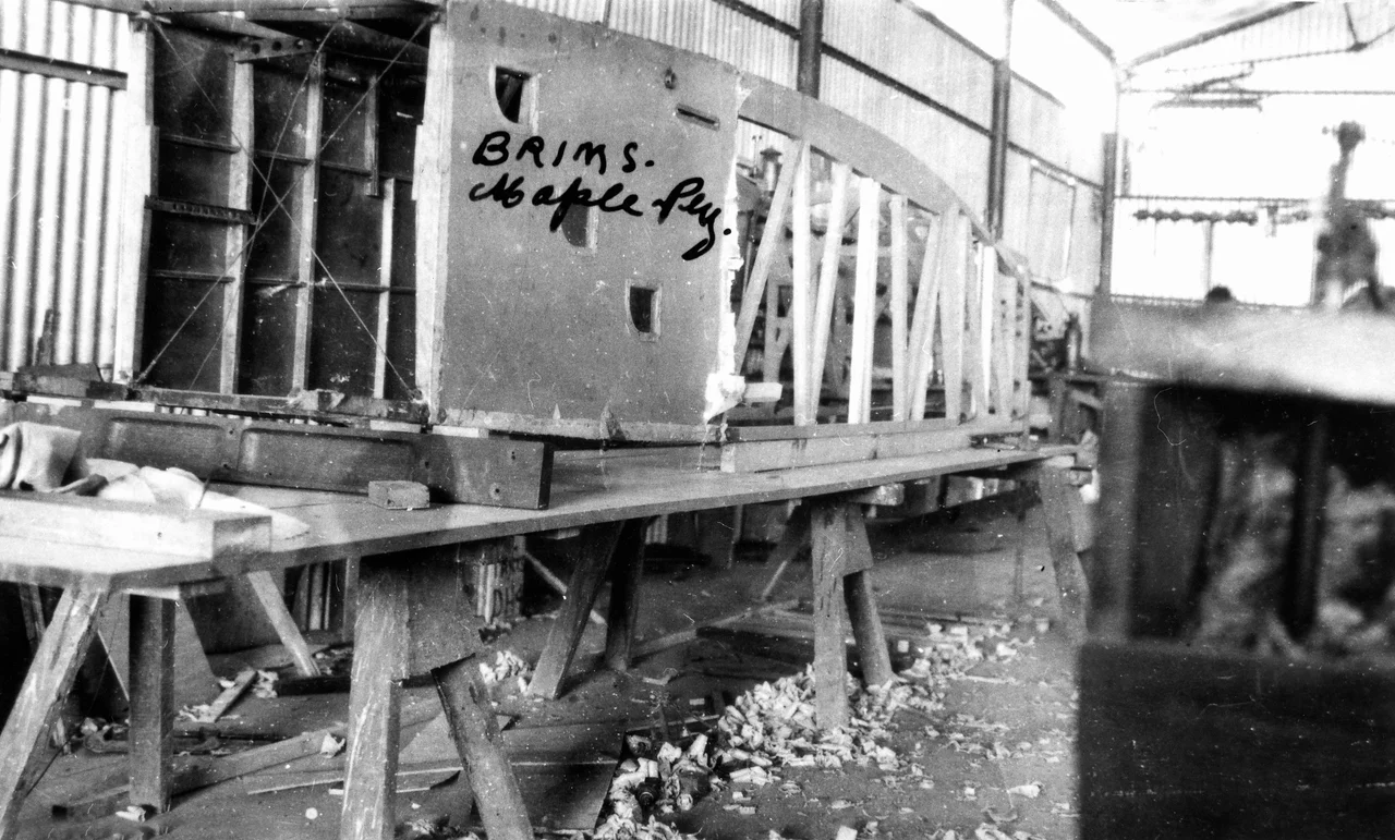
Cloncurry's usefulness drew the wider world to it. The great long-distance air races of 1919 and 1934, in which aviators gambled their lives flying from Britain to Australia in fragile machines, routed competitors through the aerodrome - a checkpoint in some of the most daring flights of the age. In the late 1930s the Dutch airline KNILM threaded its Batavia-to-Sydney service through Cloncurry, connecting onward to KLM flights bound all the way to Amsterdam. Southbound passengers spent the night in the outback town; northbound travellers paused for a luncheon before pressing on toward the tropics. For a remote settlement at the dry heart of Queensland, the airfield was a genuine international gateway - a place where a traveller might step off a plane having flown, in stages, across half the planet. The aerodrome even had a hand in building aircraft: in the 1920s a local plywood works supplied the timber from which Qantas fashioned the bodies of its early machines, a reminder that this town did not just refuel aviation but helped manufacture it.
Frontline of '42
When the Pacific War crashed toward Australia in 1942, Cloncurry's position on the Darwin-to-Sydney air route turned it from a country aerodrome into a strategic asset. The Royal Australian Air Force expanded the field, planning for it to become a major base should Japanese forces seize New Guinea and Papua to the north. The United States Army Air Forces moved in, basing B-17 Flying Fortresses of the battered 19th Bombardment Group here as they regrouped after the fall of the Philippines and the Dutch East Indies. RAAF operational base and radar units came and went through 1942 and beyond. As the tide turned and the fighting pushed northward, the American squadrons followed it to forward bases - but for one tense year, this outback strip was part of the air shield protecting the continent.
From the Air
Cloncurry Airport (ICAO YCCY) lies at approximately 20.67°S, 140.50°E, on the northern edge of the town of Cloncurry in North West Queensland, at an elevation of around 190 metres (620 feet). It serves regional airline and charter traffic and hosts flight-training operations. From the air the field is easy to fix: the town of Cloncurry sits immediately south, the braided Cloncurry River winds nearby, and the Flinders Highway runs past east-west. Pilots should consult current aeronautical charts for runway orientation, circuit details, and CTAF frequencies. Mount Isa Airport (ICAO YBMA) lies roughly 110 km west and makes a natural diversion or waypoint. Conditions are best in the dry season (April to November); summer afternoons bring fierce heat, strong thermals, and reduced visibility in haze and dust.
Nearby Stories
- Eloise Copper Mine 3.9 km away
- Quamby 18 km away
- Lake Moondarra 38 km away
- Kuridala Township site 41 km away
- Mount Cuthbert Township and Smelter 45 km away
- Millungera Station 85 km away
- Moonah Creek Hanging Tree 123 km away
- Combo Waterhole 155 km away