Cologne Ring
The wall came down in the 1880s, and Cologne was suddenly, dizzyingly free. For seven centuries the medieval ramparts had defined where the city ended and the countryside began. When industrialization made the old fortifications obsolete, the masons swung their hammers, and within a few years the stones were gone. What replaced them was not a void but a curve: a six-kilometer arc of boulevards swinging southwest, west, and northwest around the old town, named not for kings or generals but for the dynasties that had ruled the German lands. Walking the Ring today, you are walking a ghost. The wall is gone. Its shape remains.
A Chronicle in Pavement
The Ringe, as Cologne calls them in the plural, read like an index to a thousand years of German history. Start at the Ubierring in the south, named for the Germanic tribe the Romans resettled here in 38 BC. Walk clockwise and the dynasties march past in order: Karolingerring for Charlemagne's house, Sachsenring for the Saxon emperors of the tenth century, Salierring for the Salians who followed, Barbarossaplatz for the red-bearded Hohenstaufen emperor Frederick I. Past the Hohenstaufenring lies the Habsburgerring, only 180 meters long. The Hohenzollernring carries the name of Prussia's royal house. By the time you reach Ebertplatz at the northern end, named for the Weimar Republic's first president, you have traveled from Latin antiquity to the twentieth century in a single walk.
Where the Gates Remain
Three of the twelve medieval gates survived the demolition, marooned now as monuments at squares the wall once defined. The Severinstorburg stands at Chlodwigplatz in the south, named for Clovis I, the Frankish king who converted to Christianity around 500 AD. The Hahnentor anchors Rudolfplatz at the western bend, where Cologne's busiest entertainment district begins. The Eigelsteintorburg watches over Ebertplatz, where four Stadtbahn lines converge in the city's largest underground station. The gates are heavy, weathered, deeply out of scale with the modern street life that flows around them. They look like time travelers who took a wrong turn.
The Living Ring
North of Barbarossaplatz the Ring transforms. Trees grow taller. Shops fill the ground floors and offices stack above them. The Hohenzollernring is Cologne's nightlife spine, lined with restaurants, clubs, and movie theaters that pulse until dawn on weekends. The Belgisches Viertel that begins at Rudolfplatz has become one of the city's most fashionable quarters. Cologne's first skyscraper, the 65-meter Hansahochhaus, was finished in 1925 on the Hansaring and gestures back to an older identity: the name honors Cologne's centuries as a Hanseatic League city, when its merchants traded from London to Novgorod. The Ring is not a relic. It is the place where Cologne argues with itself about what kind of city it wants to be.
The Hanseatic Memory
Cologne was among the oldest and most powerful members of the Hanseatic League, a major trading force in the confederation from the 1260s onward. In 1475, Emperor Frederick III formally confirmed the city's status as a free imperial city — a separate milestone from its long Hanseatic role. For two centuries the League's merchants moved amber, herring, wool, and Rhine wine across northern Europe, and Cologne sat at one of its richest junctions. The Hansaring's 1,100 meters trace that prosperous past in their length alone. The trees here are slightly thinner, the commerce slightly quieter, but the name does the work of memory. So does Ebertplatz, originally called Deutscher Platz, renamed in the 1920s for a republican president who tried to hold Weimar Germany together against extremists on both sides. Even the squares argue politics.
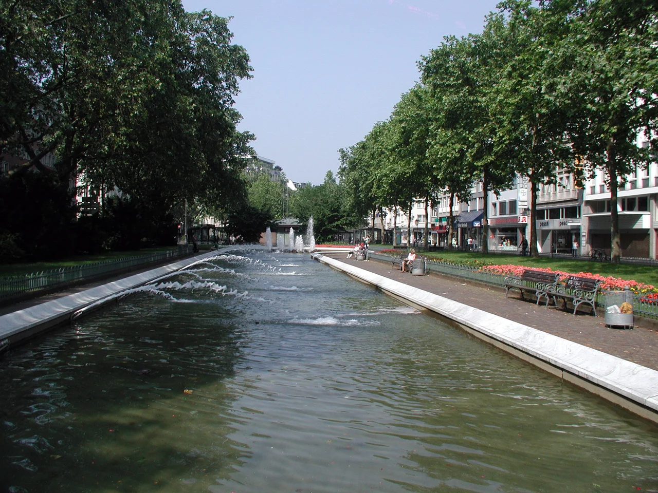
The Walk Itself
From Ubierring to Theodor-Heuss-Ring is roughly an hour on foot, longer if you stop. The path passes the Rautenstrauch-Joest ethnological museum, the early-13th-century Ulrepforte, the Sacred Heart Church at Zülpicher Platz, and the Mediapark with its fountain at Kaiser-Wilhelm-Ring. Tram lines weave overhead and underground. The Theodor-Heuss-Ring opens at the end into a long park along the Rhine, where the Ringturm tower rises beside the art nouveau Villa Bestgen. The wall is gone. What replaced it has its own thousand-year story now.
From the Air
Located at 50.92 degrees north, 6.96 degrees east, immediately west of the Rhine and the cathedral. From altitude, the Ring is visible as a semicircular green-and-grey arc cradling Cologne's compact old town against the river. Cologne Bonn Airport (EDDK / CGN) lies 14 kilometers southeast; Düsseldorf (EDDL / DUS) is 40 kilometers north. Look for the twin spires of Cologne Cathedral just inside the eastern edge of the arc.
Nearby Stories
- Diamond Interchange: How a Simple Idea Reshapes Towns Like Julich 2.8 km away
- Dusseldorf-Unterbach 6.1 km away
- Baumwollspinnerei Ermen & Engels 11 km away
- RAF Bruggen 15 km away
- Hagen Open-air Museum 21 km away
- Belgium 130 km away
- Marcinelle Mining Disaster 173 km away
- Zwingenberg Castle 178 km away