
Cork, Blackrock and Passage Railway
On Sunday 10 June 1850 the trains opened to the public for the first time, and the Cork, Blackrock and Passage Railway moved six thousand passengers on its second day of operation. The line was six miles long. The Cork terminus sat at City Park, twelve minutes' walk from Patrick Bridge. The other end was the steamboat pier at Passage West, where paddle steamers waited to ferry passengers onward to Cobh and the harbour resorts. The railway and the steamers worked as one system, and the system kept Cork city connected to its eastern coast for eighty-two years - until cars and buses finally undid it. What remains today is one of the prettiest greenways in Munster, the rail bed paved or gravelled, the bridges restored, the signal lights at Carrigaline standing like silent monuments along the Owenabue River.
Steam, Coaches, and a Price War on the Water
Three small Sharp Brothers locomotives pulled the original trains. Passenger stock was about a dozen coaches in mixed first, second, and third class. Within five years the railway had launched its own fleet of paddle steamers to compete on the harbour, after the existing ferry operators tried to undercut the rail connection at Cove. By 1855 the CB&PR was operating four steamers between 56 and 11 tons. A formal Act of Parliament was needed before the company could own steamships directly, but the workaround - a private subsidiary that did the actual operating - was enough to keep the integrated rail-and-water service profitable. When the Cork and Youghal Railway opened a more direct route to Queenstown in 1862, the CB&PR cut its combined fares to compete, and survived.
Conversion to Narrow Gauge
The latter part of the nineteenth century saw the railway hatching ambitious extension plans. A nine-mile branch from Passage to Crosshaven would eliminate some of the costlier steamer journeys and open new residential commuter traffic. Building the extension to narrow gauge would save money - so the company decided to do something rare: convert the existing Irish-standard-gauge line to narrow gauge as well. Staff laid a third rail to allow the changeover, then closed the entire railway on 29 October 1900 for the switch. The Cork-to-Blackrock section was also converted to double track at the same time, which made it unique among Irish narrow-gauge railways. The 1500-foot tunnel just north of Passage caused most of the construction headaches. The final extension to Crosshaven opened on 1 June 1904, including a viaduct over the Owenabue and a four-span 300-foot lattice bridge at Crosshaven itself.
The Tourist Railway
From day one the CB&PR was disproportionately dependent on summer tourist traffic. Day-trippers from Cork city flooded the trains in fine weather, riding out to Blackrock for the views, to Passage for the harbour, to Crosshaven for the beaches. In 1904-05 the railway recorded a net profit of £8,859 on receipts of £23,341, and the summer numbers carried the rest of the year. Then the First World War arrived. Crosshaven station was closed to civilians for security reasons. Non-essential travel was discouraged. The steamers were requisitioned to move cargo for the military, and the British government did not bring the railways under central control - and therefore did not pay compensation - until 1917. The railway never quite recovered the prosperity of those Edwardian summers.
Civil War Damage
The Irish Civil War of 1922-1923 caused extensive damage to the line. The workshops at Passage were attacked. The viaduct at Douglas was partly destroyed and had to be replaced initially with a wooden structure built by the new Irish Army's Railway Repair and Maintenance Corps. By 1924 the CB&PR was absorbed into the larger Great Southern Railway as the Irish Free State amalgamated its independent railway companies into a single national network. Economy measures followed quickly. The double-track section was singled in 1927. The steamer fleet was sold off. And buses, faster and more flexible than the narrow-gauge trains, started taking the day-trippers. The Monkstown-to-Crosshaven section closed on 31 May 1932. The rest of the line followed on 10 September of the same year. The locomotives were sent north to the Cavan and Leitrim Railway.
A Greenway Where the Trains Ran
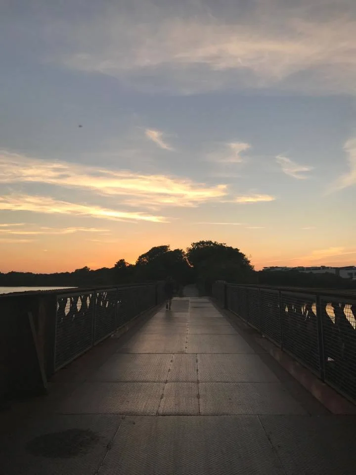
The CB&PR's afterlife is happier than its closing years. The line has been progressively converted into a recreational walkway: paved sections, gravel sections, lighting, benches, bridges restored, signal lights resurrected. The Albert Road station building survived, occupied for decades by a metal-products factory and later by a tool-hire company. The Blackrock signal house and platform are still intact. The bridge over the Douglas estuary - which had fallen into serious disrepair by the late 1990s - was reopened after extensive repair. Improvements continued into 2017 with the Marina Park connection, and a Passage Railway Greenway Improvement Scheme started in 2021. Walking the route now, you can read the geography of the old railway in the surviving artefacts: the platform remains at Rochestown, the water towers and small bridges between Passage and Carrigaline, the chain of signal lights along the Owenabue from Carrigaline to Crosshaven.
From the Air
Route runs from central Cork (approximately 51.90°N, 8.46°W at the Albert Road terminus) south and east along the west bank of Cork Harbour to Blackrock and Passage West, then inland via Carrigaline to Crosshaven at the harbour mouth. Cork Airport (EICK) lies about 4 nm south of the central section. Recommended viewing altitude 2,500-4,000 ft for tracing the entire greenway, especially the harbour-side curve between Blackrock and Passage West. The bridge over the Douglas estuary near Rochestown is the most visible single artefact from the air.
Nearby Stories
- Ballyvourney 1.6 km away
- Castlemartyr 3.9 km away
- Ballybeg Priory 4.1 km away
- Kilbrittain 5.2 km away
- Shanbally Castle 10 km away
- Skibbereen 17 km away
- Castleisland 22 km away
- SM U-27 118 km away