
Ballyvourney
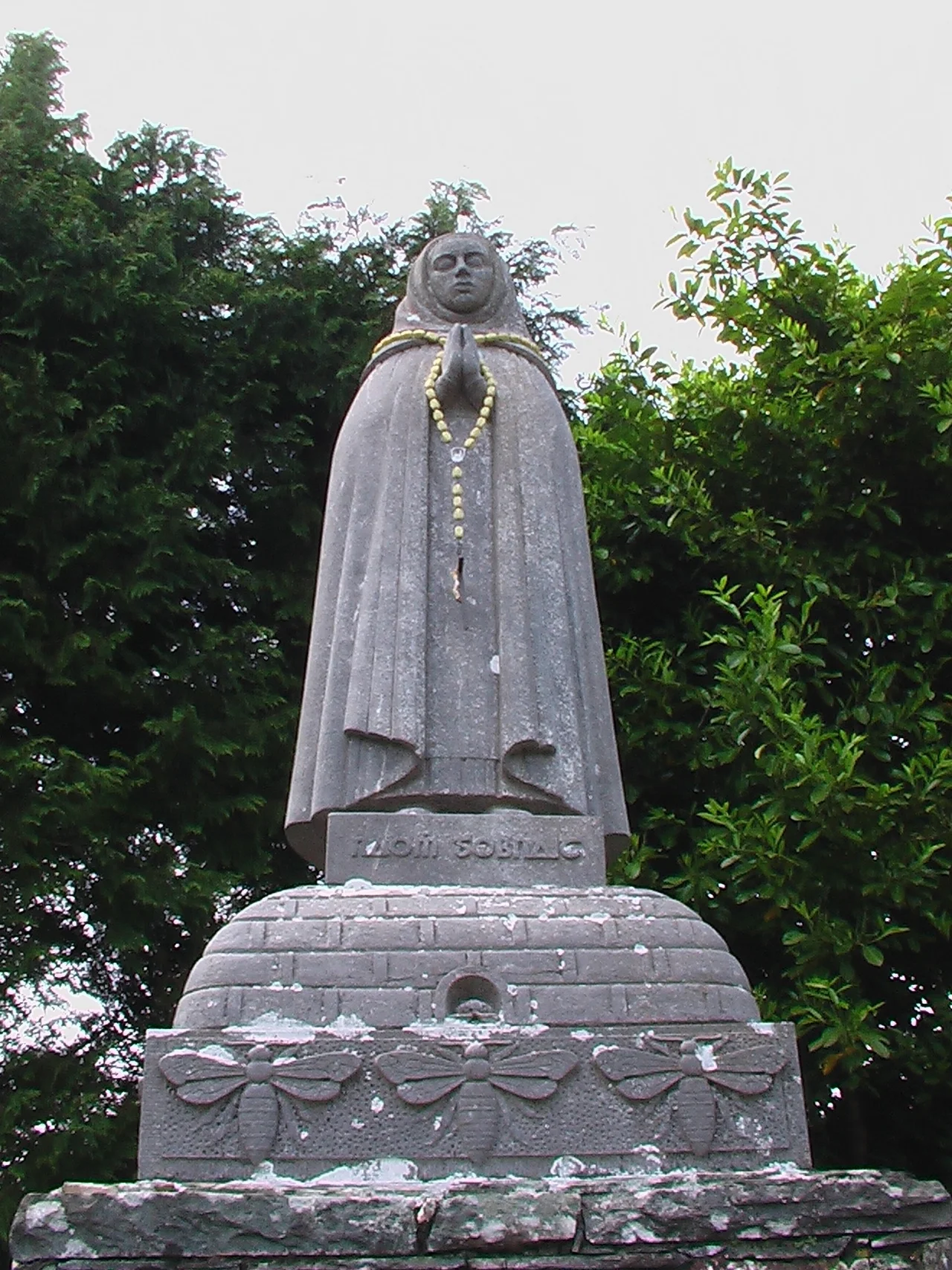
Saint Gobnait was told by an angel to walk south until she found nine white deer, and that wherever the deer stood would be her home. She left County Clare, took refuge for a while in the Aran Islands, then began walking. At Clondrohid she found three. At Killeens she found six. At Baile Bhuirne - Ballyvourney - she found all nine, and stopped. That story is roughly fourteen centuries old. In the village along the River Sullane today, on 11 February each year, people still walk between her abbey, her cells, and her holy well, taking water from it during Mass. The deer have been gone for generations. The pilgrimage has not.
Baile Bhuirne
The Irish name is Baile Bhuirne, often glossed as 'town of the beloved,' and the village is one of the small handful of places in Ireland still designated a Gaeltacht - an officially recognised Irish-speaking area. About 21 percent of locals in the An Sliabh Riabhach electoral division speak Irish daily, outside of school, according to the 2016 census. English took over as the predominant household language back in the 1920s, but Irish never disappeared. It survived in the prayers said at Gobnait's well, in the names of the surrounding townlands - Coolavokig, Derrylahan, Slievereagh, Ballymakeery, Coolea - and in the songs sung at the Ionad Cultúrtha, the cultural centre at the heart of the village. The Muskerry Gaeltacht takes its name from this district. To hear the language used naturally, this is one of the few places in the world you still can.
The Woman of the Bees
Gobnait was born in County Clare in the 6th century. The legends collected over the centuries gave her a particular companion: bees. Folklore credits her with using swarms to drive off raiders and with curing illnesses through honey. She founded a convent here once she had found her nine white deer, and the convent's ruins remain a focus for visitors. The abbey contains a Sheela na Gig - one of those startling medieval carvings of a female figure that scholars still argue over - fertility symbol, warning, protective spirit, or something older that the masons absorbed without explanation. The pilgrimage to her well is officially Christian, but its rhythm, its emphasis on water and earth and the turning of the year, may well be pagan in origin. The well, the deer, the bees - the old layer shows through.
Ambush on the Macroom Road
On 18 July 1921, during the closing weeks of the Irish War of Independence, the IRA ambushed a British rations lorry on the road just south of Ballyvourney. Two British soldiers were killed in the attack, including Captain James Airy. The truce was less than a week away. For the people of the parish, the violence of those years was not abstract. Members of the local IRA had grown up in the same school, attended the same Mass, knew the lanes and ditches that allowed an ambush to vanish into the landscape. The film The Wind That Shakes the Barley, which dramatises this same period in Cork, was shot in locations near here. Coláiste Íosagáin, the former De La Salle college whose grounds were used for the related Song for a Raggy Boy, sits in the village. The history is layered into the buildings.
Roads and Mountains
The village stretches along the N22, the road that links Cork city with Killarney. Cork is 48 kilometres to the southeast; Macroom, the nearest large town, is 14 kilometres away. The N22 climbs steadily west toward the Kerry border through a country of mountain and bog. To the north, the Derrynasaggart and Boggeragh Mountains divide the Sullane valley from the Munster Blackwater. To the south, the Shehy Mountains and the upland of Reananerree separate it from the Lee. Mullaghanish, the highest point in the parish at 694 metres, rises just northeast of the village - its summit is crowned by a television transmitter mast that locals use as a weather indicator. When Mullaghanish disappears into cloud, the rain is coming.
What Remains
St Gobnet's Wood, 30 hectares of old sessile oak woodland, sits at the edge of the village - one of the surviving fragments of the forest that once covered Munster. The Mills Inn, one of the local pubs, occupies the site of the former police barracks. The annual Pattern Day on 11 February still draws people back. Údarás na Gaeltachta, the Gaeltacht development agency, supports businesses in the local industrial estate to keep work in the parish so that young families can stay and the Irish language has someone to be passed to. Naomh Abán GAA fields Gaelic football teams in the West Cork league. There is a regional cultural centre, an Irish college that runs summer language courses, and a community that has held onto something most of Ireland let slip. The deer are still in the story.
From the Air
Ballyvourney sits at 51.945 degrees north, 9.163 degrees west, on the N22 road through the Sullane valley between Cork and Killarney. From the air, look for the village strung along the road with the Derrynasaggart Mountains rising to the north and the Shehy uplands to the south. Mullaghanish (694m), the highest point in the parish, sits just northeast with a prominent transmitter mast. Cork Airport (EICK) is roughly 50 km to the southeast; Kerry Airport (EIKY) about 35 km west-northwest near Farranfore. Recommended viewing altitude 3,000-5,000 feet for the valley context. Cloud often caps Mullaghanish even when the valley below is clear.
Nearby Stories
- Carrignamuck Tower House 2.9 km away
- Killelton Church 3.1 km away
- Timoleague 3.6 km away
- Ring of Kerry 5.1 km away
- Castletownbere Lifeboat Station 5.4 km away
- Ballybeg Priory 8.2 km away
- Castleisland 10 km away
- Abbeystrewry Church 15 km away