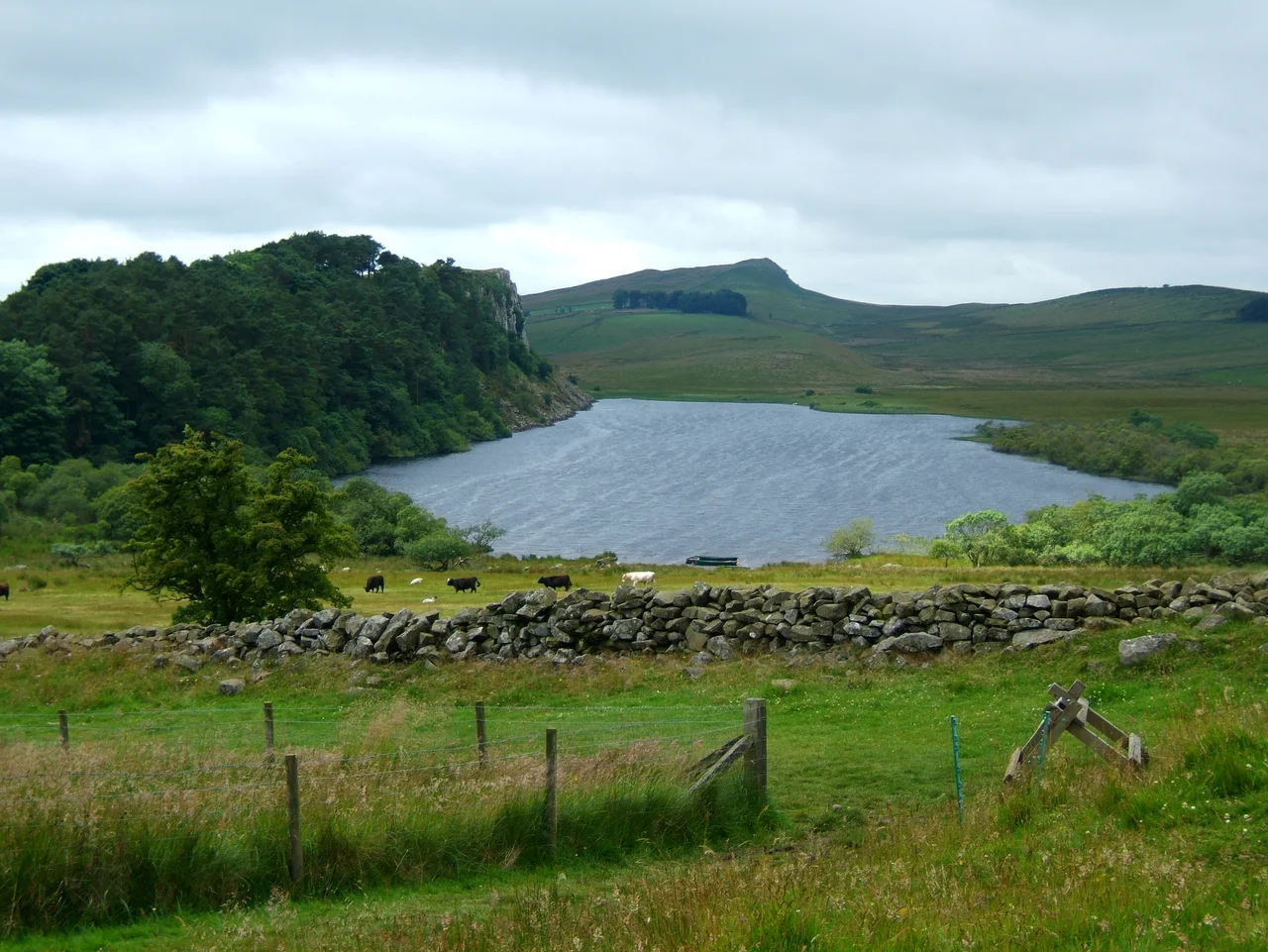

Crag Lough
Look up from the water and you see the Romans' work: a stone wall threading the very edge of a basalt cliff, two thousand years old, perched where no army should reasonably need to walk. Look down and you see the lake the glaciers left behind. Crag Lough sits at the southern edge of Northumberland National Park, a strip of cold, dark water pressed against the foot of the Whin Sill, where Hadrian's Wall takes one of its most theatrical lines along the cliff tops above. The geometry is improbable. Roman engineers chose the highest point of the landscape for their frontier; melting glacial ice chose the lowest point for its lake. They meet here, vertical wall and horizontal water, separated by a hundred feet of black volcanic stone.
A Cumbric Word for Water
The name is older than English in this country. Crag Lough's second element comes from the Cumbric word luch, meaning lake, a cousin of the Welsh llwch and the Scottish Gaelic loch. The first element, crag, derives from a word equivalent to Welsh craig, meaning cliff. The lough sits between two languages and two ages: the Brittonic Celtic speech of the people who lived here before the Romans, and the English that washed over Northumbria centuries after Rome left. To stand on its shore is to stand inside a piece of linguistic geology, the layers of speech as visible as the layers of stone in the cliff above.
The Whin Sill
Some 295 million years ago, magma forced its way between layers of older sedimentary rock, cooled in place, and hardened into a sheet of dolerite known as the Whin Sill. Erosion eventually stripped the softer rock above and around it, leaving the harder dolerite exposed as a long line of cliffs running across northern England. The Romans recognised what nature had built for them. Hadrian's Wall follows the top edge of the Whin Sill for miles, turning the geology into a ready-made rampart. At Crag Lough, the cliff rises straight from the lake bed; the wall above runs the cliff's very lip. Glaciers scoured out the soft ground at the cliff's base, gouging the basin where the lough now rests. The lake is an inadvertent moat, finished after the fortifications were already designed.
Water Below, Stone Above
Crag Lough lies two and a half miles north of Bardon Mill and half a mile north of the B6318, the eighteenth-century Military Road built after the 1745 Jacobite rising to speed troop movements between Newcastle and Carlisle. The lough is shallow but cold, fed by the moorland streams that drain the higher fells north of the Wall. Anglers come for the trout. Walkers on the Hadrian's Wall Path see it from above, a dark mirror flashing through gaps between the trees as the path threads the cliff tops. The combination of cliff, wall, and water creates one of the most photographed views along the entire 84-mile route. In autumn, the surrounding birch and rowan turn the lough's edge to copper. In winter, when the wind drops, the surface freezes flat and dark beneath the basalt overhang.
A Quiet Companion
Crag Lough has siblings nearby. Broomlee Lough, Greenlee Lough, and Halleypike Lough lie within a few miles, each a glacial leftover, each a quiet pool in a landscape that gets most of its attention for what is built above the water rather than what fills the hollows below. None of these other loughs have the trick of geometry that Crag Lough does: only here does the Whin Sill rise straight from the shore, only here does the wall march directly along the cliff edge above. The lough is a punctuation mark in the geological sentence the Romans paragraphed with stone.
From the Air
Coordinates: 55.006°N, 2.366°W. Recommended viewing altitude 2,000-4,000 ft AGL for the dramatic ridge-and-water view. The lough is a small dark water feature roughly half a mile long pressed against the base of the Whin Sill cliffs; Hadrian's Wall runs the cliff top immediately above. The B6318 Military Road parallels the ridge to the south as an easy navigation line. Northumberland National Park airspace; expect glider activity in summer. Nearest airports: Newcastle (EGNT) approximately 25 nm east-southeast, Carlisle Lake District (EGNC) approximately 24 nm west-southwest.
Nearby Stories
- Bishop Auckland 5.1 km away
- Battle of Newburn 5.8 km away
- Battle of Otterburn 7.4 km away
- Siege of Carlisle (1315) 8.8 km away
- Ullswater 12 km away
- Cresswell Lifeboat Station 15 km away
- Brough, Cumbria 16 km away
- Battle of Philiphaugh 39 km away