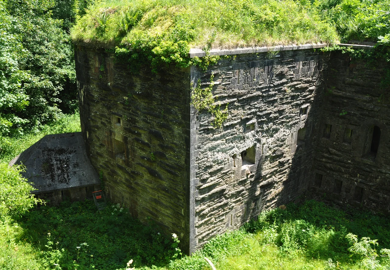

Crownhill Fort
Crownhill Fort was built to fight a war that never happened. In 1859, Britain's prime minister Lord Palmerston saw Napoleon III's France as a rising threat and convinced Parliament to fund the most expensive peacetime fortification programme in British history. The forts that resulted came to bear his name, and Crownhill, completed in 1872 on a natural outcrop above Plymouth, was the largest of the ring built to defend the Royal Dockyard at Devonport from a French overland attack. The French never came. Russian General Todleben, the engineer who had defended Sevastopol against the British during the Crimean War, was shown the building works in 1864 and gave them his professional compliments.
A Seven-Sided Defence
Captain Edmund Frederick Du Cane designed Crownhill as a heptagon, seven sides each protected by massive earthen ramparts and a deep dry ditch. The ditch alone required moving 200,000 tonnes of bedrock, hewn out by hand to a depth of thirty feet and a width of thirty feet. Six three-storey caponiers project into the ditch like teeth: their first floor for infantry with small-arms loopholes, their second for gun casemates housing smooth-bore breech-loaders, their third connecting to the *chemin de ronde*, the parapeted walkway that circles the entire fort. The northern caponier is the only full one, facing in two directions; the other five are demi-caponiers, each watching a single arc of approach. Around 350 rifle loopholes pierce the walls. Every inch of the surrounding ditch was meant to be killing ground.
The Forgotten Bankruptcy
Construction began in April 1863. In 1866, after a strike, the building contractor George Baker went bankrupt, and the Royal Engineers finished the work themselves and then moved in as the fort's first occupants. The total cost came to £76,409, a substantial sum at the time but, by Palmerston-fort standards, almost a bargain. Crownhill was designed for thirty-two guns on its ramparts, six mortars in two pits, and a garrison ready to repel any column marching on Devonport from the north-east. In 1881 it was selected as one of only two forts in Britain to receive a complete peacetime armament. None of the original guns survive. The fort's collection today is a mix of replicas, rescued artillery pieces, and originals from the Royal Armouries, including two 13-inch mortars believed to have fired against Russia in the Crimean War.
From Recruitment Hall to Falklands Springboard
The French invasion never materialised, but Crownhill kept finding work. In the First World War it became a recruitment and transport centre for troops bound for Turkey and Africa, then a demobilisation depot, then the home of the newly-formed Royal Corps of Signals. In the Second World War, anti-aircraft guns went onto the ramparts and the fort was armed for the last time. After the war, the Royal Engineers' 59 Independent Commando Squadron made Crownhill their base. From here, during the 1982 Falklands War, they despatched 647 troops and 1,897 tonnes of war material to the South Atlantic. The squadron stayed until 1983. The fort was sold to the Landmark Trust in 1987, who have restored it as the best-preserved Palmerston fort in Britain.
A Disappearing Gun and a Holiday Apartment
Today Crownhill is part museum, part wedding venue, part holiday let: a holiday apartment inside the Victorian barracks sleeps up to eight. The fort opens to the public on the last Friday of each month, January through November. On event days the working artillery is fired, recreating the percussion and smoke of a working fortress. The collection includes one of only two functioning Moncrieff Counterweight Disappearing Guns in the world: a carriage that uses the recoil of its own firing to power a counterweight system that drops the gun back below the parapet, where it can be reloaded in safety before rising to fire again. Two muzzle-loading 32-pounders were rescued from Tregantle Fort in Cornwall, where they had been repurposed as bollards. The Landmark Trust still pulls saplings from the counterscarp walls each year, using logging horses, slowly, by hand.
From the Air
Crownhill Fort sits at 50.41 degrees north, 4.13 degrees west, on high ground north of central Plymouth in the Crownhill district. From the air the seven-sided polygon is unmistakable: a heptagonal earthwork ringed by a dark ditch, with the ramparts and caponiers visible as geometric shadow patterns on the green. Plymouth (EGHD) is 3 nm to the south; Exeter (EGTE) 35 nm to the north-east. Best viewed at 1,500-2,500 feet with morning or late-afternoon light, when the deep ditch casts shadows that trace the full polygon.
Nearby Stories
- Davidstow Circuit 3.7 km away
- Golden Hind 3.9 km away
- Powderham Castle 4.4 km away
- Fowey Lifeboat Station 5.1 km away
- Okehampton Castle 12 km away
- Battle of Plymouth (1652) 19 km away
- Goonhilly Satellite Earth Station 44 km away
- German Submarine U-672 73 km away