
Croydon: The Gold Town the Outback Kept
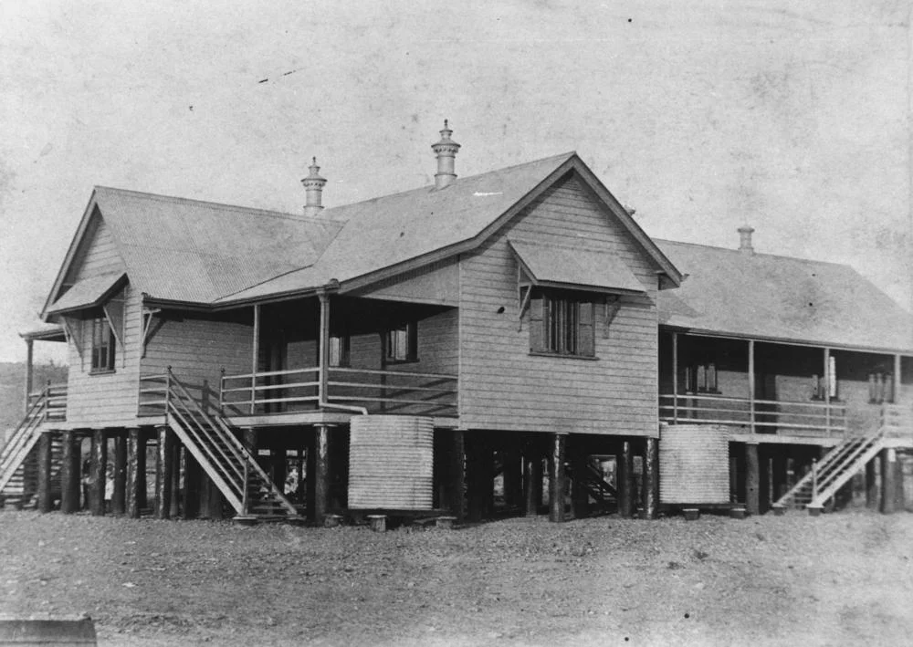
By 1890 Croydon was the fourth-largest town in the colony of Queensland. There were general stores and banks, two newspapers, dozens of hotels, a school, a courthouse, and a goldfield humming around the clock. Today fewer than three hundred people live here, on a flat red plain 529 kilometres west of Cairns where the heat shimmers off the corrugated iron and the dry season runs eight months long. What makes Croydon remarkable is not that it boomed and faded - that happened to a hundred outback fields - but that so much of it is still standing. The courthouse where the last case was heard in 1926 still stands on Samwell Street. The 1890s town hall still wears its delicate cast-iron balustrade. Walk the precinct at dusk and the empty town tells you, better than any museum could, what gold once built out here and what it left behind.
Tagalaka Country
Before any of it - before the reefs and the rush and the railway - this was Tagalaka country, and it still is. The Tagalaka people had lived across the Gulf Savannah around present-day Croydon, Normanton and the middle Gilbert River for thousands of years. The gold rush of the 1880s pushed them off their land with brutal speed; the early settlers' own records are blunt about how quickly mining displaced the people who belonged here. That dispossession was never the end of the story. In 2012 the Federal Court of Australia formally recognised the Tagalaka people's native title over roughly 30,000 square kilometres of this country, an act of legal acknowledgement that the connection the rush tried to sever had never been broken. The land that drew the prospectors had owners long before, and has them still.
The Rush
Gold was found in payable quantity in 1885, on what was then Croydon Downs pastoral station, by the manager and a couple of station hands. Word travelled the way it always did. Within two years thousands of people had poured onto a field that, a season earlier, had been open grazing run. The town took its name from a pastoral lease - itself named for Croydon in England, the birthplace of one of the pastoralists who had held the country. Gold remained the district's economic engine for four decades, but the easy returns came first and the long grind followed. By the time the mining warden packed up and left in 1926, there were too few miners on the field to justify keeping him there. The boom had lasted barely a generation.
The Market Gardeners
An isolated goldfield is only as viable as its food supply, and on the Croydon field that supply came largely from its Chinese community. Chinese settlers arrived within months of the 1885 strike and built a settlement on the north-west fringe of town, the same pattern that played out across the goldfields of north Queensland. They worked market gardens on land set aside in the town plan, and for years they were the chief providers of fresh fruit and vegetables on a field where scurvy was a real threat. They also worked as cooks and carriers and on tribute. At its height this was among the largest Chinese communities in regional Australia, and at its centre stood a temple - the focus of the settlement, surrounded by houses and pig ovens and the ordinary infrastructure of a people making a life far from home. The archaeological remains of that temple and settlement are now on the Queensland Heritage Register, a record in the ground of who kept this field alive.
A Town That Stayed Put
Most rush towns vanished. Croydon, improbably, did not. Its heritage precinct survives almost intact: the 1887 courthouse, the oldest building in town, where you can sit and listen to a recording of a real 1902 trial; the police station and gaol of the 1890s; the town hall with its statement tower. The True Blue Visitor Information Centre hands out a map, and all of it is free to walk through. Croydon was abandoned enough by mid-century that Nevil Shute name-checked it in his 1950 novel A Town Like Alice as an example of a played-out gold town. Yet the buildings stayed, baked and preserved by the same fierce dry climate that drove the people away, and that accidental preservation is now the town's living.
From the Air
Croydon sits at 18.21 degrees south, 142.26 degrees east, on the flat Gulf Savannah plain of north-west Queensland, 529 km west of Cairns. From altitude the town reads as a small grid of streets and corrugated-iron rooftops on an otherwise featureless red plain, with the thin scratch of the Normanton-to-Croydon railway line running away to the north-west toward the coast and the silver sheet of Lake Belmore, the town water supply, just to the south. Croydon Airport (ICAO YCRY, IATA CDQ) lies on the town's edge; Normanton (YNTN) is the nearest sizeable airstrip, about 150 km to the north-west, and Cairns (YBCS) is the regional hub to the east. The climate is brutally clear - averaging over 200 cloudless days a year - so the dry season (April to November) offers near-perfect visibility, while the December-to-March wet can flood the surrounding country and cut the roads entirely.
Nearby Stories
- Normanton to Croydon Railway Line 28 km away
- Georgetown: The Piece of North America in the Outback 87 km away
- Burns Philp Building, Normanton 123 km away
- Millungera Station 156 km away
- Mungana Archaeological Area 199 km away
- Augustus Downs Station 247 km away
- Great Northern Railway (Mt Isa line) 254 km away