
Mungana Archaeological Area
The country around Mungana keeps its records in stone. On the walls of the limestone caves and bluffs that rise abruptly from the savanna, Aboriginal artists left motifs in red, white and black - hands, figures, designs whose meanings belong to the people of this land. Many of the paintings of the broader Chillagoe district are relatively recent, less than 3,500 years old, but human presence in the region runs back tens of thousands of years. And then, scattered across roughly six and a half square kilometres nearby, lies a second archive entirely: the foundations, shafts and ruins of a mining town that flared into life, burned bright for a generation, and went out.
The Older Story in the Rock
Long before any shaft was sunk, this was a meeting place of Aboriginal country, near the lands of groups including the Wakaman, Wakara and Kuku Djunga peoples. The limestone karst that makes Chillagoe famous - jagged grey towers riddled with caves - also gave shelter and a canvas. More than fifty rock art sites are recorded across the district's cliffs and cave walls, and the Mungana site holds a striking gallery of painted motifs. These are not relics of a closed past. They are the visible edge of a continuous relationship with this landscape, one that the surveyors, miners and pastoralists who arrived in the 1880s entered without understanding, and largely without recording.
A Town Conjured From Ore
The newer story begins with metal. During Queensland's mining boom of the 1880s, prospectors found payable deposits in the hills here, and the magnate John Moffat, acting on reports from local pastoralist William Atherton and others, acquired the mineral rights and began building. What followed was a full community - the Girofla and Lady Jane mines with their deep shafts and machinery, a smelter, a cemetery, a school, a hospital on the hill, cattle yards, hotels, explosives magazines tucked behind the karst. The Girofla Mine's pumping plant, installed in 1911 to fight the groundwater that constantly flooded the workings, was among the largest of its kind in Queensland. The town fed ore to the great smelters at nearby Chillagoe, and for a while it thrived.
What the Bush Reclaimed
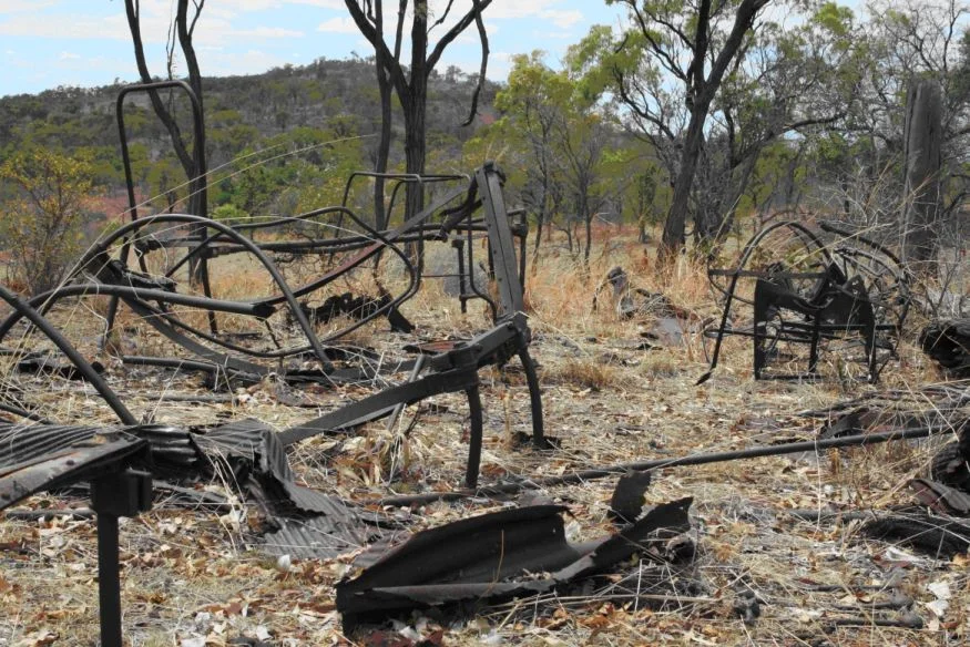
It did not last. The township officially shifted to its present Mungana site in 1901, though stubborn residents lingered in the old Girofla location into the 1930s - a fact archaeologists deduced from broken ceramics and glass rather than any written record. One by one the people left, and the savanna moved back in. Today the cattle yards stand termite-gnawed but still legible, their hardwood rails refusing to fall. A frangipani tree, planted by some long-gone household, still flowers beside a bare concrete floor. Mine shafts gape, fenced for safety. Of all the buildings, only two small whitewashed magazines - one built to hold detonators, the larger for explosives - survive intact, sheltered behind the limestone.
A Complete Life, Preserved
What makes Mungana rare is its wholeness. Most abandoned mining towns are picked over or built upon; this one was simply too remote to disturb. The result is an almost complete community frozen at the moment it was left - every layer of it, from the magnate's industrial ambition down to the bottle dumps behind workers' cottages, surviving in some form. Listed on the Queensland Heritage Register in 2008, the site offers archaeologists something they almost never get: the chance to read an entire town's life, from boom to abandonment, written in the ground. It is a snapshot of how isolated communities in the far north lived, worked, traded and endured - and of how quickly even a busy place can return to silence.
From the Air
The Mungana Archaeological Area lies at 17.10 degrees South, 144.39 degrees East, just west of Chillagoe in the Gulf Savannah of far north Queensland, partly within Chillagoe-Mungana Caves National Park. From the air, the defining feature is the limestone karst - clusters of pale grey towers and bluffs erupting from flat, dry woodland - with the faint grid of old railway formations and the Burke Developmental Road threading through. Coordinates place it roughly 200 km west-southwest of Cairns. The nearest sealed major airport is Cairns (YBCS); a small airstrip serves Chillagoe town nearby. Visibility is best in the dry season, April to September; wet-season storms from December onward bring haze and heavy afternoon cloud.
Nearby Stories
- Mount Mulligan Mine Disaster 3.7 km away
- Mbabaram language 27 km away
- OK Mine & Smelter 31 km away
- Undara Volcanic National Park 94 km away
- Georgetown: The Piece of North America in the Outback 103 km away
- Palmer River Gold Company Dredge 112 km away
- Paronella Park 121 km away
- Croydon: The Gold Town the Outback Kept 201 km away